A tropical wave moved offshore western Africa on July 25. On the following day, a poorly defined low formed near the
wave. The large cyclonic circulation moved westward, devoid of convection. Beginning on July 28, convection began to
burst near its center, waiting until July 30 to become more concentrated in its vicinity. At this point, there were
two competing low-level centers. A burst of thunderstorms on August 1 led to a better defined center which became
dominant. The low passed through the Lesser Antilles with winds near tropical storm force. By that evening, Tropical
Storm Emily formed just northwest of Martinique. The cyclone moved west- northwest, forming an oddly-shaped
central dense overcast on August 2 and 3 while moving south of Puerto Rico. Vertical wind shear increased on
August 3, exposing Emily's low-level center. By the afternoon of August 4, the system opened up into a tropical
wave south of Hispaniola. Its remains would move through Cuba and the Bahamas and briefly regained tropical depression
status near Grand Bahama Island on August 6. Vertical wind shear caused Emily to became a remnant low on August 7. Its
remains would move quickly through the central Atlantic, with winds near gale- force, before dissipating on August 11 well
to the west of the Azores.
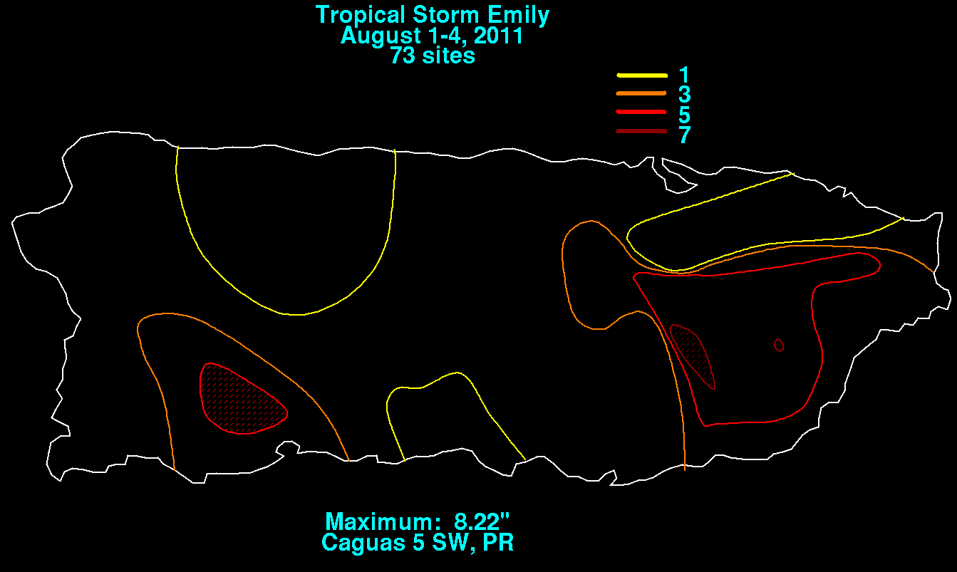
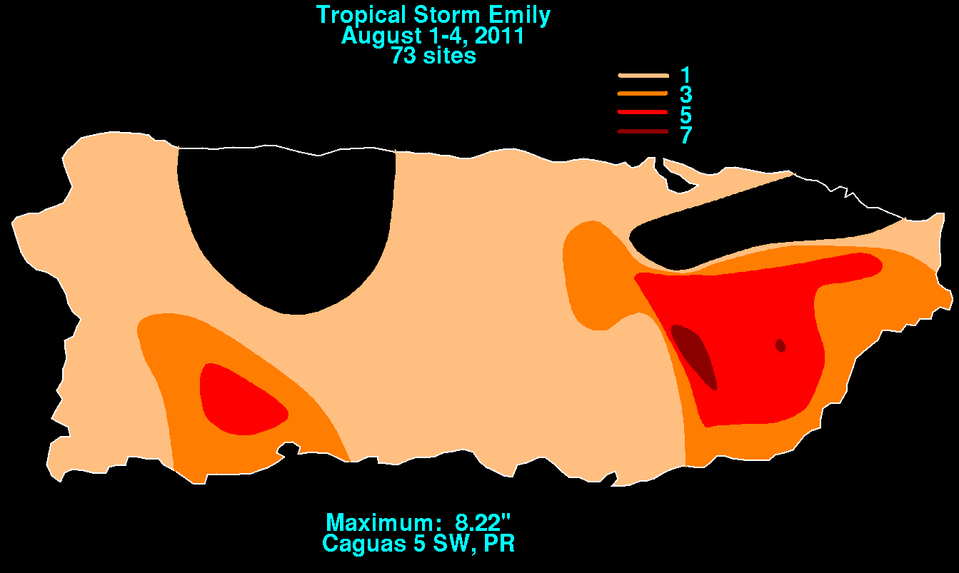
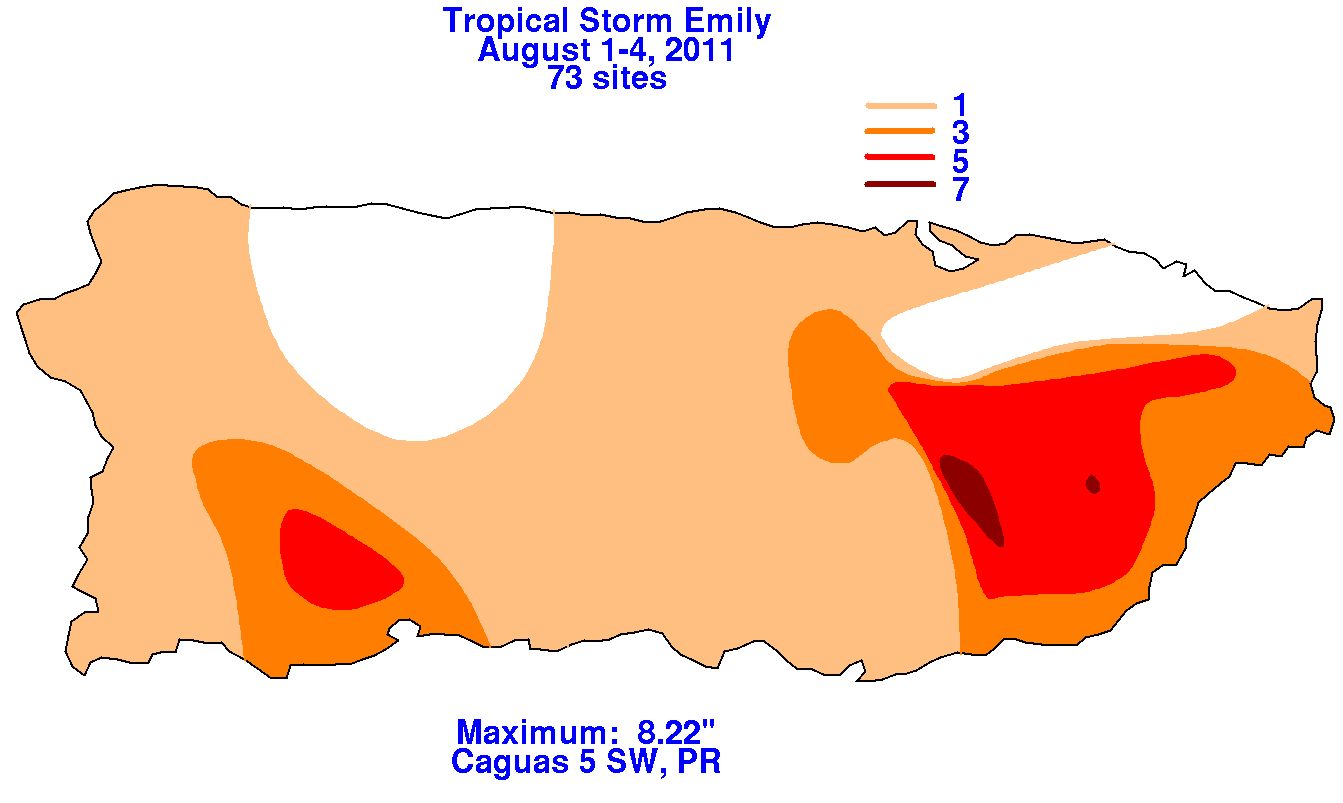
The graphics below show the storm total rainfall for Emily, which used information from the National Weather
Service River Forecast Centers, Forecast Offices, and CoCoRAHS.
 |
 |
 |