Early on July 30th, a weakening front dropped south into the northeast Gulf of Mexico. Later that day, a surface low
formed within the decaying frontal zone and acquired enough thunderstorm activity to meet the tropical depression criteria
that afternoon 145 miles west-northwest of St.
Petersburg. Development continued, with tropical storm strength reached by evening. The small low moved east to east-
southeast along the baroclinic trough, reaching peak intensity as it made landfall during the morning of the 31st near
Longboat Key. Weakening into a tropical depression that evening, Emily turned east to east-northeast, emerging into the
Atlantic on the morning of August 1st. Now an exposed circulation, the low failed to reacquire persistent central
thunderstorm activity and ceased being warm core by evening. The low dissipated soon afterward offshore the Southeast
coast.
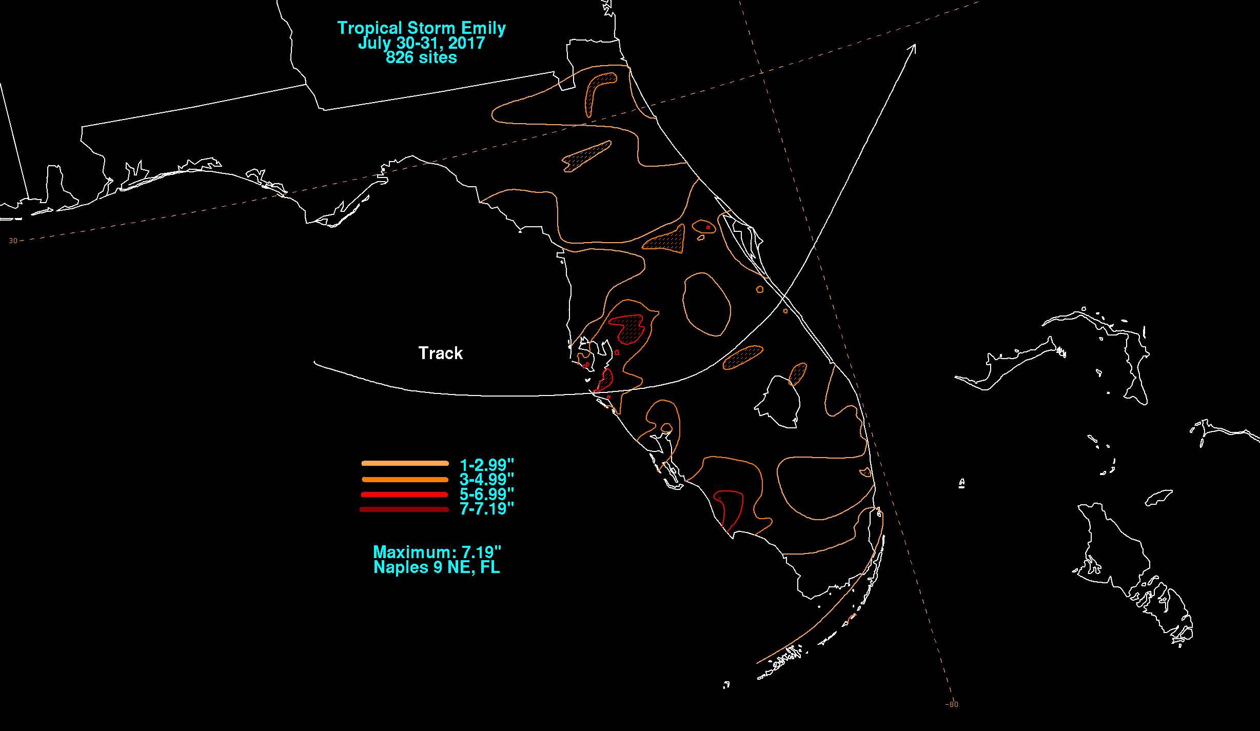
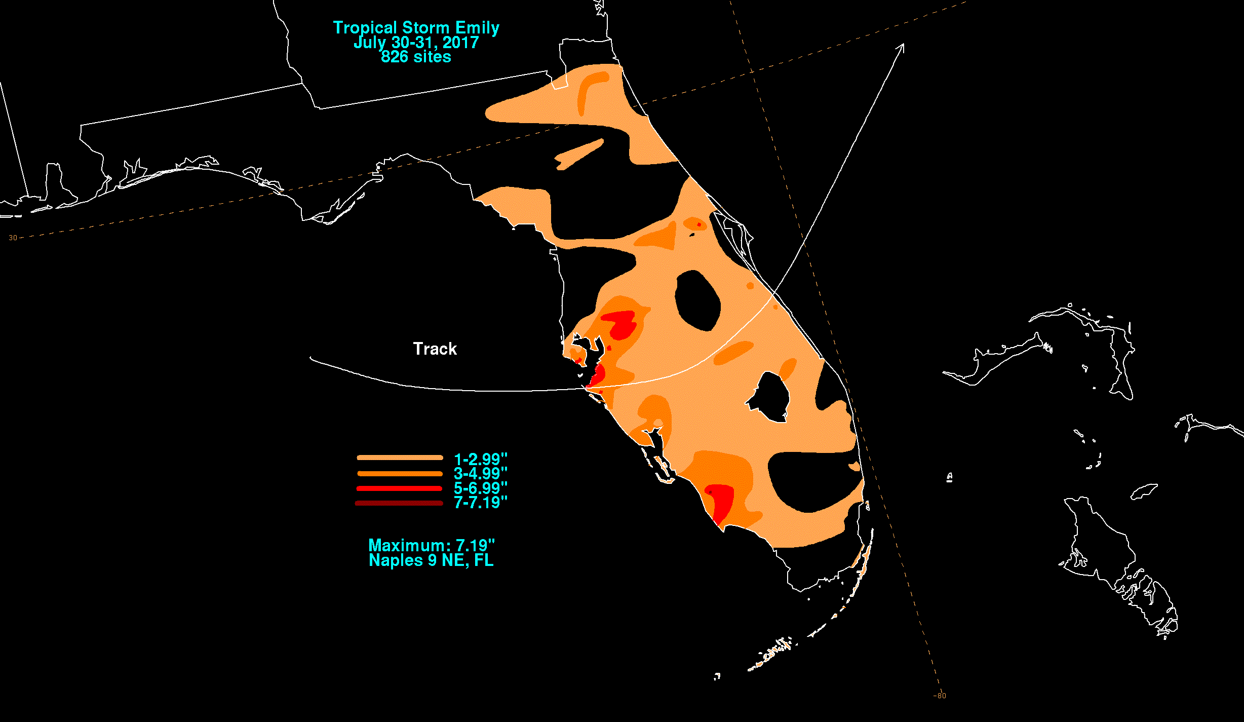
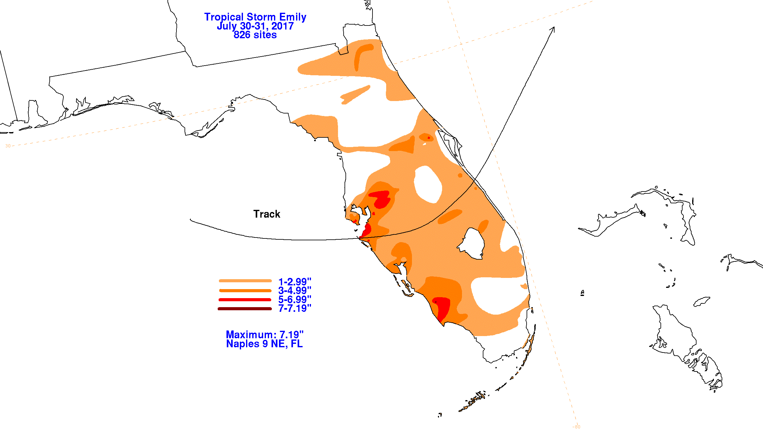
The graphics below show the storm total rainfall for Tropical Storm Emily, which used information from National Weather
Service River Forecast Centers, Forecast Offices, and CoCoRAHS.
 |
 |
 |