A tropical wave emerged from the coast of Africa on August 25th, which moved westward near the Cape Verde
Islands on the 26th. The system organized as it crossed the Atlantic, developing a low pressure area by the 28th.
The system became well-enough organized to be classified a tropical storm by September 1st. The system moved
generally westward, and experienced moderate vertical wind shear through most of its existence as a tropical cyclone.
As the surface circulation left most of the associated thunderstorms behind, the system tracked south of due west due
to the low-level flow pattern Erika was embedded within. By the 3rd, Erika weakened into a tropical depression as
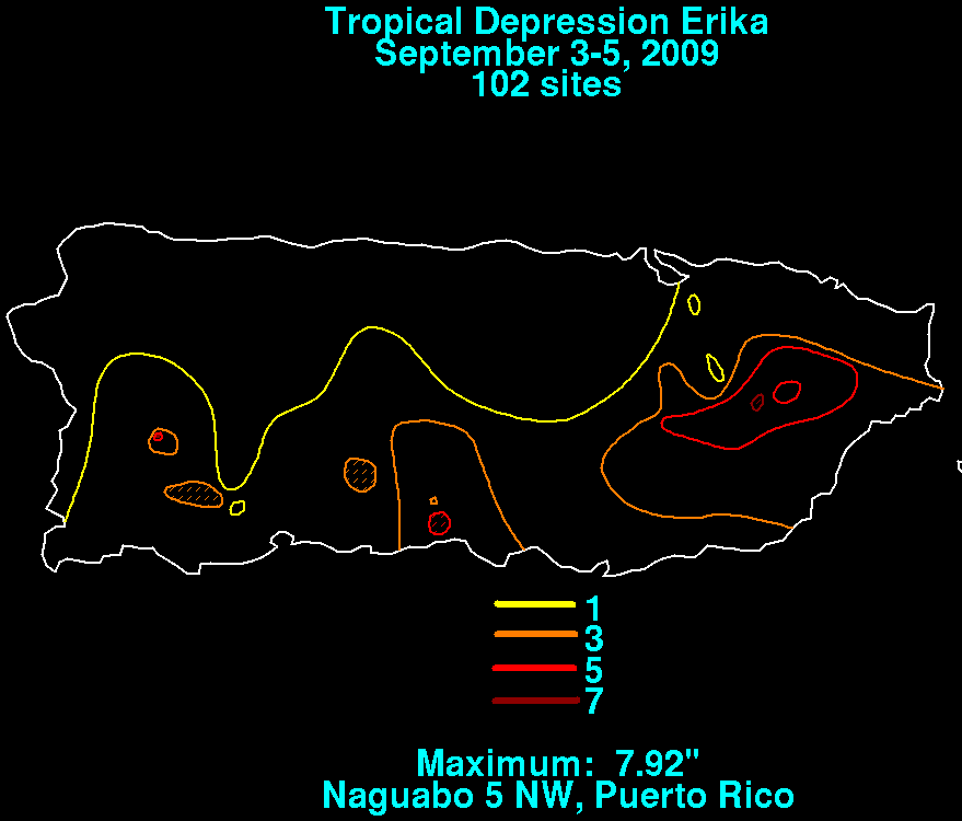
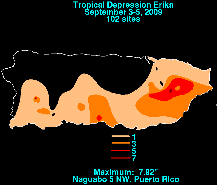
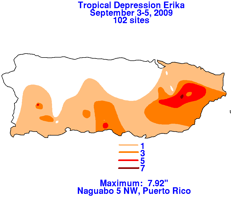
it moved into the eastern Caribbean, and soon devolved into a remnant low. The remnant disturbance led to heavy
rains over Puerto Rico during the day on the 5th, which caused flooding. Below are the storm total graphics for Erika.
Data was compiled from the National Weather Service River Forecast Centers from the San Juan National Weather
Forecast Office.
 |
 |
 |