A tropical wave moved off the African coast on August 21st. The system moved west for a couple of days producing disorganized shower
activity. By the 23rd, thunderstorms showed signs of organization, but the system remained a sharp surface trough. By midday on the
24th, tropical storm-force winds were present but no well defined center was evident at the surface. By late that afternoon, a buoy
report indicated that a well-defined circulation existed and Tropical Storm Erika had formed. The storm moved westward. By the
25th, northerly vertical wind shear led to its surface circulation occasionally becoming exposed, which halted development.
Erika remained a tropical storm as it passed Guadeloupe on the 27th. Vertical wind shear became more west-northwesterly, which
led to weakening. It lost its well-defined circulation center south of Hispaniola on the 28th. The remnant low moved across Haiti
on the 29th, through the Florida Straits on the 30th, then turned north over the eastern Gulf of Mexico on the 31st and September 1st.
The remaining disturbance moved over north Florida on the 2nd, losing its identity over Georgia on the 3rd.
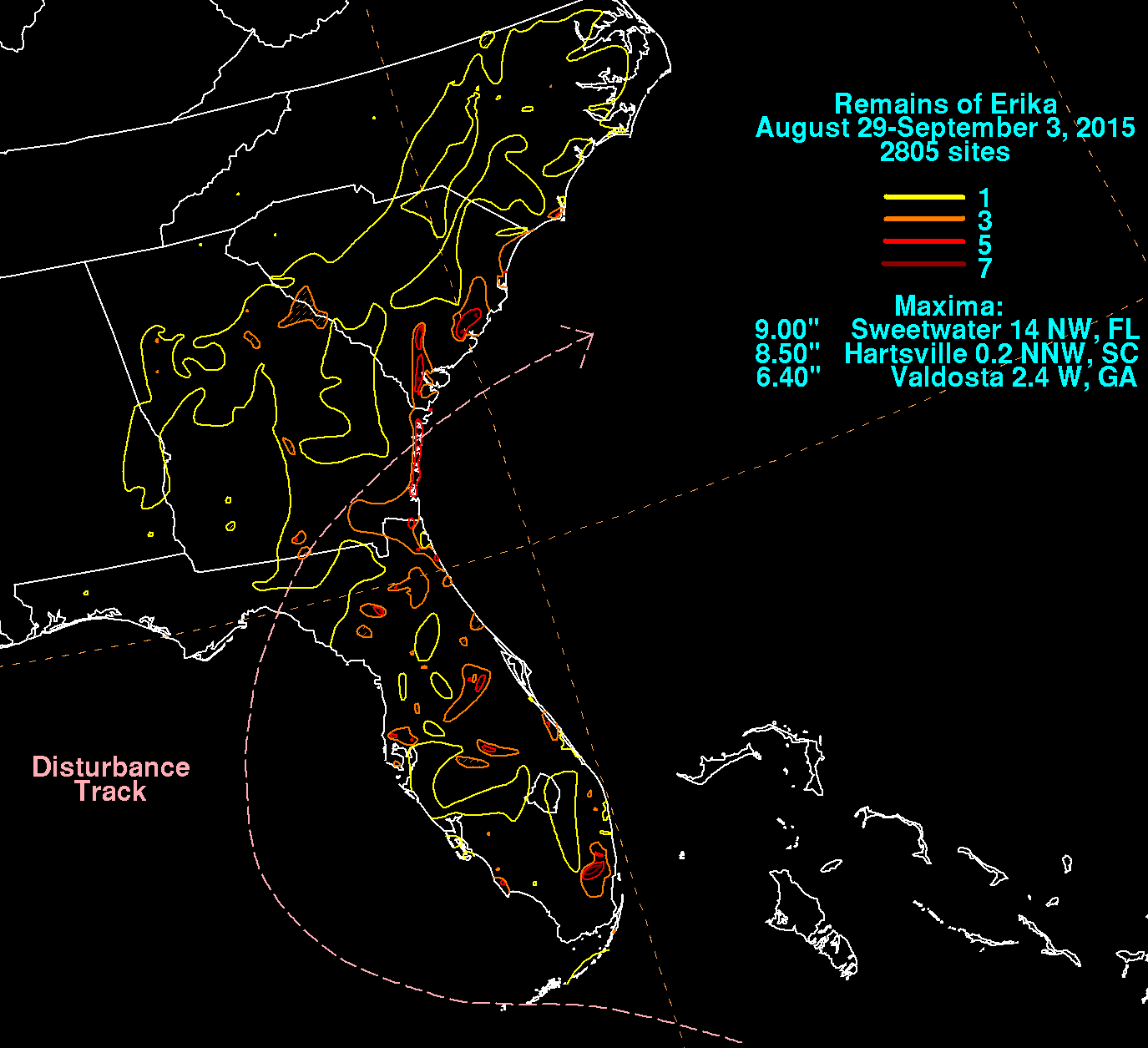
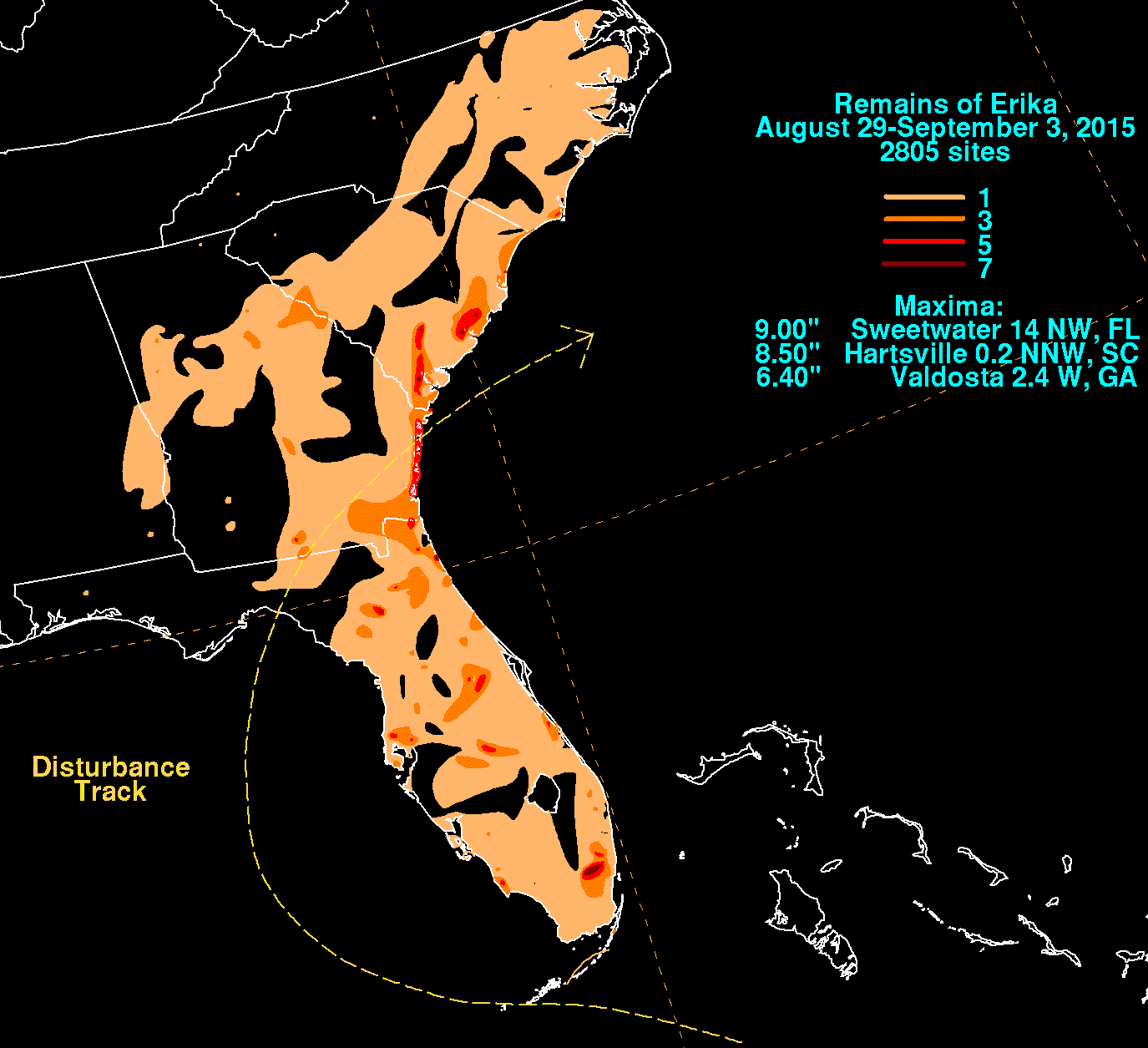
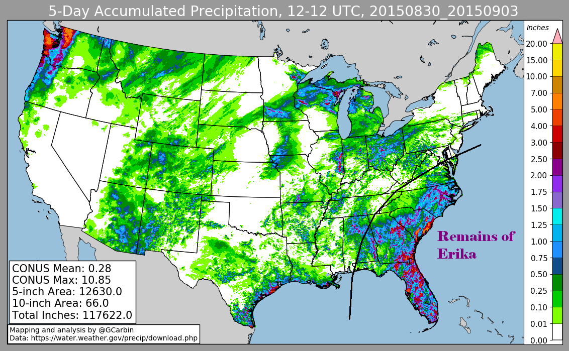
The first three graphics below show the storm total rainfall for the remains of Erika, which used rain guage information from National
Weather Service River Forecast Centers, Forecast Offices, and CoCoRAHS. The fourth image is a multi-sensor rainfall estimate, which
includes radar-derived information.
 |
 |
 |
 |