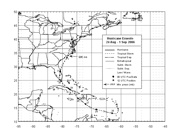
Forming from a tropical wave, a tropical depression formed on August 24th while passing
through the Windward Islands. The system strengthened into a tropical storm on the 25th
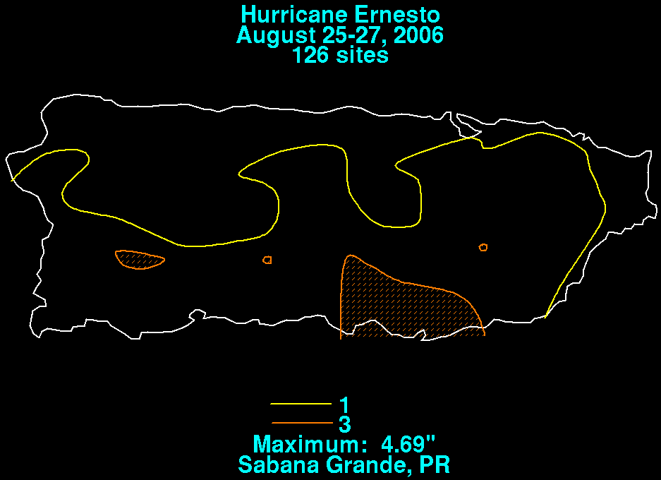
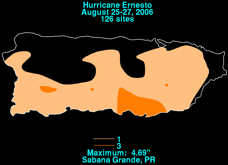
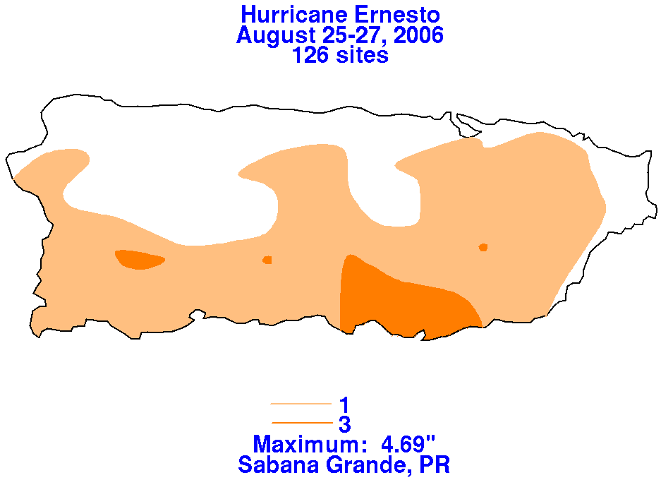
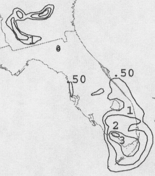
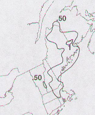
in the eastern Caribbean Sea about 300 miles south of Puerto Rico. The images below
show the rainfall across the island, using data provided by the Southeast River Forecast
Center.
 |
 |
 |
Moving west-northwest, Ernesto slowly strengthened while experiencing southerly
shear and slowly edged more northwesterly. By the morning of the 27th, while 70
miles south of Haiti, Ernesto briefly became a hurricane. Soon afterward, its main
inflow band stalled over Hispaniola, which appeared to cut off inflow into the cyclone
center and led to steady weakening. The cyclone limped ashore Cuba just west of
Guantanamo Bay as a weak tropical storm. Tracking over Cuba for 18 hours, Ernesto
emerged into the Florida Straits and intensified slightly. The cyclone turned north
into the southern Florida peninsula early on the 30th, before recurving back offshore
into the Atlantic. Ernesto restrengthened into a tropical storm and made landfall
near Long Beach, North Carolina on September 1. This powerpoint presentation shows
the synoptic environment around Ernesto near the time of its North Carolina landfall,
provided courtesy of Jared Klein from SUNY-Albany. The cyclone became an extratropical
gale center by the 2nd, before tracking north-northwestward to Lake Ontario. The system
turned northeast, and became absorbed into a new cyclone across Maine by the morning
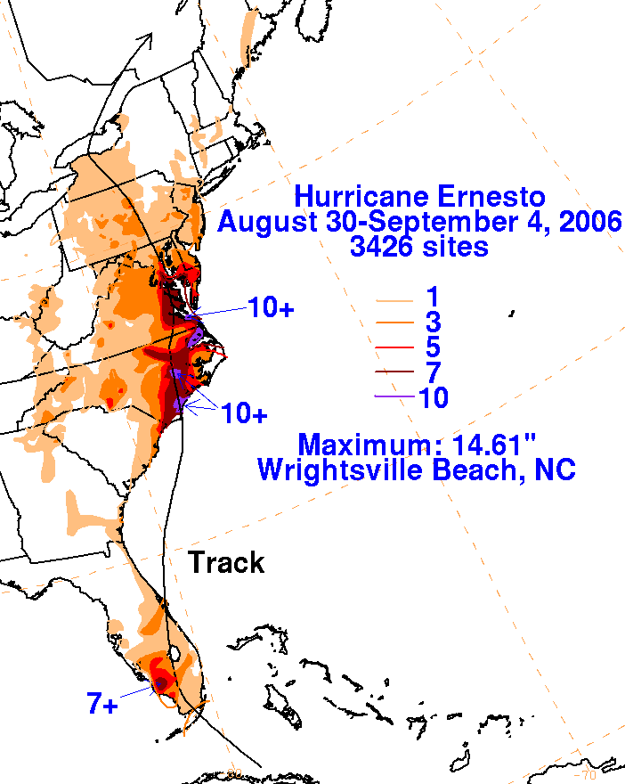
of the 4th. Below is its track, supplied by the National Hurricane Center.
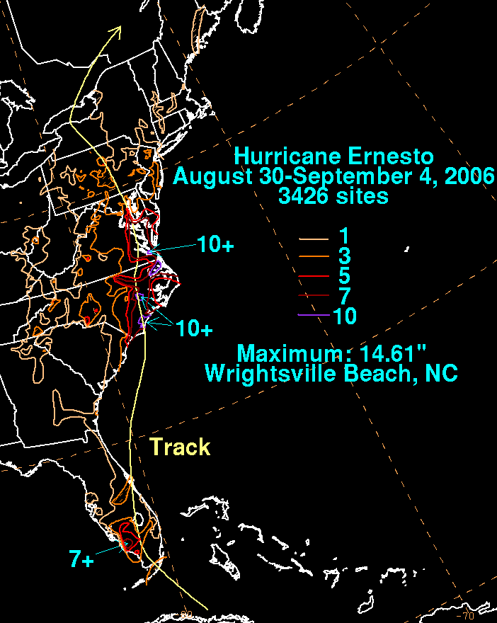
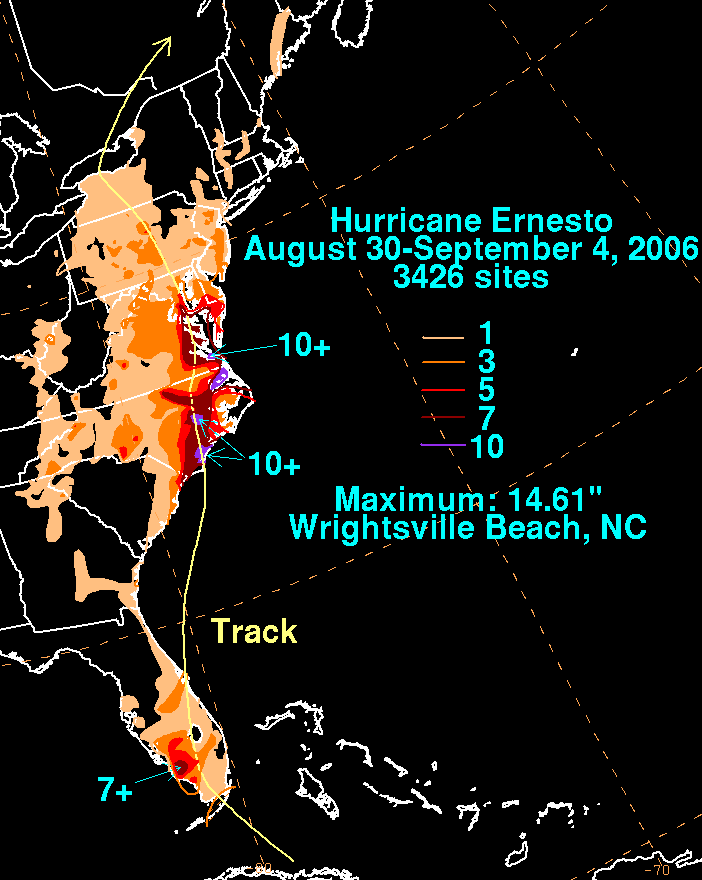
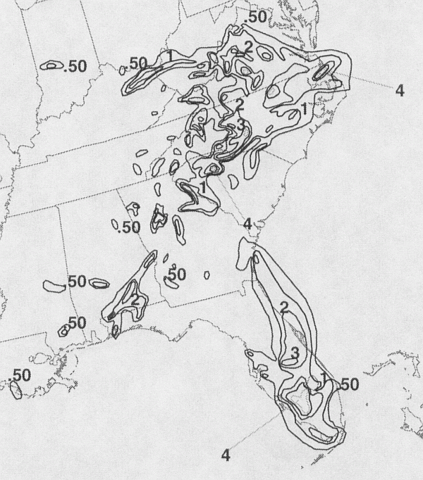
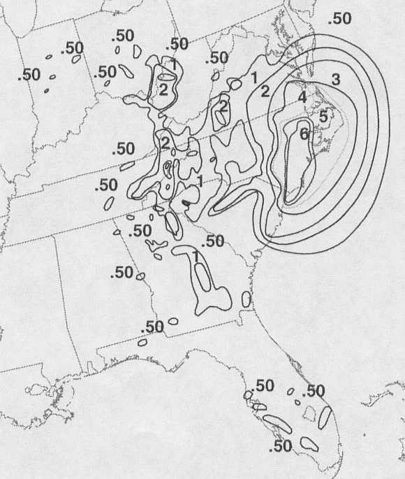
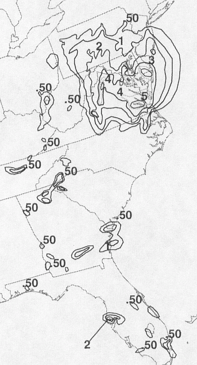
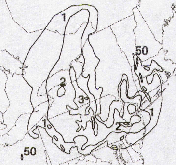
The graphics below show the storm total rainfall for Ernesto. The first three used rain guage data provided
by the River Forecast Centers, CoCoRAHS, post storm reports, and South Florida Water
Management District.
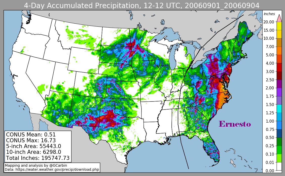
The fourth graphic included radar-derived information.
 |
 |
 |
 |
Below are the calendar for Daily Precipitation Maps. Note that the 24-hour periods end at 12z
that morning.
| Sun | Mon | Tue | Wed | Thu | Fri | Sat |
| 30 |
31 |
1 |
2 |
|||
| 3 |
4 |