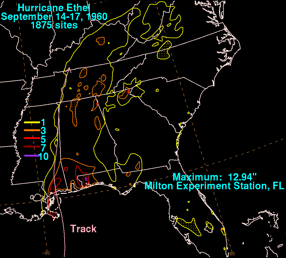
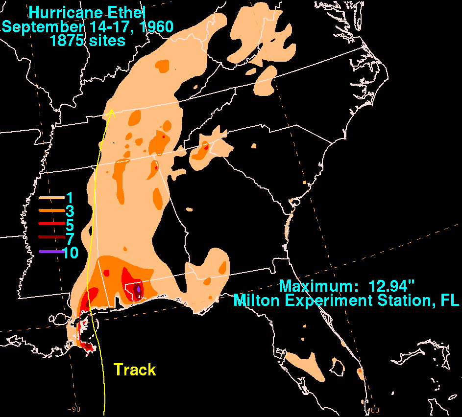
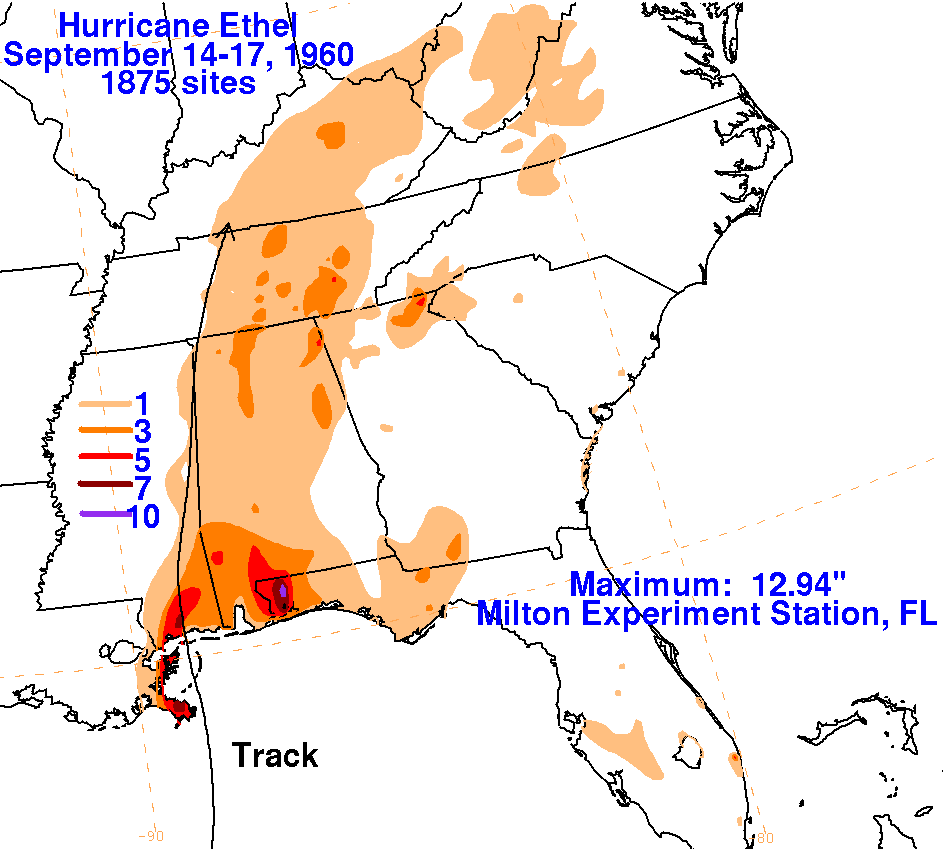
This system's existence was first identified by a marine buoy in the
central Gulf of Mexico on the morning of September 14th.
The cyclone intensified rapidly in the central Gulf of Mexico, becoming
a major hurricane by afternoon. That night, cooler and
drier air entered the hurricane's circulation, causing weakening.
The hurricane made landfall near Biloxi, Mississippi on the afternoon
of the 15th, and weakened further after moving inland. The center
of its low pressure area dissipated as it was entering Kentucky on the
afternoon of the 17th. The graphics below used
data supplied by the National Climatic Data Center in Asheville, North
Carolina.
 |
 |
 |