An area of disturbed weather developed over Venezuela on August 31,
which may have formed from the
same tropical wave which spawned Hurricane Fran
in early September. The active weather moved to 200
miles south of Acapulco on the 9th, where it developed a low level
circulation. The system became a tropical
depression the next day about 200 miles south-southeast of
Manzanillo. Moving around the western periphery
of the subtropical ridge, the system strengthened into a major
hurricane by midday on the 12th as it was turning
northward towards Baja California. Wind shear began impacting the
cyclone, and the weakening hurricane
struck Todos los Santos on the afternoon of the 13th, then moved across
the Gulf of California to hit Los Mochis
early the next morning. The surface cyclone dissipated over the
Sierra Madre Occidental mountain chain.
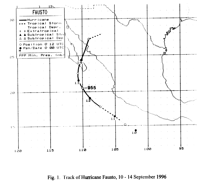
Below is a track of
the cyclone, prepared by the National Hurricane Center.
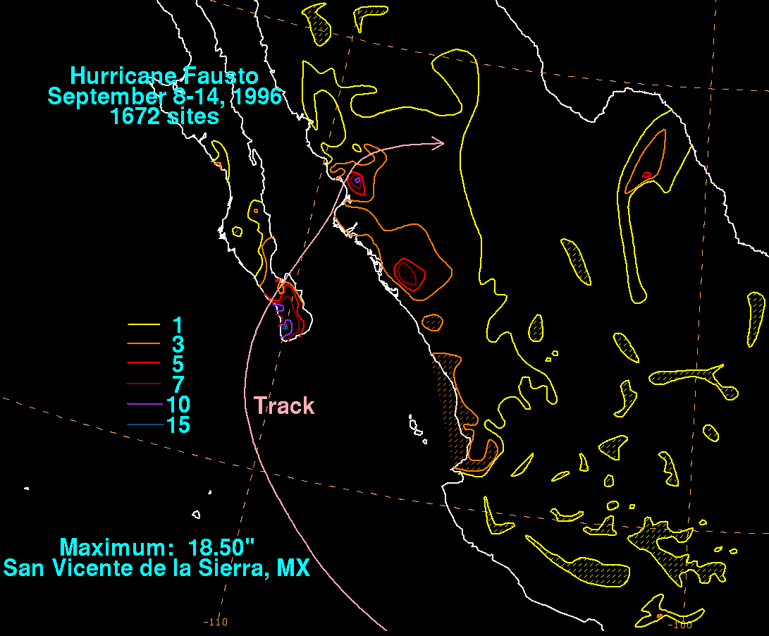
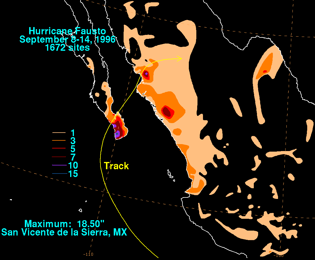
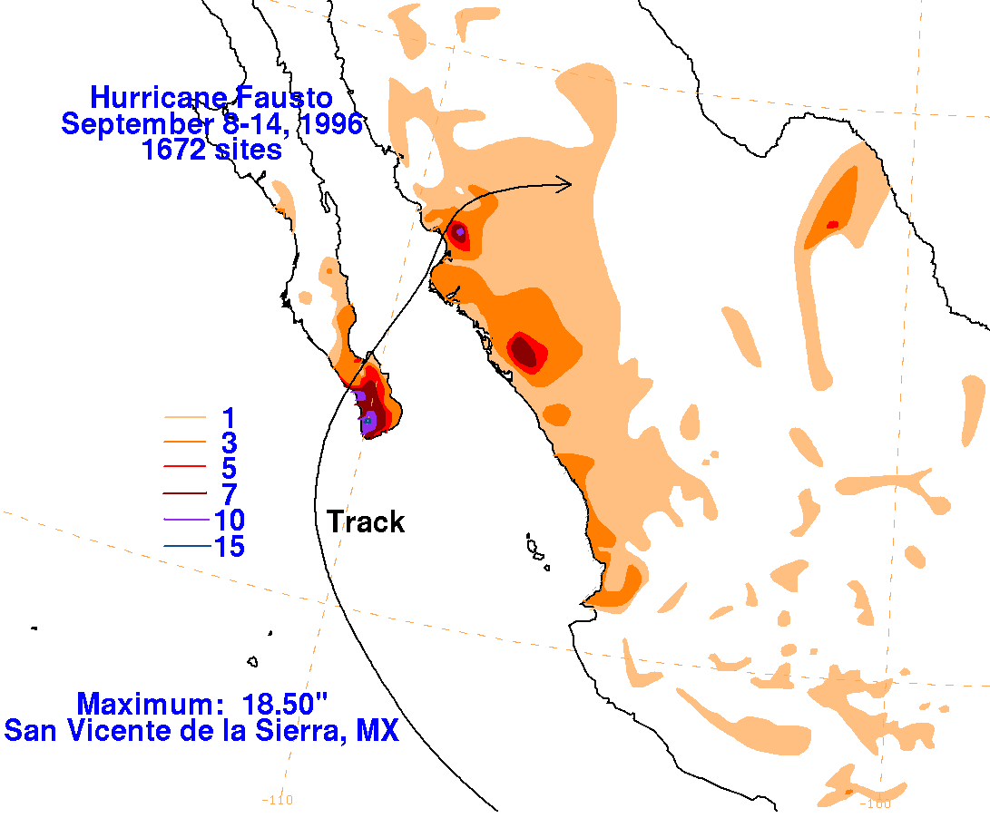
Below are the storm total graphics for Fausto. The absolute
maxima were near the points of landfall.
Data for the maps was obtained from the Comision del Agua, the
parent
agency of Mexico's National
Weather Service.
 |
 |
 |