The system was first noted on TIROS satellite imagery in the tropical Atlantic southwest of the Cape Verde
Islands on September 26th. The system grew in size on the 27th, before disappearing from the satellite's few
over the next few days. Ship reports and reconaissance aircraft from the 30th found the system with a small,
well-defined eye, and the hurricane was named Flora late that morning. By early afternoon, it tracked across
Tobago. Development continued, and Flora became a major hurricane by the 2nd as it began to track towards
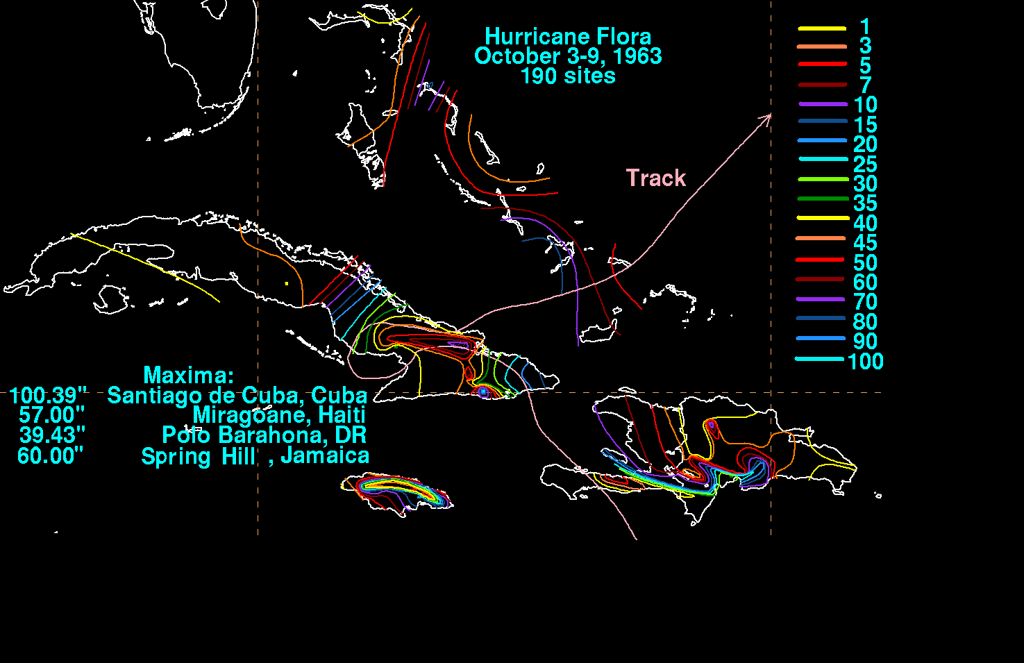
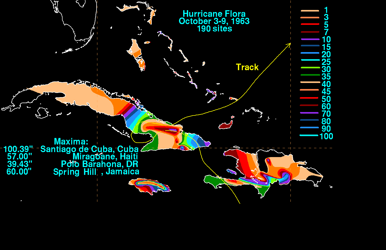
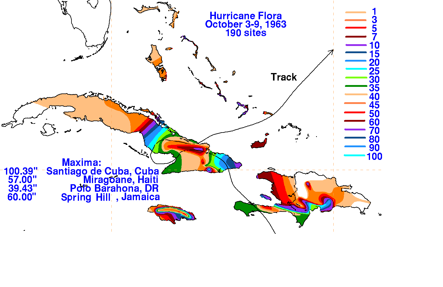
the Greater Antilles. Excessive rains fell near the hurricane, setting records for Haiti, the Dominican Republic,
and Cuba as the system wandered across southeast Cuba between the 4th and 8th. A trough developed in the
western Atlantic thereafter, whisking Flora off to the east-northeast.
The graphics below show the storm total rainfall for Flora, using
data provided by the Climatological
Data publications for the West Indies, published by the National
Climatic Data Center, the anuual tropical
cyclone summary issued by the National Hurricane Center, and the
Meteorological Service of Cuba.
 |
 |
 |