A large, deep cyclonic circulation formed in the eastern North Pacific during the end of the first week of August.
On the 7th, the circulation was well-developed before thunderstorm activity increased in its vicinity southwest
of Acapulco, which could have been augmented by a tropical wave moving into the region. By the morning of
the 7th, the system had evolved into a tropical depression. Later in the day, Flossie strengthened into a tropical
storm as it tracked northwest, parallel to the western coast of Mexico, on the southwest side of the subtropical
ridge. Although the center remained offshore, heavy rains fell around its eastern periphery across southern
Baja California and across portions of western Mexico, when a monsoon surge in connection with Flossie moved
up the coast. By the 10th, Flossie developed into a hurricane. However, like most eastern Pacific tropical cyclones,
the hurricane moved over cooler waters which caused convection to wane with the cyclone, which led to weakening.
By the morning of the 13th, Flossie was a weakening tropical depression consisting of mainly low-level clouds
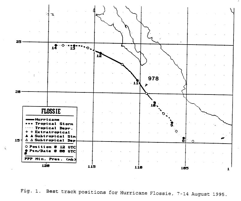
moving westward under the base of the surface high across the eastern Pacific ocean. Below is the track of Flossie,
furnished by the National Hurricane Center.
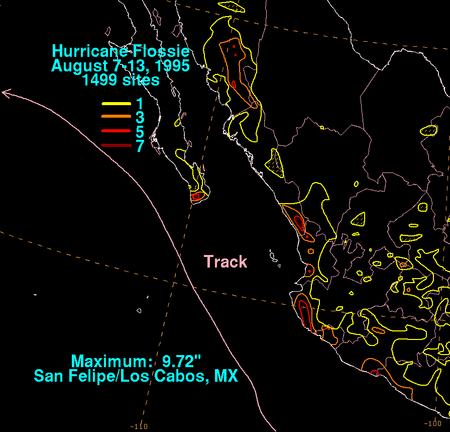
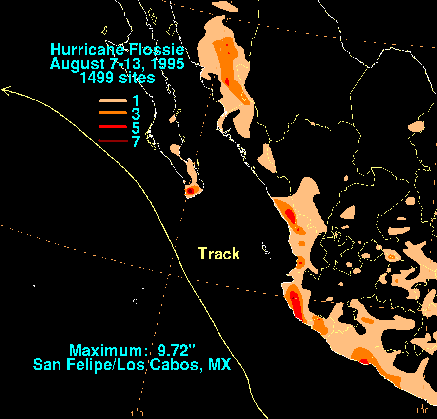
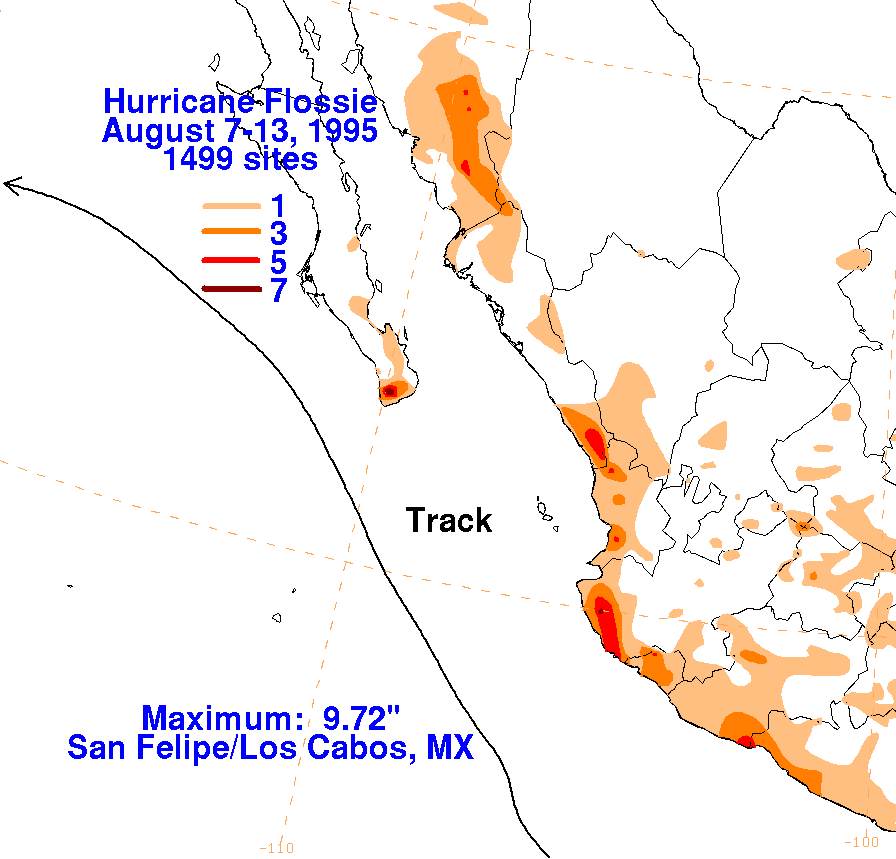
The storm total rainfall maps below were constructed using data
from the National Climatic Data Center, and
from the Comision Nacional del Agua, parent agency of Mexico's National
Weather Service.
 |
 |
 |