Squally weather was first noted south of Guatemala on the
20th. A well developed circulation formed over
the Yucatan peninsula
on the 21st as the disturbed area moved northward, and moved into the
Gulf of Mexico.
The system gradually organized as it increased in size, becoming a
tropical storm on the 22nd and a hurricane the
next day. That afternoon, the cyclone turned east-northeast,
clipping the Mouth of the Mississippi River on the 24th.
The hurricane made landfall south of Pensacola before striking the
coast again at Fort Walton Beach. As it passed out
of Florida, Flossy became an extratropical storm which continued moving
east-northeast, moving back into the Atlantic
near the Virginia Capes.
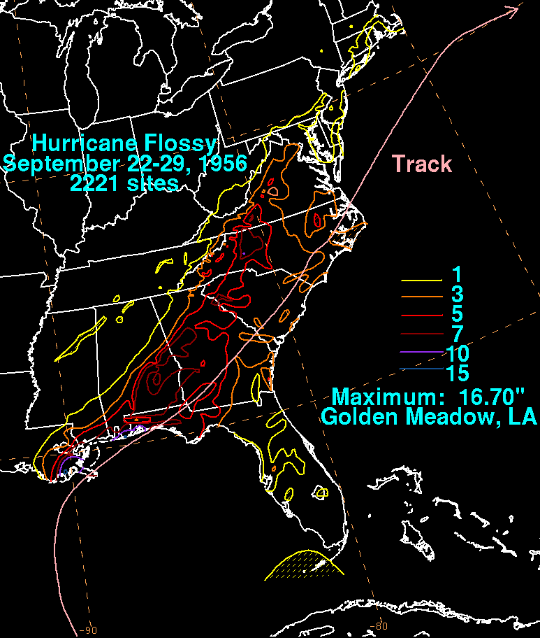
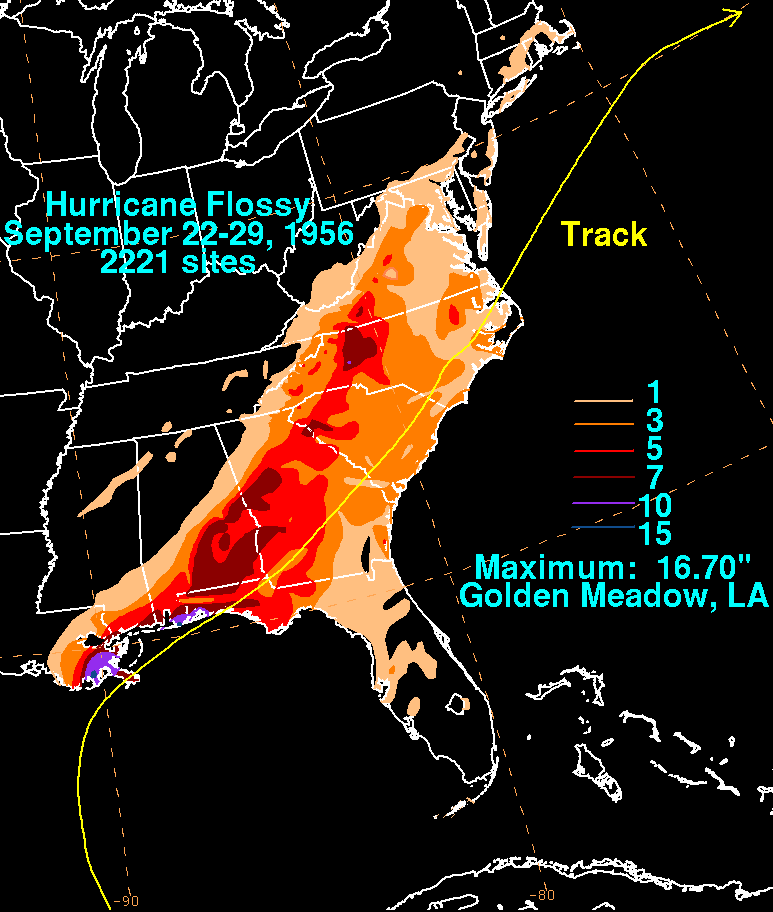
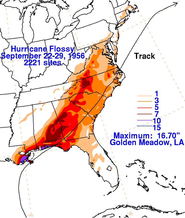
The graphics below show the storm total rainfall from
Flossy. Rainfall data was provided by the National Climatic
Data Center in Asheville, North
Carolina, with a extra data point provided by the annual hurricane
season report
published in Monthly Weather Review.
 |
 |
 |