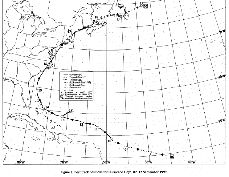
A tropical wave that moved off Africa on September 2nd moved
westward
with little change in
organization until the 7th, when upper level outflow improved over
the system and a curved
band of deep convection persisted around the center. The system
was upgraded to a tropical
depression 1000 miles east of the Lesser Antilles around noon on the
7th, and into a tropical
storm that night. Floyd moved west-northwest to the north of
the Lesser Antilles, lured into a
more poleward course by the presence of an upper trough. Now
a hurricane, it moved on a
more westward course when a mid-level high formed to its north.
It strengthened rapidly,
becoming a strong category four hurricane during the morning of the
13th. As it peaked in
intensity, the track became more northwesterly through the Bahamas
as a trough over the
eastern United States began to steer the storm. Slowly weakening, Floyd
struck the coast
of North Carolina near Cape Fear during the night of the 15th, while
transitioning into an
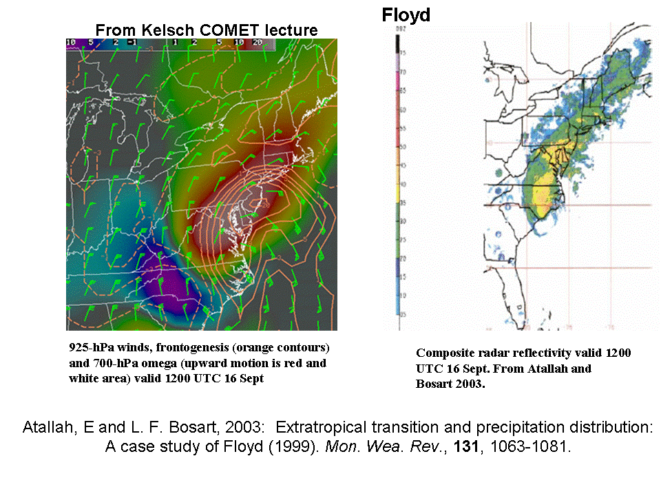
extratropical storm. The graphic below, supplied by Wes
Junker but originating by work
done by Math Kelsch and Lance Bosart, shows the frontogenesis occurring
north of its center
as it
made landfall and its effect on the rainfall distribution.
The cyclone tracked just inland of the
coast,
reaching Maine during
the morning of the 17th. It cleared the maritime provinces of
Canada on the 19th and
became absorbed by a large cyclone over the North Atlantic later that
day.
Its track is below.
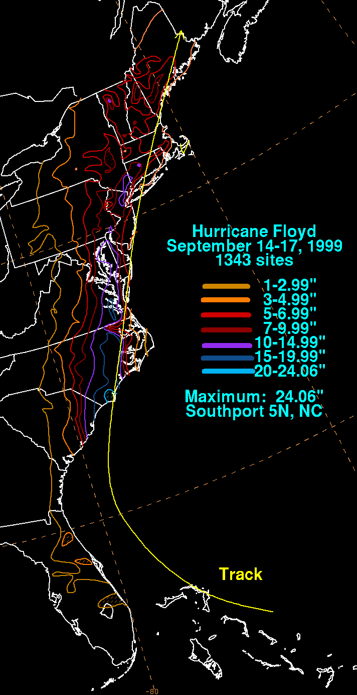
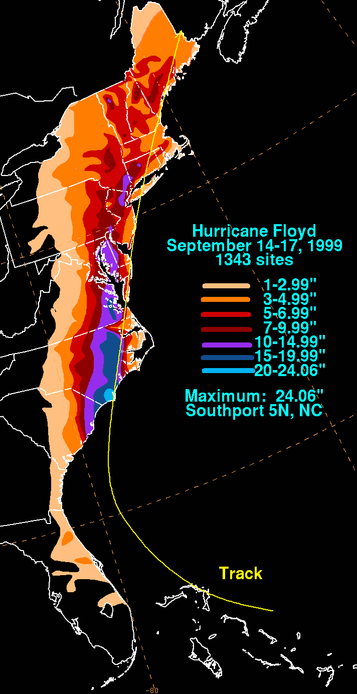
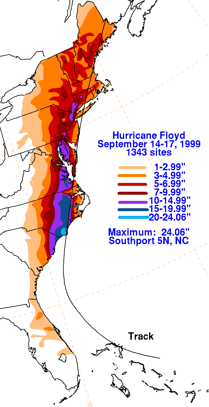
The graphics below show the storm total rainfall for Floyd...data
provided
by the National
Climatic Data Center in Asheville, NC. Note the maximum in
southeast
North Carolina,
just to the left of where the center made landfall, and the secondary
maxima in southeast
Virginia, and southeast New York. Rain in the Mid-Atlantic and New
England occurred
along a coastal front which formed in response to Floyd's circulation
and a synoptic scale
cold front that impinged on the system's west side.
 |
 |
 |
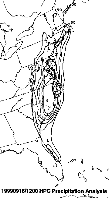
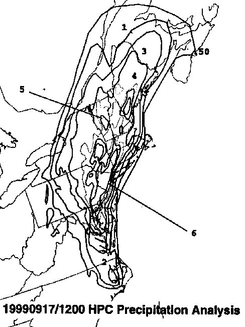
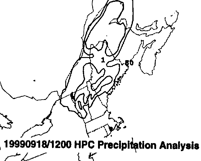
Below is the calendar for Daily Precipitation Maps. Note that
the 24-hour periods end
at 12z that morning.