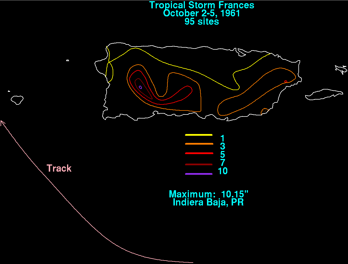
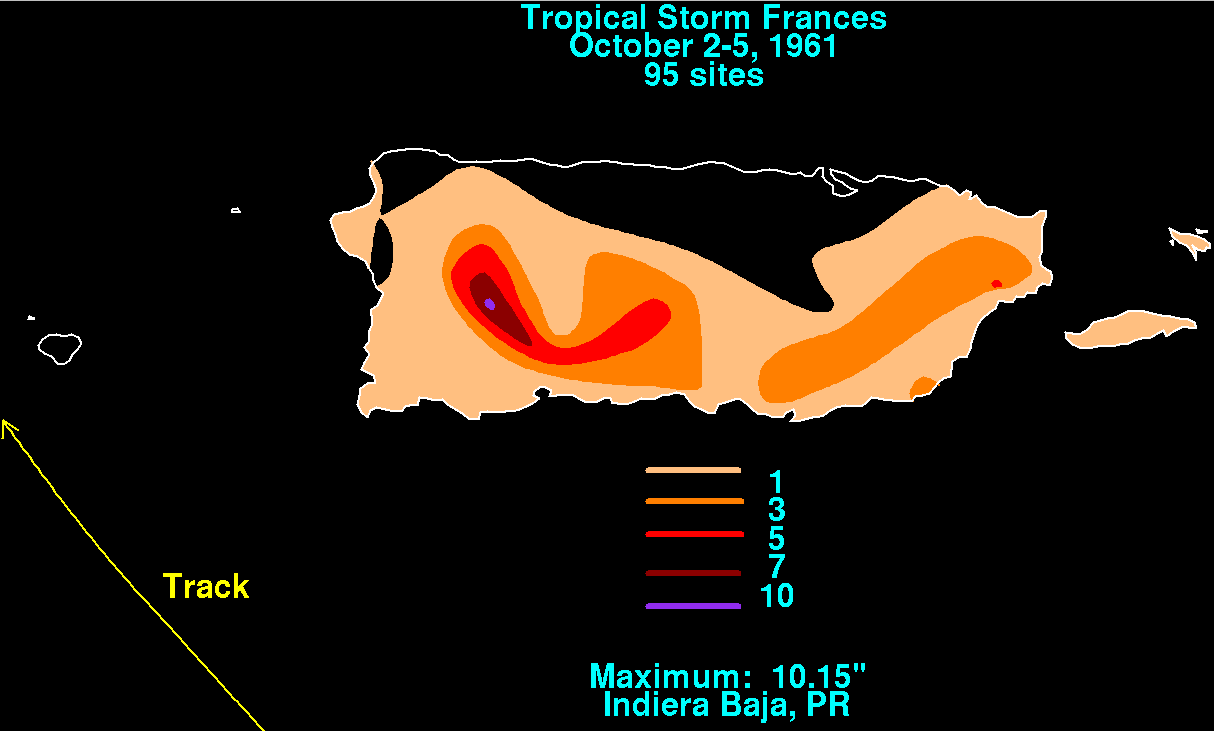
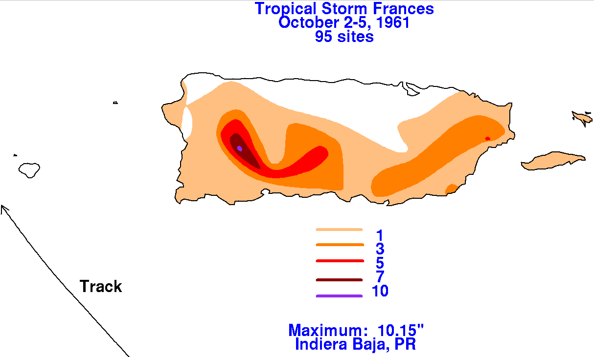
Tropical Storm Frances - October 2-5, 1961
A tropical disturbance was first spotted by satellite on September 28th east of the Lesser Antilles.
By the 30th, the system had become a tropical storm per reports from reconnaissance aircraft.  The
tropical storm moved through the northeast Caribbean, before turning northwest through the Mona
Passage and the eastern Dominican Republic into the western subtropical Atlantic.  As it did so,
Frances dropped locally heavy rainfall and flooding across Puerto Rico.   The storm total rainfall
maps below were constructed using data from data archived at the National Climatic Data
Center in Asheville, North Carolina.
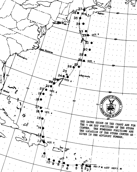
Moving more northward, Frances intensified into a hurricane on October 6 while 560 miles east of Miami.
The storm passed 70 miles northwest of Bermuda as a major hurricane overnight on the 6th and 7th.  The
hurricane turned back towards the northwest, approaching the Maine coast on the 9th before paralleling
the coastas it weakened.  Below is the track of this storm, provided by the National Hurricane Center.