A tropical wave with cyclonic turning moved off the coast of Africa
on July 19th. Weakening as it moved
westward, the wave travelled across the tropical Atlantic and Caribbean
before crossing Central America on
July 31. Thunderstorm activity with the wave increased, but did
not show organization until August 4th. The
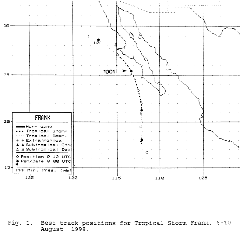
organized into a tropical depression by the morning of August 6th, 480
miles south of the tip of Baja California.
Moving northward due to a mid-level trough west of the United States,
the cyclone became a tropical storm late
on the 7th. Turning north-northwest parallel to the Baja
California peninsula, Frank spread heavy rains across
the southern portion of the peninsula. Moving into cooler waters,
the system weakened back into a tropical
depression, and eventually a remnant low. Below is a track of the
cyclone, prepared by the National Hurricane
Center.
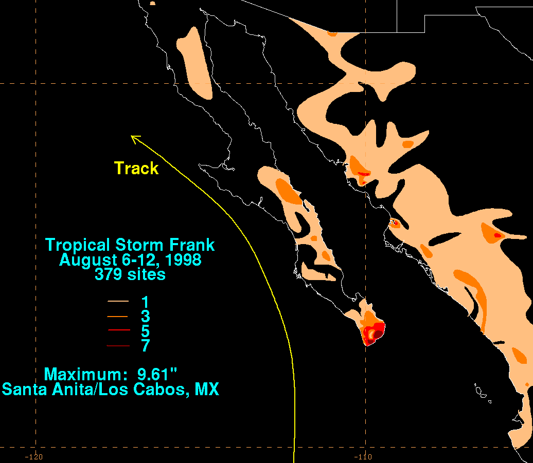
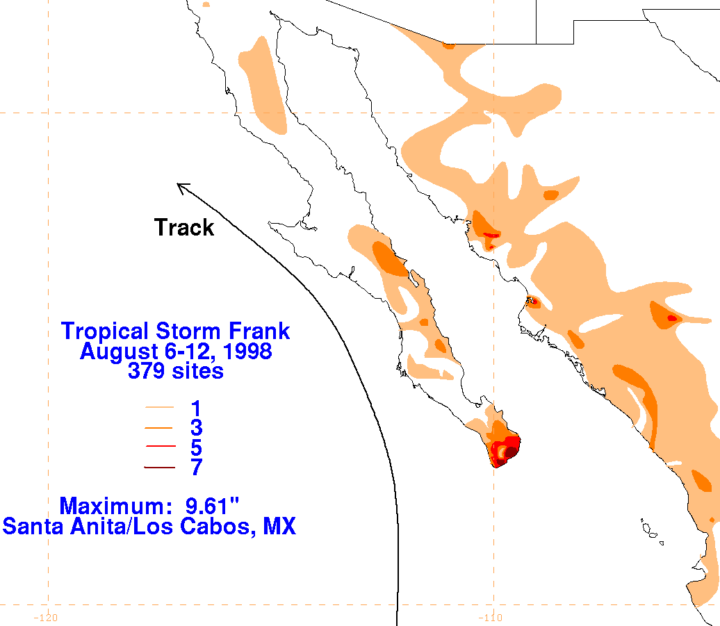
Below are the storm total graphics for Frank. The absolute
maximum on land fell across the southern
tip of Baja California to the east of the center. Data for
the maps was obtained from the Comision
Nacional del Agua, the parent
agency of Mexico's National Weather Service.
 |
 |
 |