A tropical wave left the west African coast on September 21st. It moved westward for days with little fanfare.
Showers and thunderstorms with the wave increased as it approached the Lesser Antilles on the 27th, but remained
disorganized. Another increase in convection occurred in the western Caribbean on the 30th, which persisted. A
surface low developed and the system became well enough organized to become a tropical depression early on October
2nd about 260 miles southeast of Cozumel, Mexico. Becoming a tropical storm that afternoon, Gamma continued to
intensify and became a hurricane near its landfall timing in Tulum, Mexico on the afternoon of the 3rd. Downgraded
to a tropical storm, landfall and eventually vertical wind shear importing dry air from the backside of a nearby front
kept Gamma from regaining hurricane intensity in the Gulf of Mexico. Gamma turned north and northeast before its
thunderstorm activity became stripped away. As a low level circulation, the cyclone turned southwest around Delta's
periphery as a tropical depression while randomly sputtered thunderstorms near its center. During the night of the 5th,
Gamma made landfall near Nichili, Mexico and became absorbed by Delta while over the Yucatan by the afternoon of the 6th.
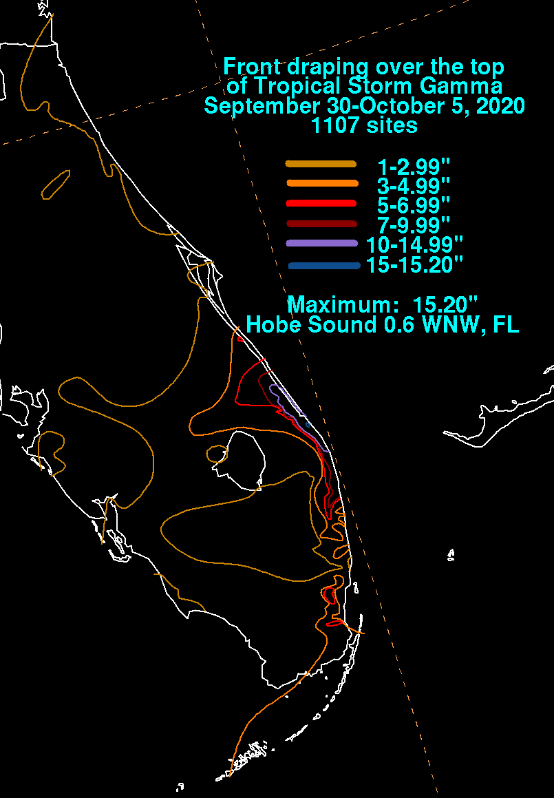
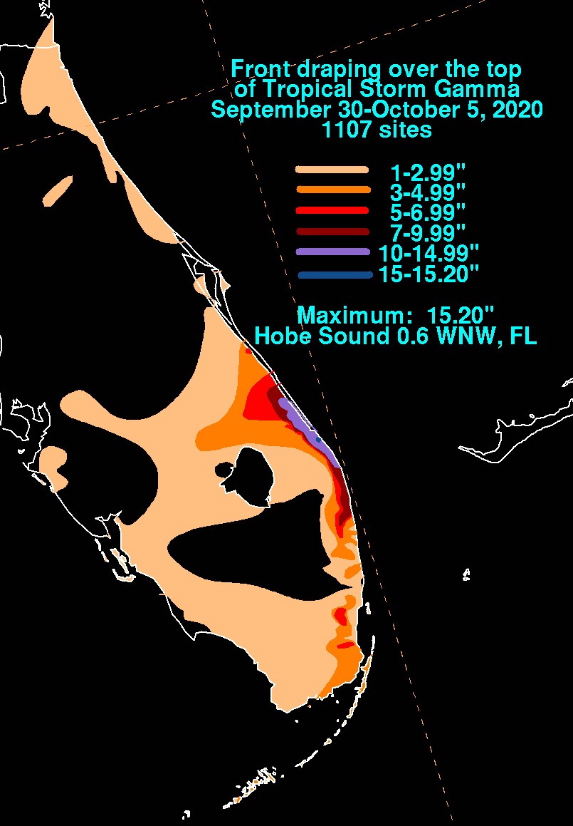
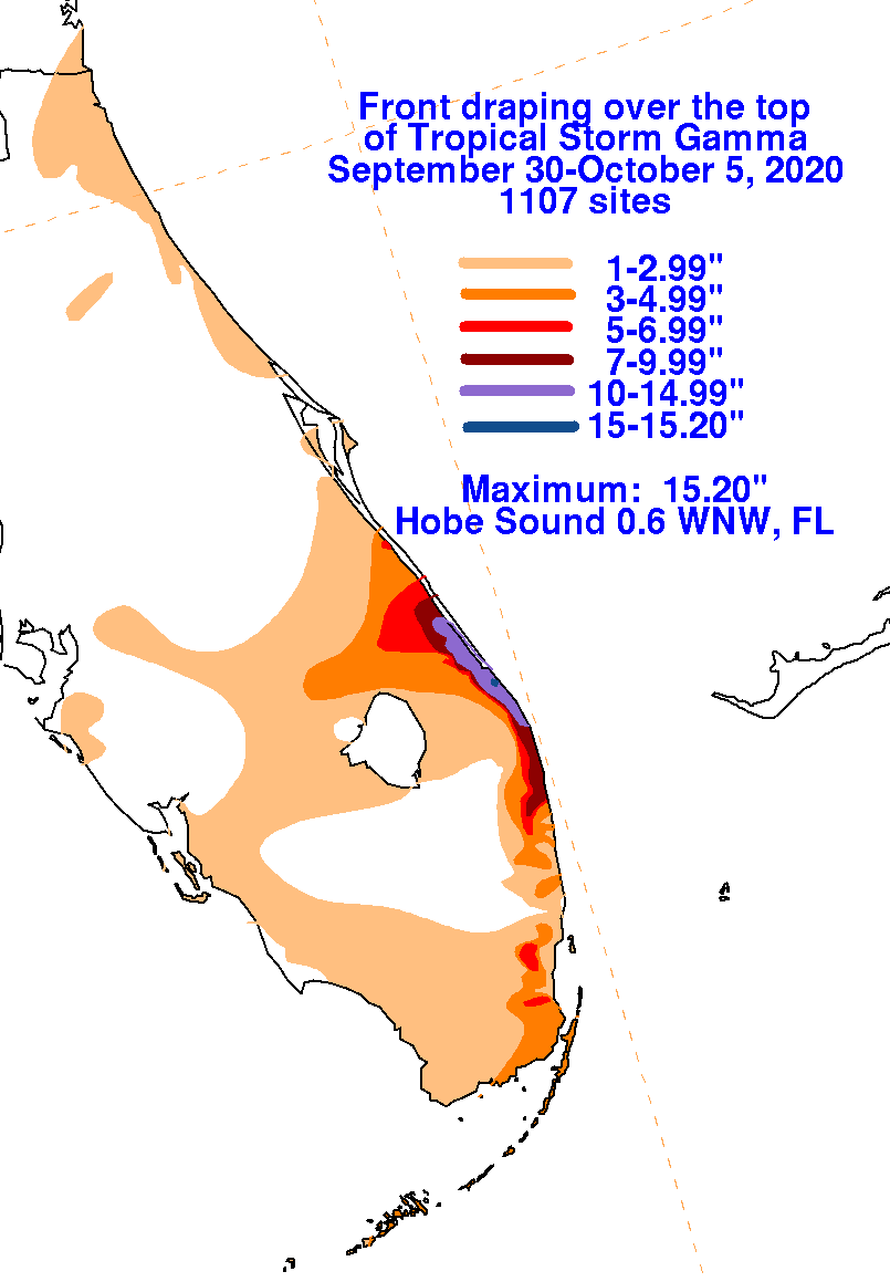
The graphics below show the storm total rainfall from the periphery Gamma -- caused by moisture overrunning a nearby front
in Florida and ocean effect rainfall in the front's wake -- which used rain gage information from the National Weather Service
River Forecast Centers, Forecast Offices, and CoCoRAHS.
 |
 |
 |