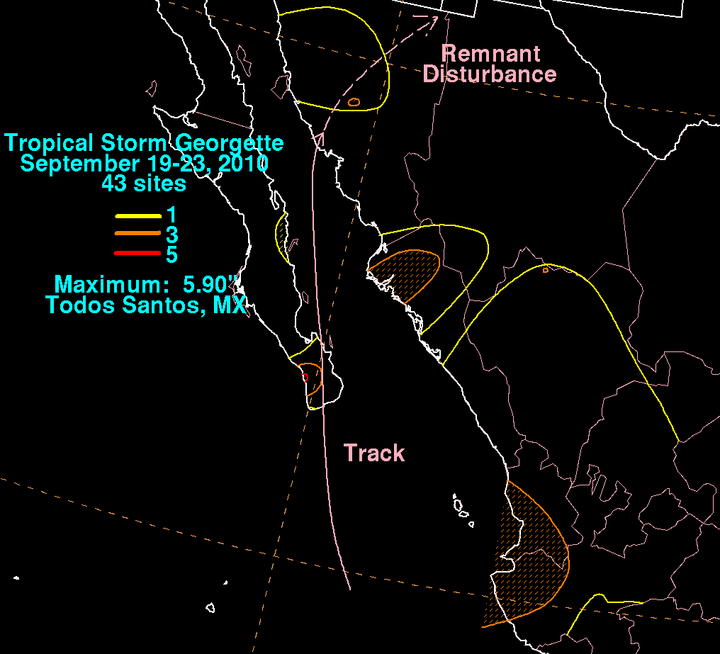
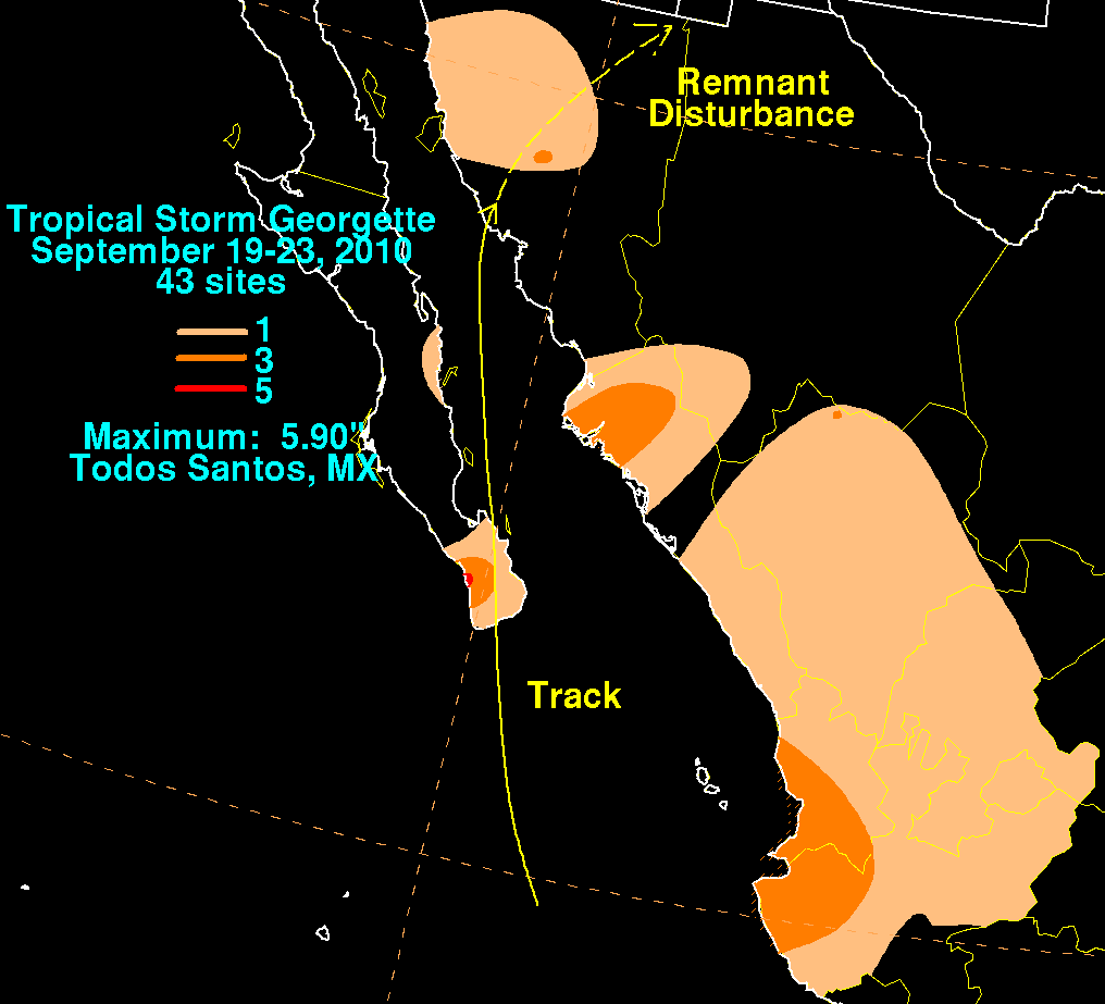
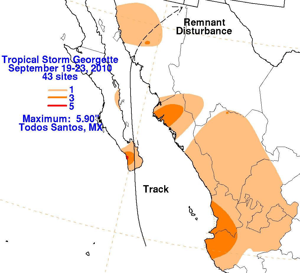
Tropical Storm Georgette - September
19-23, 2010
A tropical wave moved offshore the western coast of Africa on September 1st.  Moving across the tropical Atlantic
 as a weak system, convection eventually increased as it approached the Lesser Antilles on the 9th.  This convective
system ultimately organized into Hurricane Karl on the 14th.  The wave continued westward crossing southeast Mexico
on the 17th and 18th before emerging into the tropical eastern Pacific on the 19th.  Convection increased around a
developing well-defined circulation, and the system became well-enough organized to be considered a tropical
depression on the early morning of the 20th.  Convection continued to flare and diminish periodically due to strong
easterly vertical wind shear.  By afternoon, the cyclone had strengthened into a tropical storm to the south-southeast
of the tip of Baja California.  Georgette moved around the western edge of a subtropical ridge located over northern
Mexico, moving ashore the tip of Baja California during the afternoon of the 21st.  As a tropical depression, it crossed
the Gulf of California and struck mainland Mexico near Guaymas on the afternoon of the 22nd.  The depression dissipated
soon after landfall, with its remains becoming increasingly indistinct as they approached the central United States/Mexican
border.  Below are its associated rainfall graphics, using data and graphics provided by the Comision Nacional del Agua,
the parent agency of Mexico's national weather service.