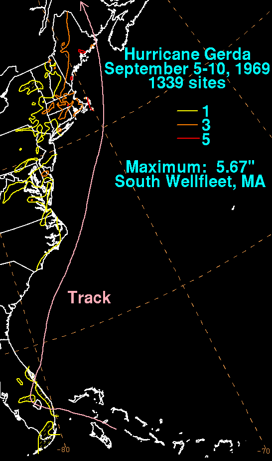
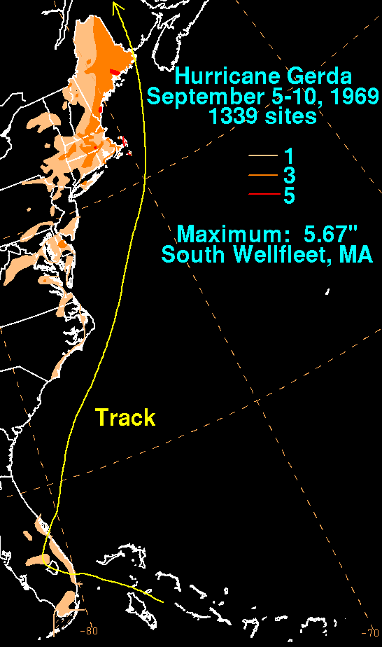
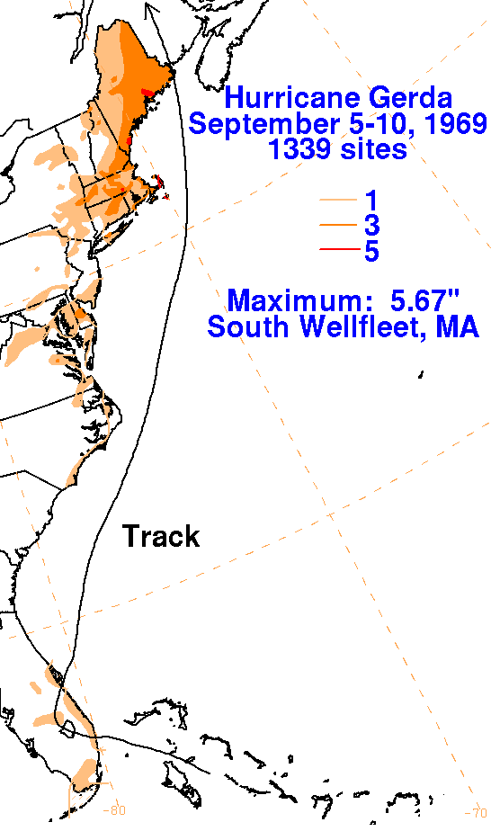
A weak tropical distrubance moved across the tropical
Atlantic. On the 3rd, it merged with an upper cyclone
north of the Greater Antilles. The system organized and moved
west-northwest, developing a surface circulation
over the central Bahamas. The tropical depression moved into
southeast Florida before recurving back out to sea
near Cape Kennedy/Canaveral. The system strengthened after
offshore and became a tropical storm late on the
7th. As the system accelerated northeast, Gerda achieved
hurricane strength on the afternoon of the 8th. The
cyclone was moving at a forward speed of 40 mph when it made landfall
across the eastern tip of Maine by
the evening of the 9th. The graphics below show the storm total
rainfall from Gerda. Rainfall data was
provided by the National Climatic Data Center in Asheville, North
Carolina.
 |
 |
 |