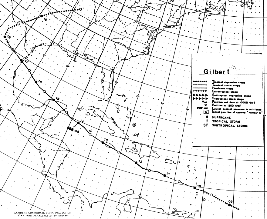
On September 3rd, a westward moving tropical wave showing no signs
of organization emerged
off the northwest African coast into the North Atlantic. Over the
next several days, a broad area
of low pressure formed whose circulation extended nearly to the
equator. An organized center
was not evident until it approached the Windward Islands on the
8th. By the 9th, it had developed
into the 12th tropical depression of the season 400 miles east of
Barbados.
The depression moved west-northwest at 17 mph, reaching tropical
storm strength over the
Lesser Antilles on the afternoon of the 9th. Rapid strengthening
ensued on the 10th, bringing
Gilbert to hurricane-force that evening. The system continued its
trek west-northwest, passing
over Jamaica as a major hurricane on the 12th. After it emerged
into the northwest Caribbean
Sea, Gilbert rapidly intensified into a category 5 hurricane, with
recon reports ranging between
882-885 hPa for the hurricane's surface pressure on the afternoon of
the 13th. It moved into the
Yucatan peninsula, becoming the first category 5 hurricane to make
landfall in the Atlantic Basin
since Camille in 1969.
Gilbert tracked west-northwest through the Gulf of Mexico as a
category 3 hurricane, making its
final landfall in northeast Mexico just north of La Pesca on the
afternoon of the 16th. As the
weakening system moved across Texas and Oklahoma, heavy rains fell
along its path, as it
accelerated northeast thru the Mid-Mississippi Valley into the Great
Lakes late on the 19th/
early on the 20th. Below is the track of this cyclone,
provided by the National Hurricane
Center.
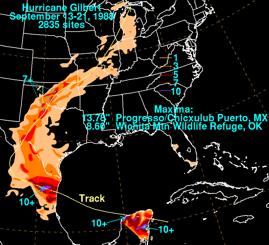
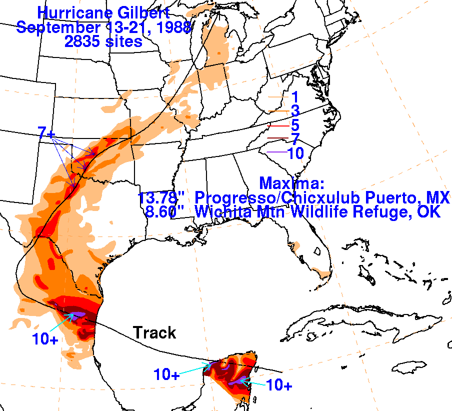
The graphics below show the storm total rainfall for Gilbert.
Note
the maxima along and just to the left/west
of the track of the cyclone.
|
|
 |
 |
