A tropical depression formed in the southeast Bahamas on October 16th due to a polar trough to its north.
On the 19th, it reached gale force but was still not tropical as there was no warm core. The ocean storm
developed hurricane-force winds on the 20th, but reconnaissance aircraft was not able to detect a warm
core until the 22nd, when Ginny's thermal structure finally resembled a hurricane. The cyclone drifted near
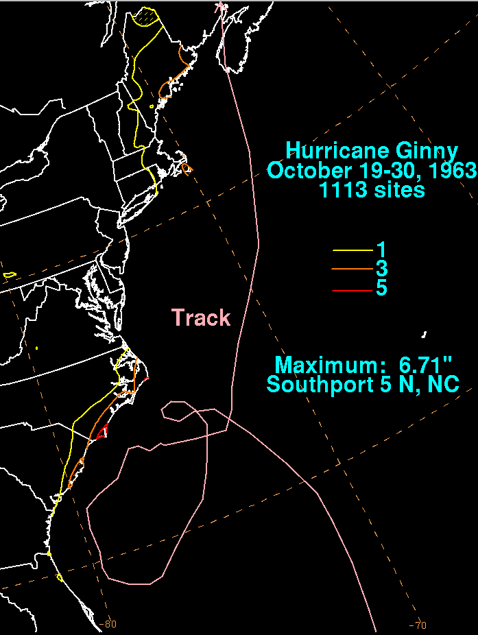
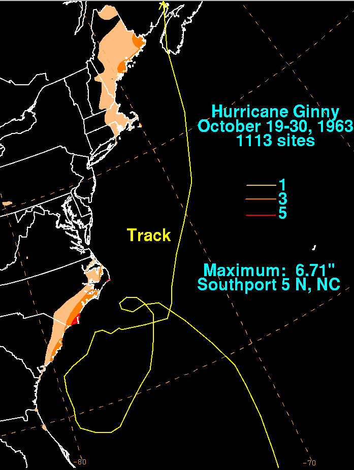
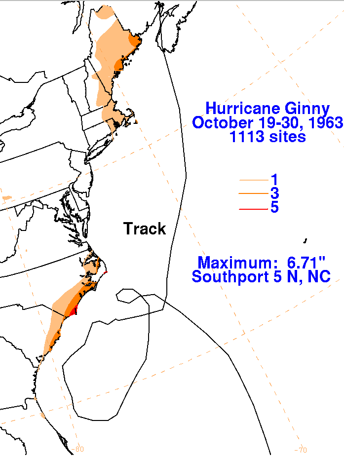
the Gulf Stream for the next week, remaining within 250 miles of the Southeast coast. Its eyewall came within
50 miles of Cape Canaveral and Daytona Beach before turning back to the northeast. As the storm moved offshore
New England, cold air was drawn southward through New England, leading to up to 13 inches of snow across
northern and central Maine. The graphics below show the storm total rainfall for Ginny. Data was provided by
the National Climatic Data Center in Asheville, North Carolina.
 |
 |
 |