A tropical wave moved through the Lesser Antilles on October 6th
withour developing during the following four days.
On October 11, a depression formed near Swan Island. A second
disturbance was seen forming on satellite imagery on
the 12th, with a third distrubed area forming near San Andres.
The system near San Andres moved north-northwest
over the next couple of days, developing into Gladys by the
14th. Gladys strengthened to a hurricane just south of
the western Cuba. A deep trough over the Plains steered Gladys
northward. The cyclone recurved into western
Florida near midnight on the 19th and accelerated as it passed
Ocala. Quickening its pace to the northeast, Gladys
headed towards Cape Hatteras on the 20th.
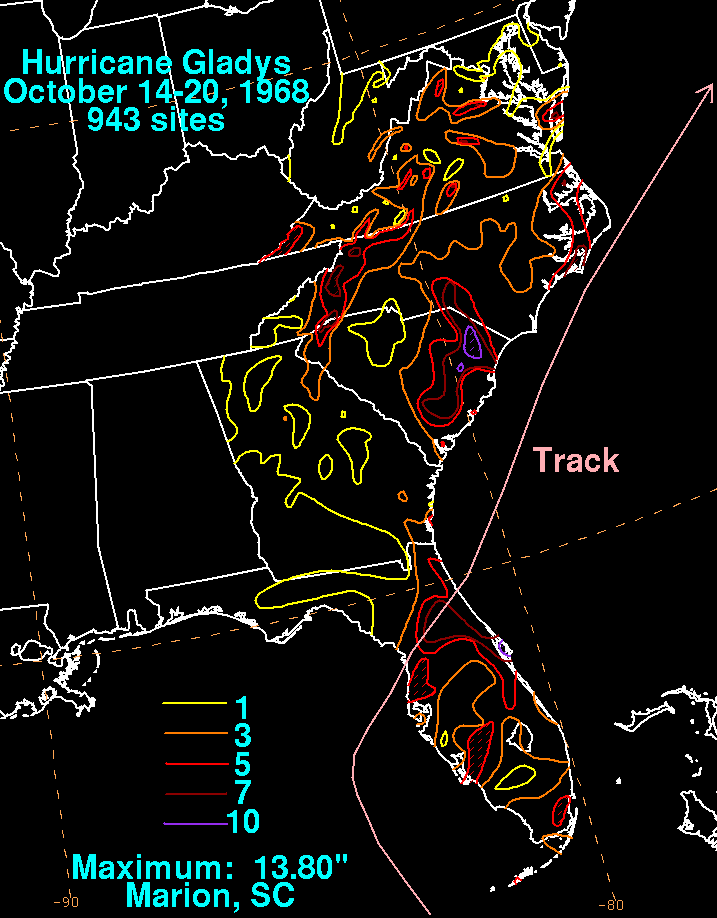
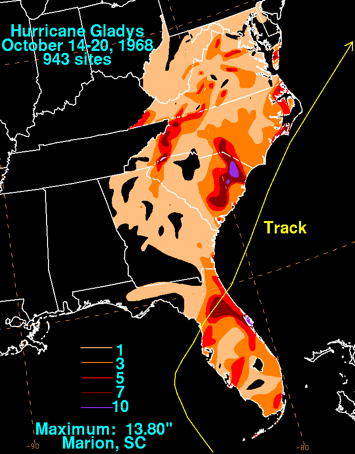
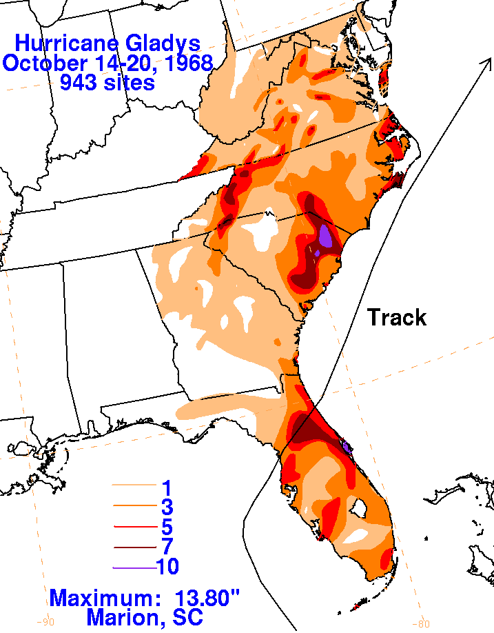
The graphics below is the storm total rainfall for Gladys using data
obtained from the National Climatic Data Center
in Asheville, North Carolina. The rainfall that fell across
the East fell in advance of the storm as moisture was lured
northward from Gladys by a deep upper trough to the west. The
rainfall from the tropical cyclone broke the worst
drought seen across North Carolina since 1932.
|
|
|
|