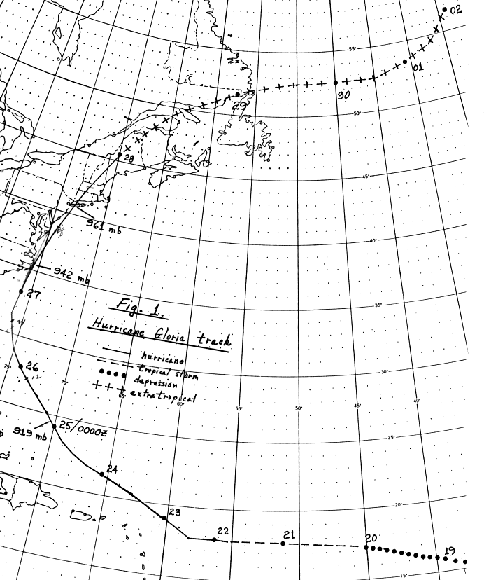
Gloria became a tropical depression near the Cape Verde Islands on
the 16th. It slowly
developed into a tropical storm, and moved west-northward through the
tropical Atlantic
at near 20 mph. On the 22nd, Gloria finally became a hurricane to
the north of the Leeward
Islands. Development continued at a faster rate, and Gloria
became a category four hurricane
as it moved northwestward to the east of the Bahamas. Gloria
assumed a more northward
track, and passed over the Outer Banks of North Carolina early on
the 27th. Accelerating
rapidly, Gloria made a second landfall on the afternoon of the
27th on western Long Island,
then fully became a strong nontropical low as it passed into the
Canadian Maritimes that
evening. Its track lies below, provided
by the National Hurricane
Center.
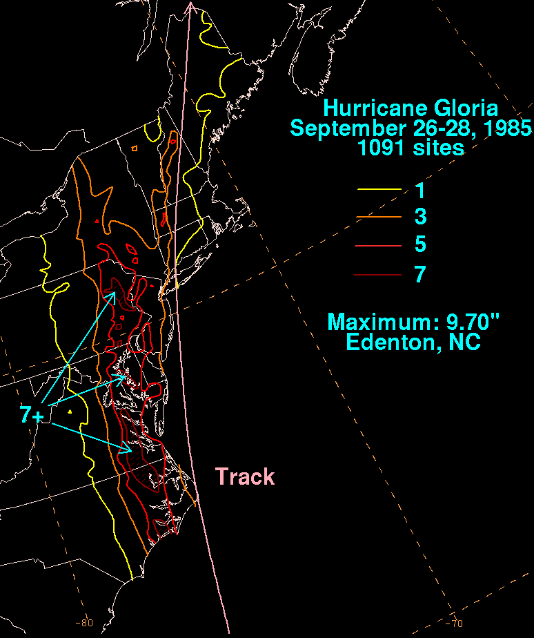
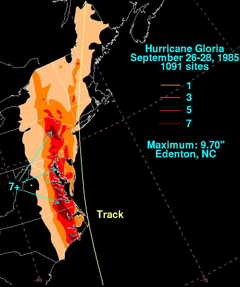
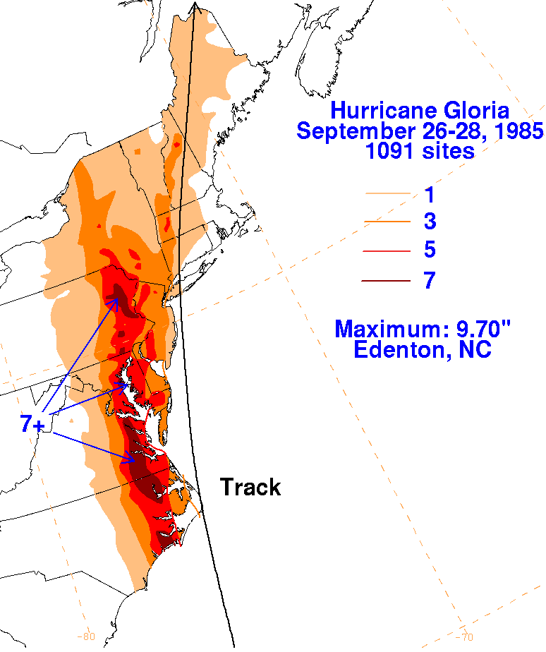
Below are a storm total rainfall maps for Gloria. Rainfall
information was obtained from the
National Climatic Data Center. Note virtually all the rain fell
west of the center, due to the
cyclone becoming nontropical as it paralleled the East Coast.
 |
 |
 |