An upper tropospheric trough, which has been intensifying along the
80th meridian north of the
20th parallel, was cutting off a cyclonic circulation near the Florida
Straits. This induced surface
cyclogenesis in the Central Bahamas. During the evening of the
13th, the cloud pattern and surface
wind field resembled a subtropical cyclone. A deep-layer ridge
near the U.S. Mid-Atlantic coast and
a larger scale deep-layer cyclone within which Gordon was embedded
provided the steering current
for the storm, which was west-northwest. Winds increased to
gale-force
over the Florida peninsula
late on the 13th. Thereafter, the cyclone moved southwest of
the western Bahamas through the
Florida Straits.
Just before dawn on the 15th, radar imagery from Key West suggested
the center of Gordon jumped
northward from the Cuban coast to just south of the lower Florida
Keys.
The new center moved
northwest through the Keys and slowed its forward motion in the
southeast
Gulf of Mexico. Gordon
moved north, then northeast, into the southwest coast of Florida near
Fort Myers during the morning
of the 16th. Moving northeast, the storm quickly corssed the
coast of Florida emerging into the Atlantic
during the afternoon of the 16th. As it accelerated northeast
on the 17th, Gordon strengthened into a
hurricane.
A blocking mid-tropospheric ridge slowed the cyclone to a halt on
the
18th southeast of North Carolina.
Gordon's center came within 80 miles of the Outer Banks that day,
before
the system moved south
then southwestward back towards Florida. Northwesterly shear
in combination of cool dry air filtering
into its circulation caused the cyclone to weaken, becoming a tropical
storm after noon on the 18th,
then a tropical depression early on the 20th. As it
circumnavigated
the surface high to its north, it
turned west then northwest towards Cape Canaveral. It then moved
inland and paralleled the coast,
crossing southeast Georgia before dissipating over South
Carolina.
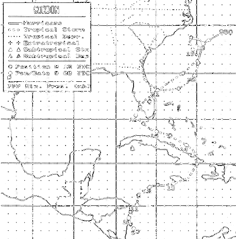
Below is the track of this storm,
provided by the National Hurricane Center.
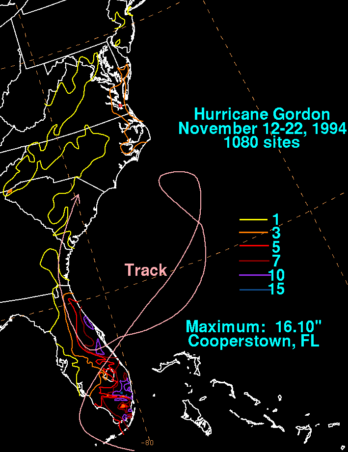
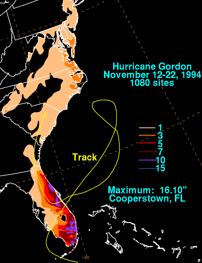
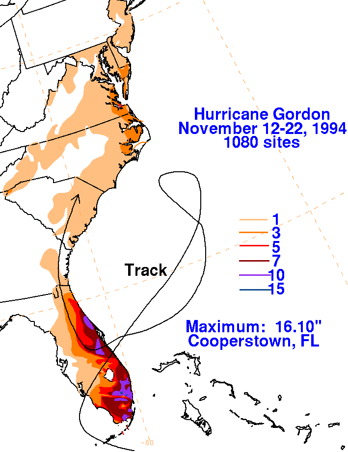
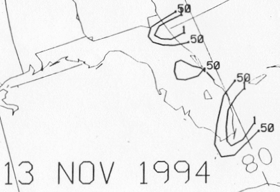
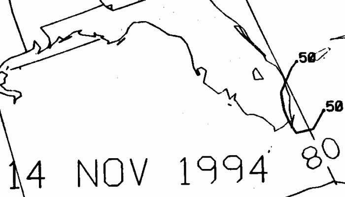
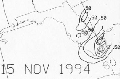
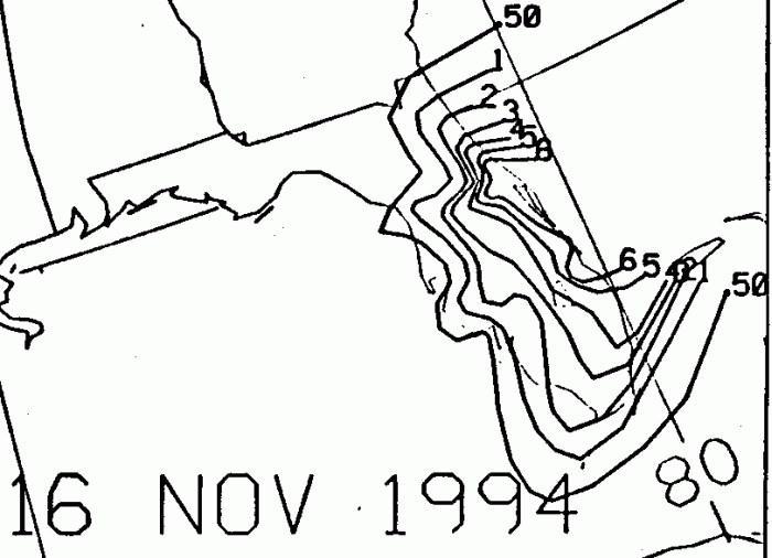
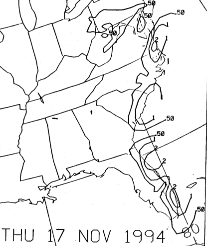
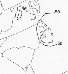
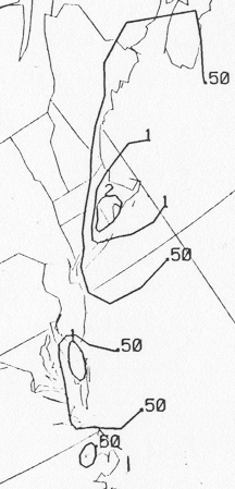
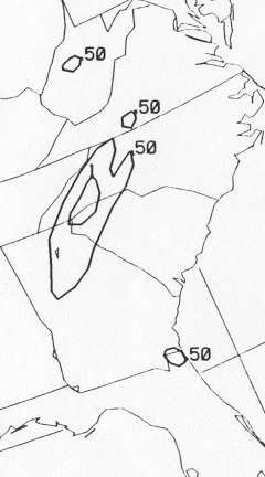
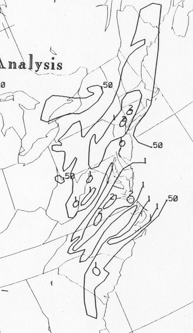
The storm total rainfall maps below were constructed using data
from the National Climatic Data Center and South Florida
Water Management District. Note the rainfall maximum is mainly to
the right of its track, with most of the eastern Florida
rainfall falling between the 12th and 16th.
 |
 |
 |
Below are the calendar for Daily Precipitation Maps. Note that
the 24-hour periods end
at 12z that morning.