A tropical wave left the west coast of Africa on August 26th. It moved quickly eastward, not showing development until the
30th across the northern Leeward Islands. While the southern portion of the wave moved through the Caribbean, the northern
section moved near the Greater Antilles without further development. Between the Central Bahamas and Cuba, development
resumed on September 2nd due to more favorable upper level winds. That night, a large blowup of thunderstorms occurred in
the Florida Straits which led to the development of a tropical depression early on the 3rd southeast of Key Largo. By sunrise,
the depression had strengthened into a tropical storm before making landfall near Tavernier. Intensification continued,
with Gordon forming an eye feature briefly offshore southwest Florida on the afternoon of the 3rd. Slower intensification
continued while trekking through the Gulf of Mexico on the 3rd and 4th, and Gordon was just shy of hurricane strength
when it made landfall in southern Mississippi late on the 4th. Gordon quickly weakened into a tropical depression and
tracked as a weaker feature through Arkansas before becoming a frontal wave and moving through the Ohio Valley on
subsequent days, making a turn into the lower Great Lakes by the 11th.
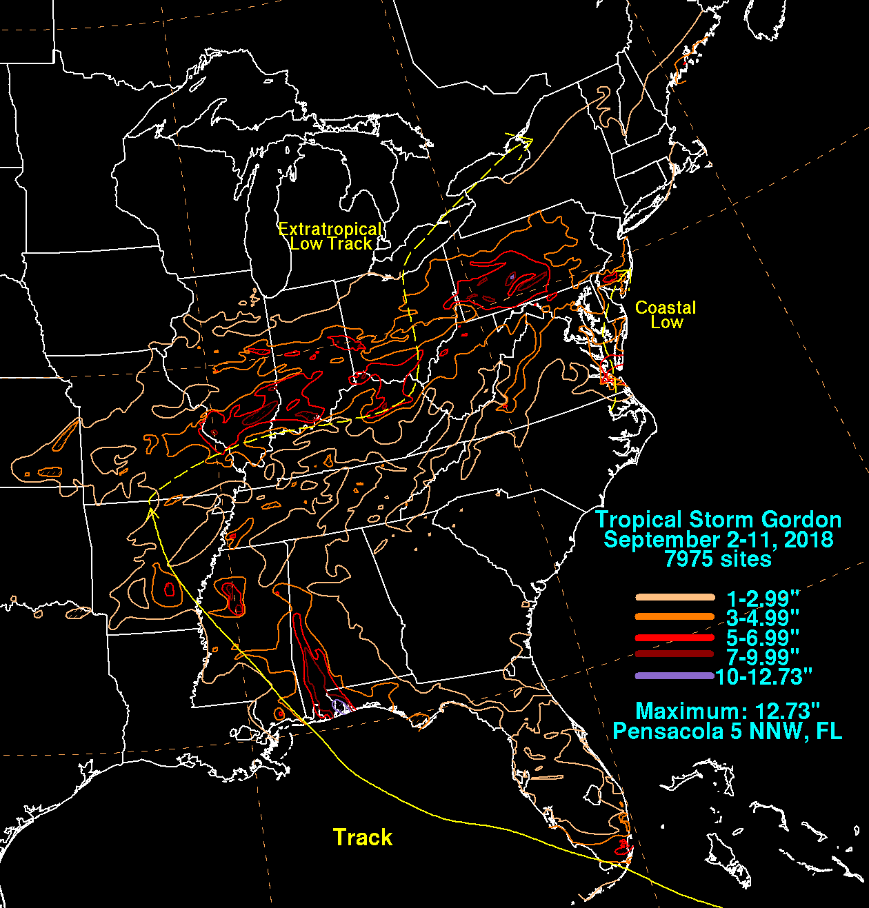
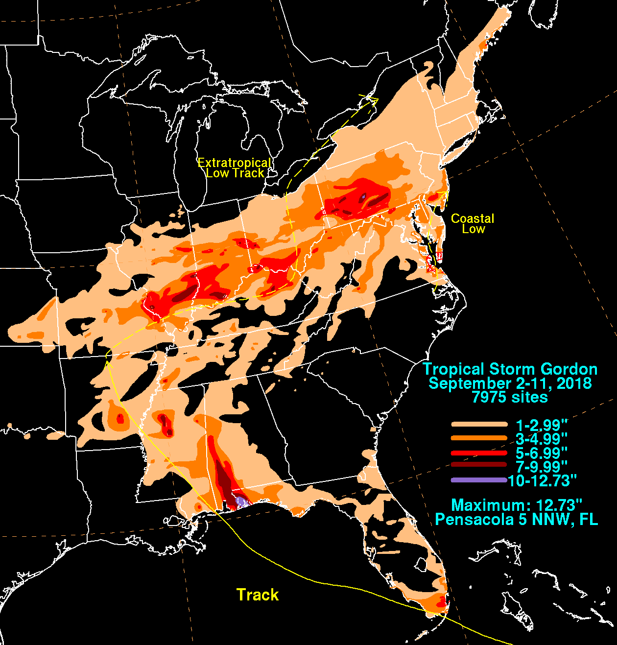
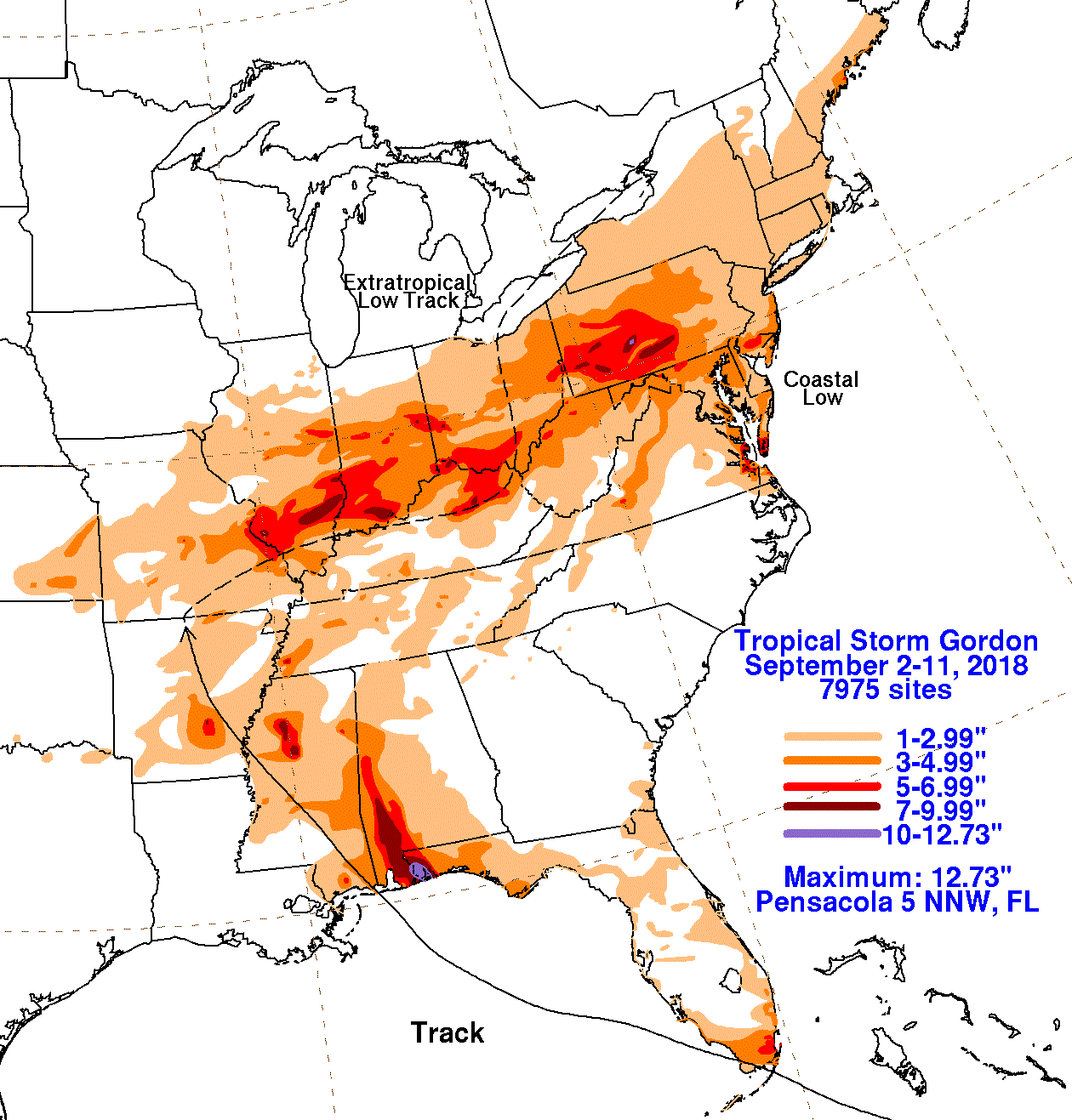
The graphics below show the storm total rainfall for Gordon, which used information from the National Weather
Service River Forecast Centers, Forecast Offices, and CoCoRAHS.
 |
 |
 |