The southern extension of the tropical wave that triggered Tropical
Storm
Emily in the Atlantic moved westward through
the Caribbean Sea for several
days and crossed Central America between 31 August and 1
September. Satellite imagery
revealed a middle-level
circulation with a large area of thunderstorms associated with the wave
moving westward partially
inland over southern Mexico. A large area of
disturbed weather associated with a cyclonic monsoon-type flow had
prevailed
over the eastern Pacific for several days. However, it was not
until the
tropical wave arrived in the area that tropical cyclone
formation began.
The thunderstorm activity became concentrated while cloud banding
features
were developing. Satellite
imagery suggested the formation of a 30-knot
tropical depression very near Manzanillo, Mexico early on the morning of
the 5th.
It appears that the same tropical wave combined with the strong
southwest
monsoonal-type flow which extended
northward into the Bay of Campeche, led
the formation of the Atlantic Tropical Depression Seven in the Gulf of
Mexico during that period.
that the tropical cyclone reached tropical storm strength by the afternoon of the 5th. Greg was then moving on a general
northwest track very close to the southwestern coast of Mexico. A large area of very deep convection formed near the
center of circulation and radar from Los Cabos, Mexico suggested the formation of an ragged eye during the morning of
the 6th. Greg was upgraded to hurricane status that afternoon while approaching the southern portion of Baja California.
No significant change in strength occurred for the next 24 hours, and thereafter, Greg weakened to tropical storm status as
its center moved over the area of Cabo San Lucas around 2100 UTC 7 September. Greg turned toward the west-northwest
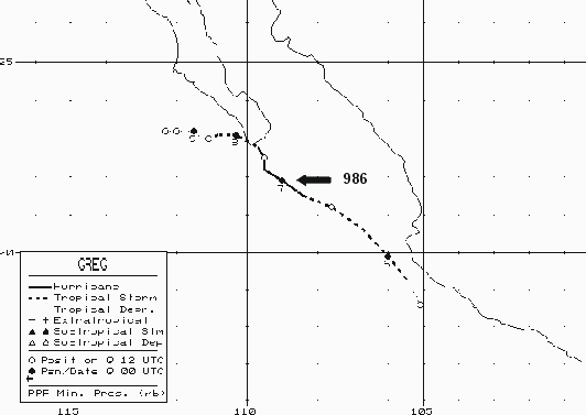
and west over cooler waters and weakening began. Below is its track, supplied by the National Hurricane Center.

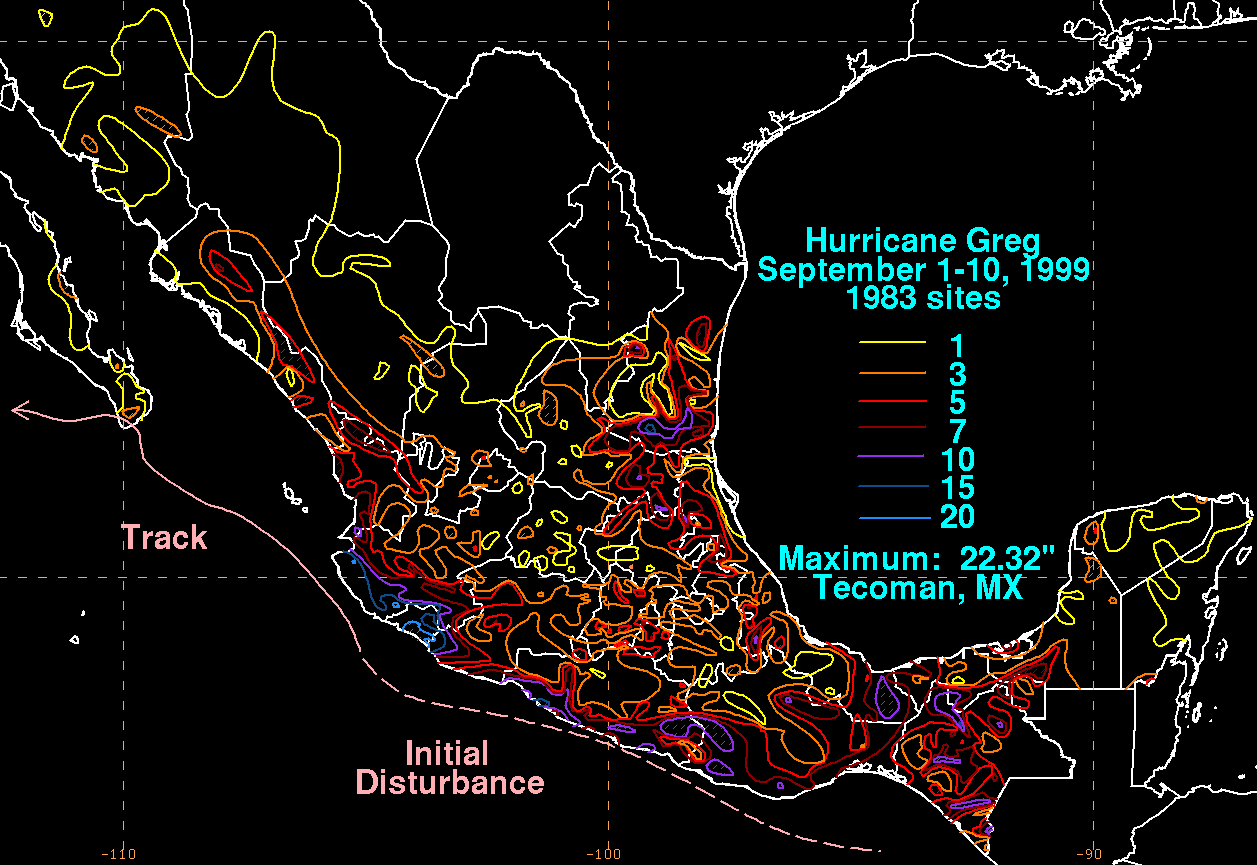
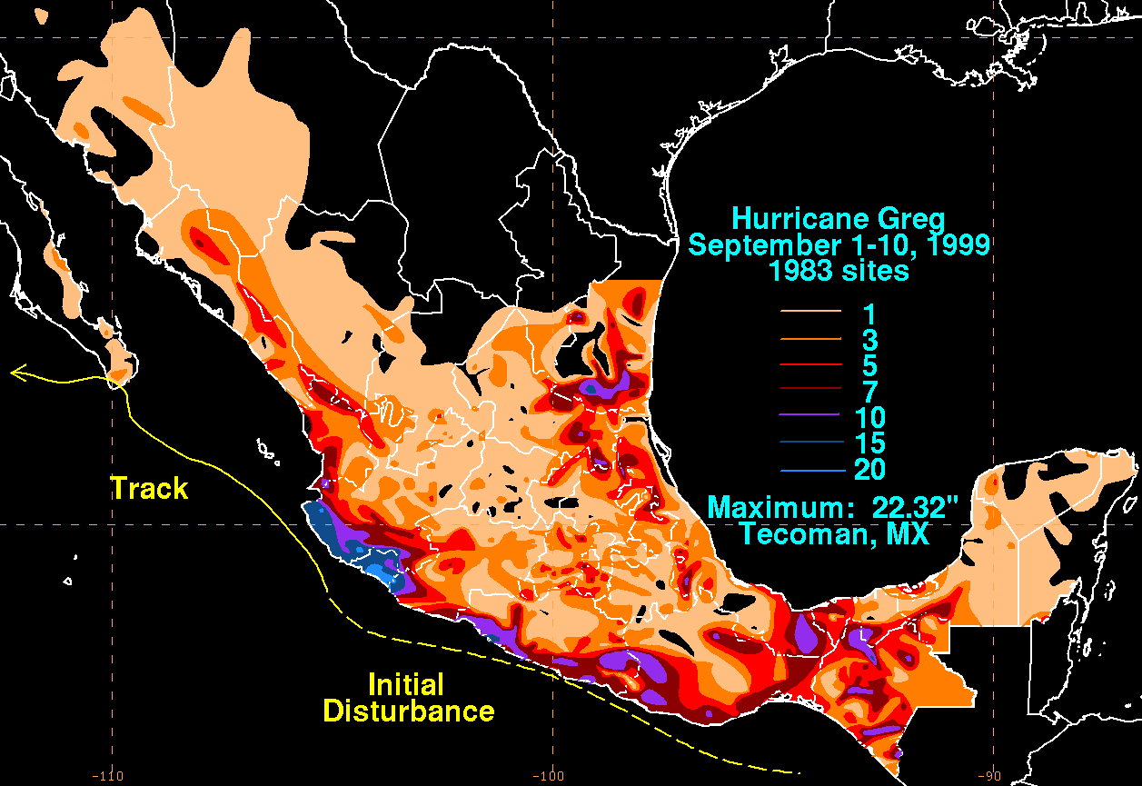
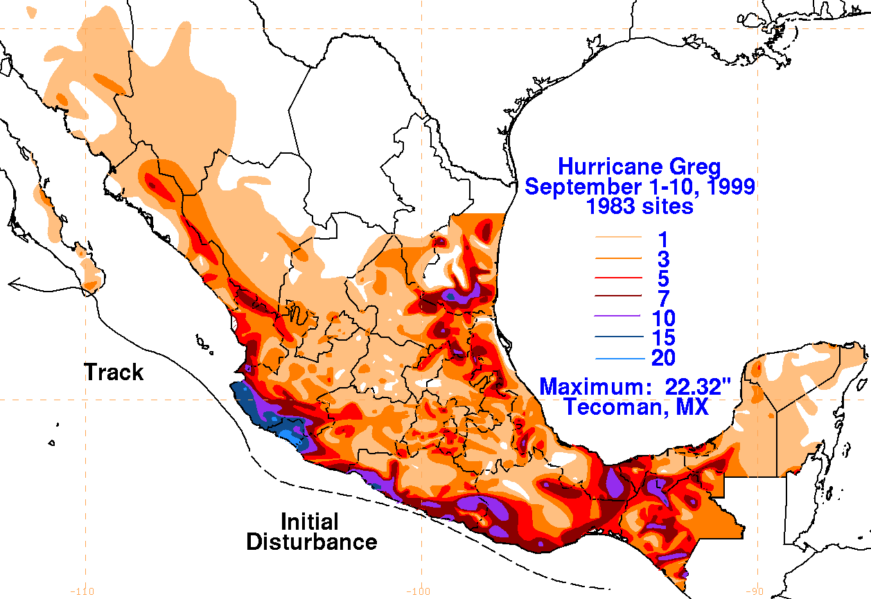
The graphics below show the storm total rainfall for Greg, which used information from the Comision del
Agua, which is the parent agency of Mexico's National Weather Service.
 |
 |
 |