A tropical wave moved off the coast of Africa on July 22nd.
Although the wave moved off with a surface
low pressure system, the low and the tropical wave weakened due to
unfavorable conditions aloft. Moving
uneventfully across the remainder of the tropical Atlantic and
Caribbean Sea without development, the wave
emerged into the eastern Pacific ocean by August 3rd. The wave
moved westward into a favorable upper
environment, thunderstorms developed which led to the development of a
surface low, and a tropical depression
had formed a few hundred miles south of Baja California by the
afternoon of the 6th. Evolving into a tropical
storm that night, the system moved northwest into cooler waters without
reaching hurricane status. Outer bands
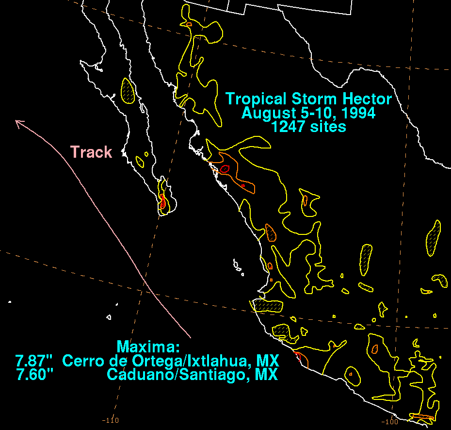
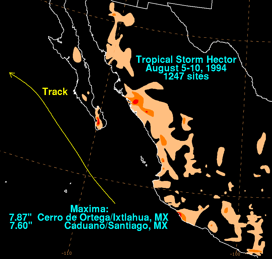
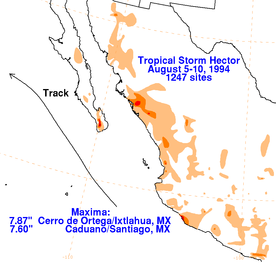
moved across portions of western mainland Mexico and Baja California as
the system moved parallel to the coast.
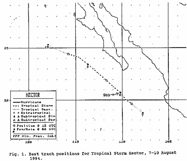
Hector dissipated as a tropical cyclone on the afternoon of the
9th. The remaining low level swirl moved west
for a couple of more days before dissipating. Below is its track,
provided by the National Hurricane Center.
Rainfall
information for Mexico was obtained from the Comision Nacional del
Agua, the parent
agency of Mexico's national weather service.
 |
|
|