Henri formed from a tropical wave that moved from
Africa to the tropical Atlantic Ocean on 22 August. The wave
reached the eastern Gulf of Mexico on September 1st where the
northern portion became nearly stationary, while the
southern portion continued westward. By the afternoon of
the 3rd, the
associated convection and low-level circulation
became well-enough
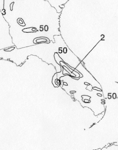
organized about 260 n mi west of Tampa, Florida to become Tropical
Depression Twelve.
The depression was embedded in the southern portion
of a slow-moving mid-latitude trough and moved slowly
eastward. The
depression became a tropical storm just after midnight on the 5th and
the wind speed increased to its
maximum value of 60 mph that afternoon even though there was at
least 25 mph of southwesterly
vertical shear
affecting the circulation. The system quickly weakened to a
tropical depression before Henri, preceded and
accompanied by heavy
rain, accelerated northeastward across north-central Florida on the
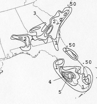
6th. Over the southwest
North Atlantic Ocean, Henri
slowed its forward speed on the 7th when it became trapped to
the south of a shallow
high pressure system. Strong vertical shear
finally led to its dissipation when the depression lost a
well-defined
low-level circulation and simultaneously became
involved with a frontal zone resulting in a spreading out of the
wind field. The broad and disorganized extratropical
low remained
nearly stationary off the coast of the Carolinas
for several days
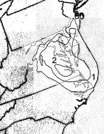
and moved inland over North Carolina on the 12th and 13th. Below
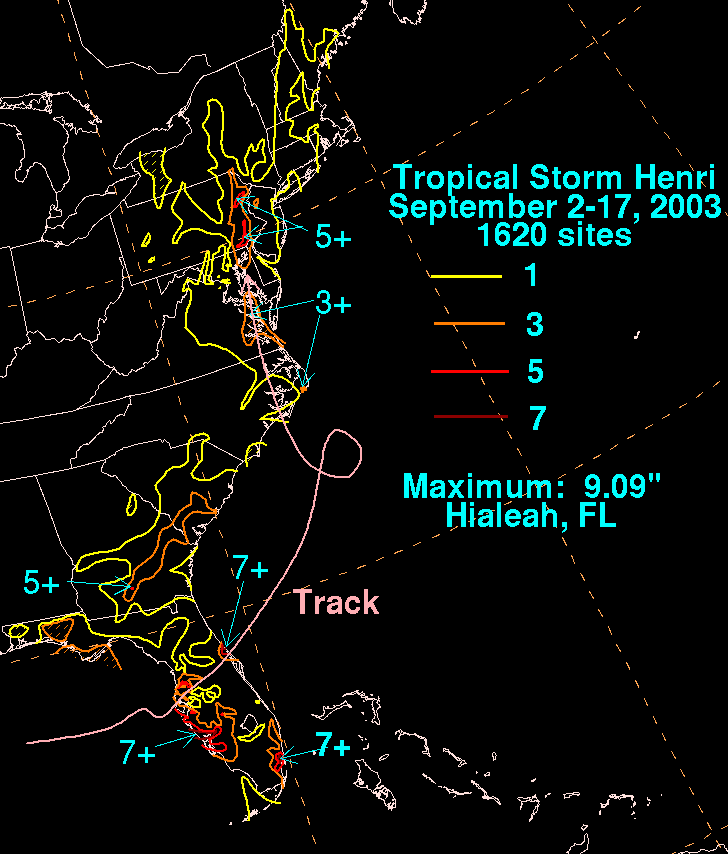
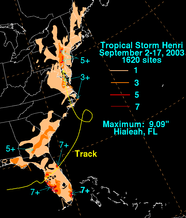
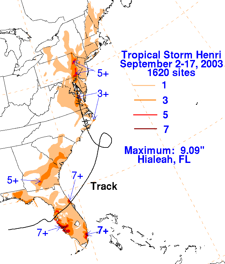
is its track provided
by the National Hurricane Center
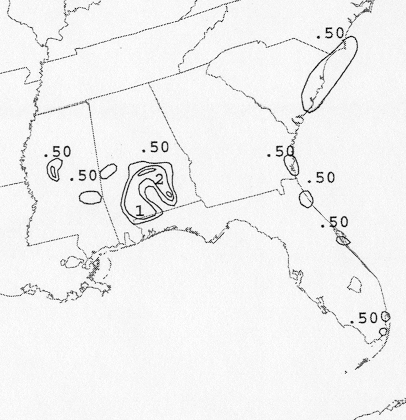
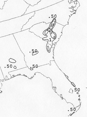
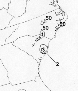
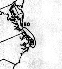
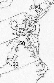
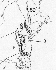
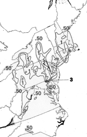
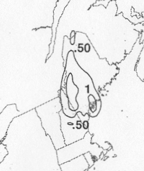
The storm total rainfall maps below were constructed using data from
data
provided by the National
Climatic Data Center, Southwest Florida Water Management, and the
Washington/Baltimore
Climate Network.
 |
 |
 |
Below are the calendar for Daily Precipitation Maps. Note that the 24-hour periods end
at 12z that morning.