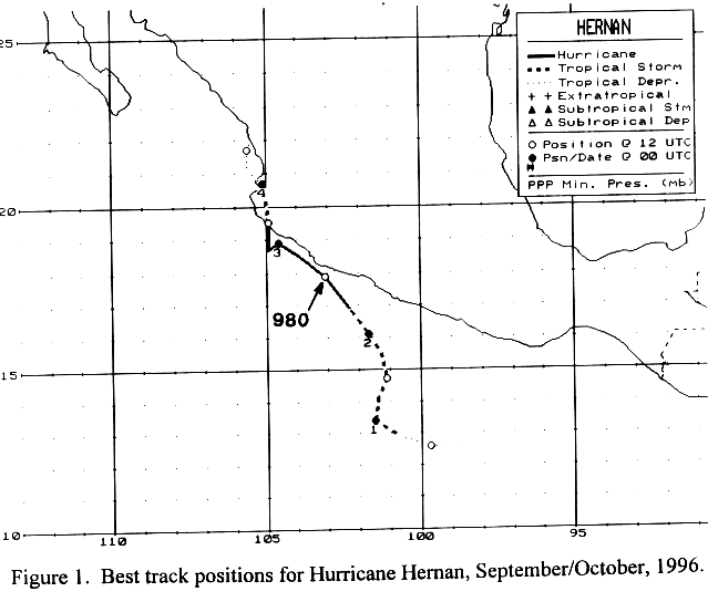
A tropical wave moved offshore western Africa in mid-September, and
moved westward through
the tropical Atlantic. Thunderstorm activity increased near the
Lesser Antilles on September 22,
then again between the 25th and 27th as it moved through the western
Caribbean sea and Central
America. On the 28th, convection became more concentrated in the
Gulf of Tehuantepec. The
system organized into a tropical depression, then tropical storm, south
of Acapulco on the 30th.
Hernan turned towards the north on October 1 due to a reformation of
the center. Turning back
to the northwest on the 2nd, Hernan strengthened into a
hurricane. A deep mid to upper level
trough over the western United States turned Hernan back to the north,
with its center passing
east of Puerto Vallarta on the 3rd. Drifting northward, Hernan
dissipated as a tropical cyclone
late on the 4th, and its resulted cloud pattern remained north of
Puerto Vallarta into the 6th.
Its track lies
below, supplied by the National Hurricane Center.
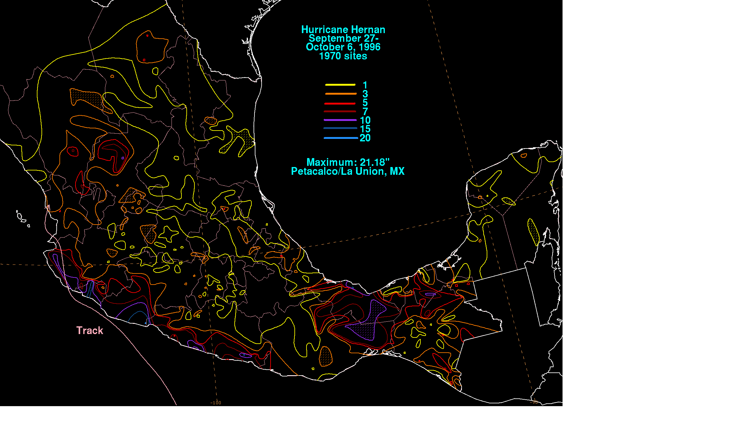
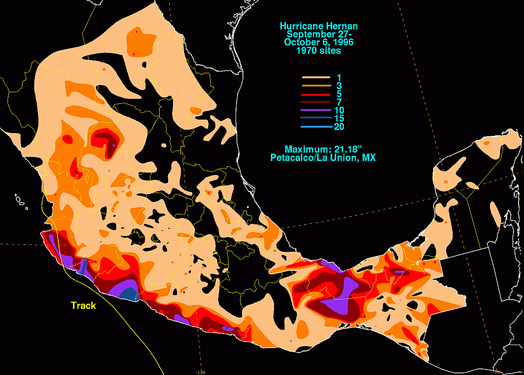
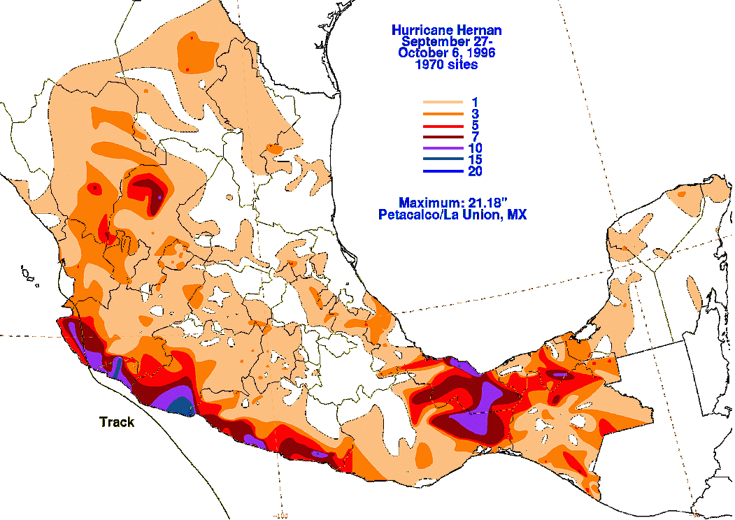
The storm total map is shown below. Rainfall information was
provided by the Comision
Nacional del Agua, the parent agency of Mexico's national weather
service. Much of
the rainfall
fell near and east of its point of landfall, with a secondary maximum
falling well in advance of
the hurricane along a frontal boundary to its northeast.
 |
 |
 |