A broad area of low-pressure associated with a tropical wave crossed Dakar, Africa on
August 30th. A surface low was noted south of the Cape Verde Islands on the 31st. Despite
the well-defined low level circulation, deep convection was minimal. By the morning of the 3rd,
Hortense had enough thunderstorm activity to be considered a tropical depression. The system
moved westward on the southern periphey of a warm core ridge. Development was very slow,
and the depression became a tropical storm as it entered the Caribbean Sea late on the 6th.
Hortense moved across Guadeloupe and turned northwest towards Puerto Rico. It became
a hurricane on the night of the 8th before making landfall. After passing by the Greater Antilles,
the hurricane strengthened to category 4 intensity on the evening of the 12th. A trough over the
Eastern United States swept the cyclone northward. The system moved across eastern Nova
Scotia as a weak hurricane on the 15th and became a nontropical low while moving south of
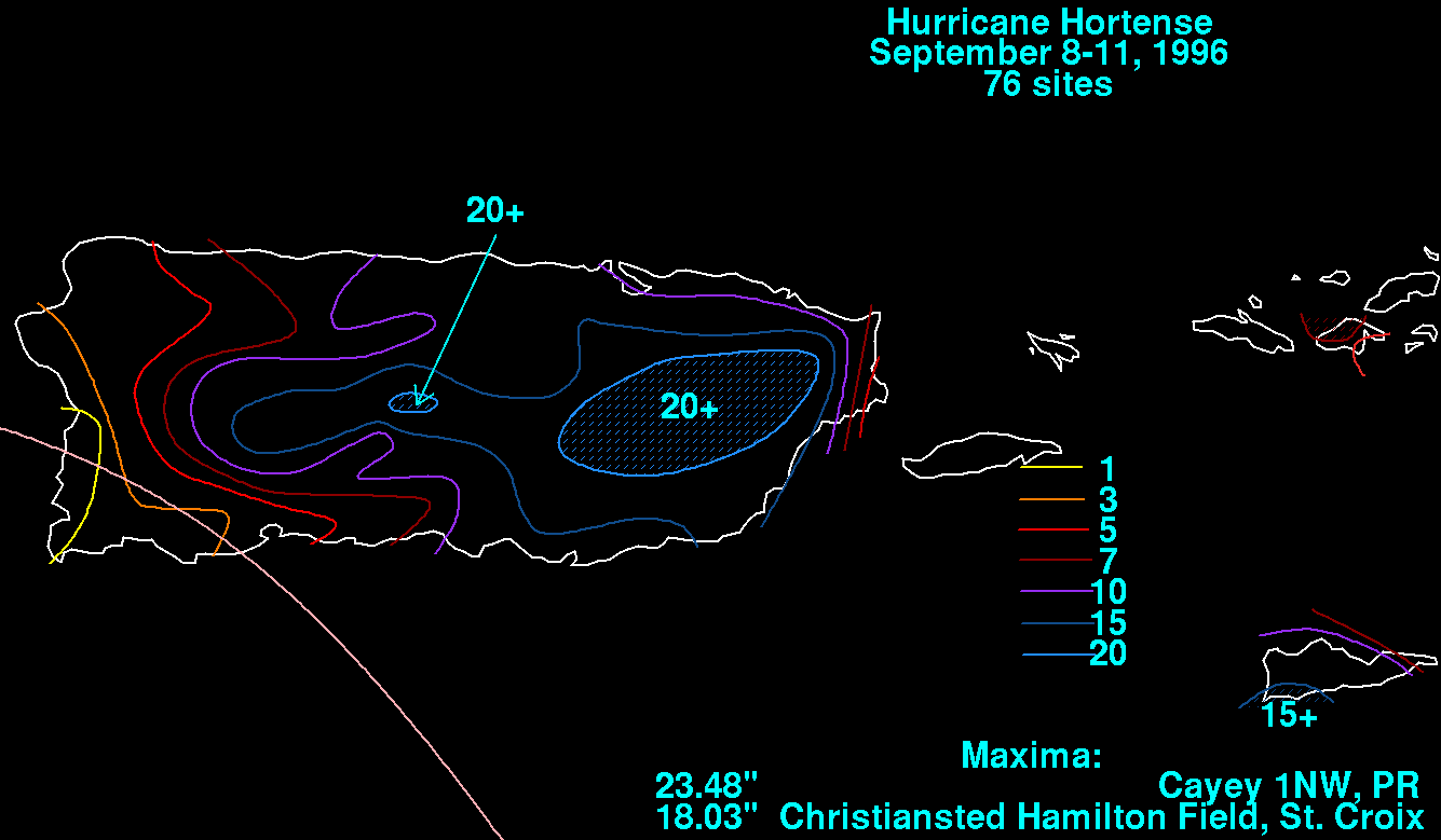
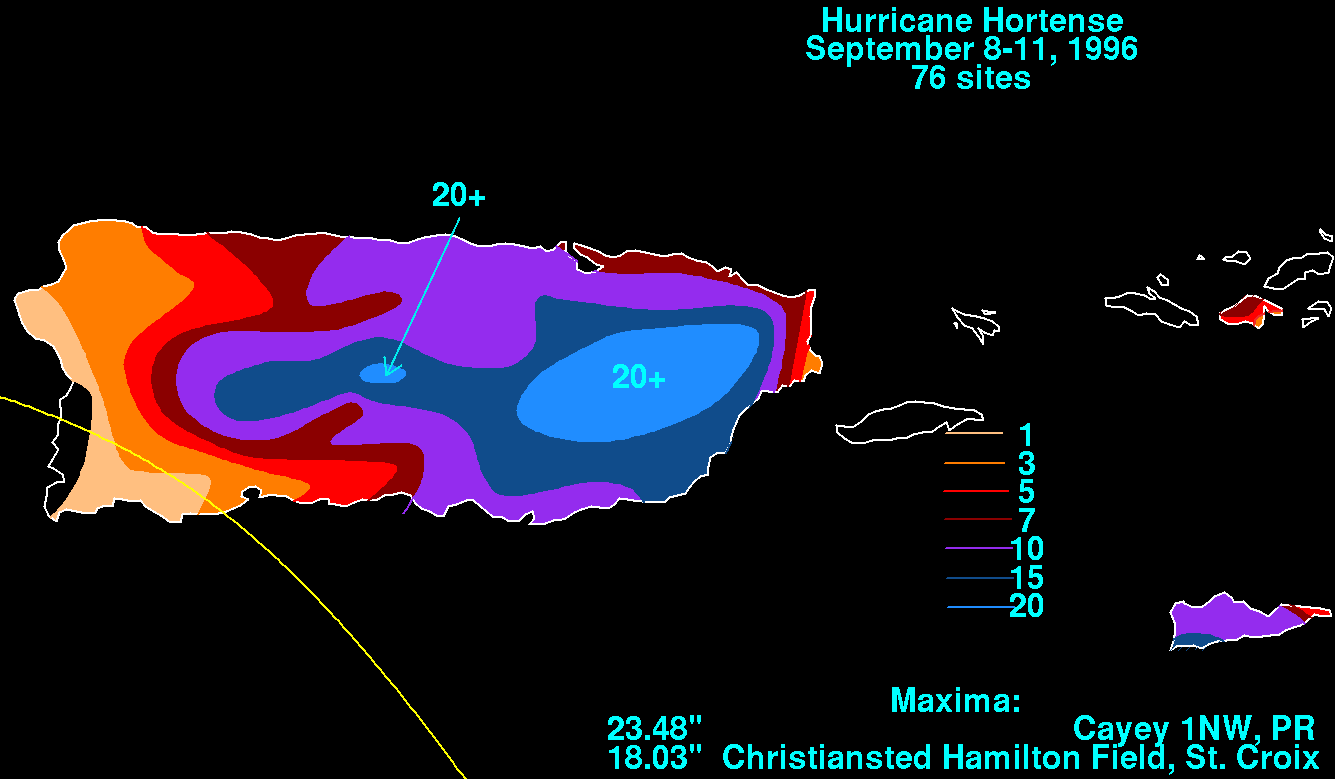
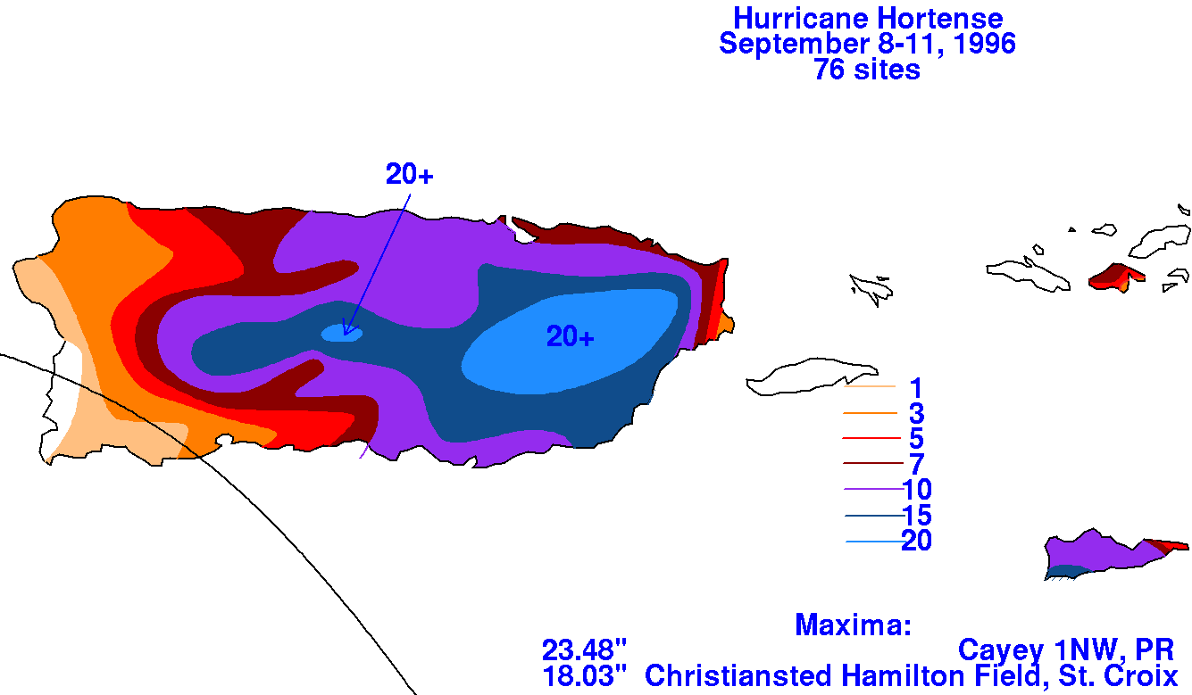
Newfoundland the next day. The storm total rainfall maps below were constructed using data
provided by the National Climatic Data Center in Asheville, NC.
 |
 |
 |