The origin of Hugo was detected on satellite imagery on the 9th of
September
when a cluster of thunderstorms moved
off the coast of Africa. It developed into a tropical depression to
the southeast of the Cape Verde Islands the following
day, then moved westward near 20 mph across the tropical Atlantic
Ocean,
becoming a tropical storm on the 11th and
a hurricane on the 13th, while located 1100 nm east of the Leeward
Islands. The storm turned west-northwest and
slowed its forward motion in response to low pressure to the north
of Puerto Rico which weakened the subtropical
ridge to its north.
Hugo struck Guadeloupe just past midnight on the 17th.
Continuing
to decelerate, the eye moved over St. Croix very
early on the morning of the 18th. It then accelerated, moving
over Vieques, Puerto Rico mid-morning and then over the
extreme northeast tip of mainland Puerto Rico an hour
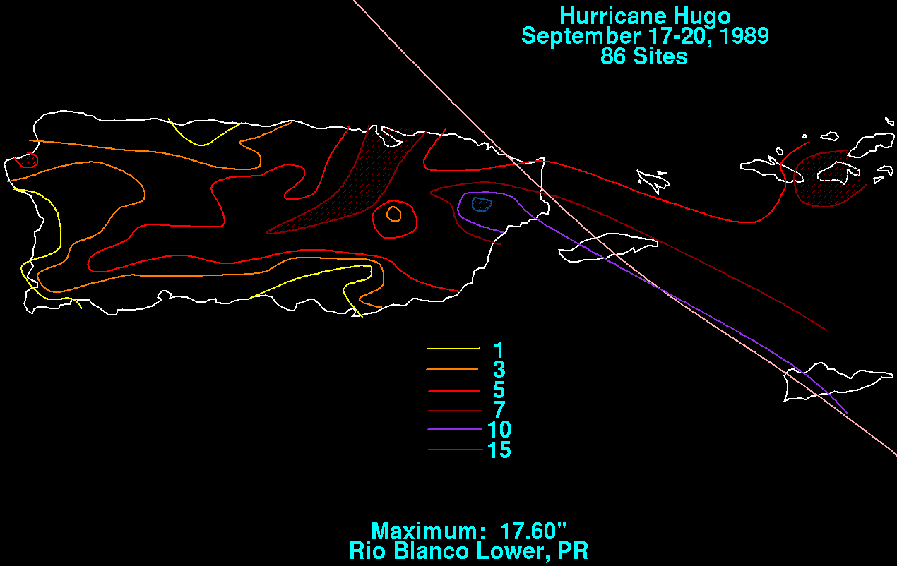
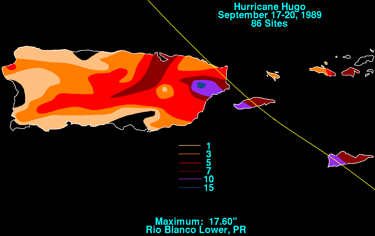
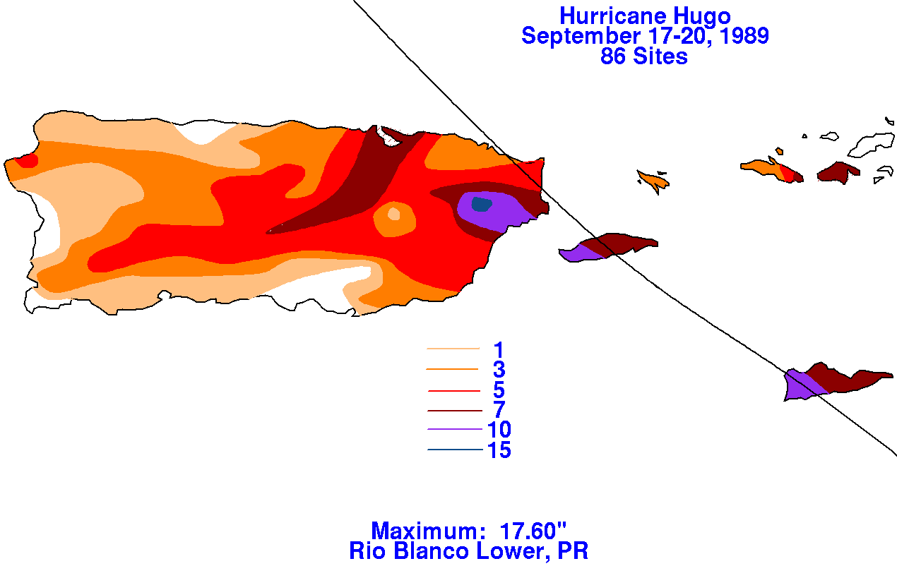
later. Below are maps showing the rainfall distribution
across
Puerto Rico and the U.S. Virgin Islands, using data provided by the
National Climatic Data Center in Asheville, North
Carolina.
 |
 |
 |
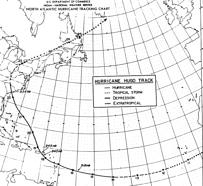
It slowly turned to the north-northwest in response to an
upper cyclone offshore Georgia. The track slowly bent to
the
left as it circumnavigated the upper low as it moved southwest away
from the storm. The cyclone then accelerated
northwest in
the confluent zone between the upper low and
the subtropical ridge to its northeast.
Landfall in South Carolina occurred at midnight on the night of the
21st as the system sped northwest at 26 mph.
It moved inland, passing between Columbia and Shaw Air Force Base early
on the morning of the 22nd. Hugo
weakened to a tropical storm by mid-morning as it passed to the west
of Charlotte, North Carolina. Thereafter,
it responded to a major extratropical cyclone moving across the central
United States by moving more to the north.
It passed quickly through western Virginia, West Virginia, and eastern
Ohio to Erie, Pennsylvania by the evening
of the 22nd as it become an extratropical storm. It then fled
northeastward
across eastern Canada into the far
North Atlantic Ocean. Below is the track of Hugo, supplied by
the National Hurricane Center.
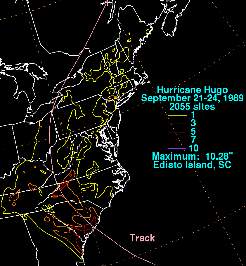
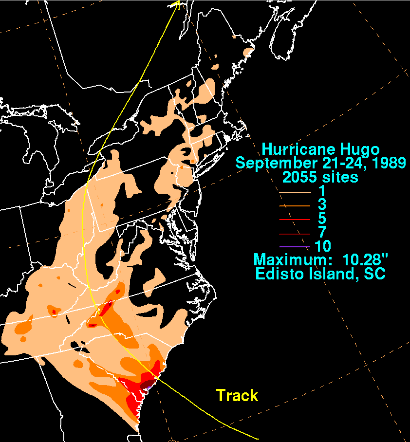
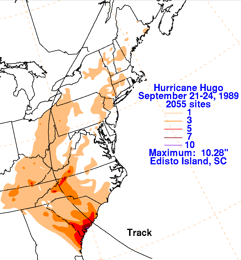
The graphics below show the storm total rainfall for Hugo.
Note
the maxima near the point of landfall in South Carolina, and
where the best upslope into the Appalachians occurred to the right
of its track.
|
|
 |
 |