Two tropical waves led to the development of this system. The pair moved across the Atlantic during the first
ten days of September. The second of the two spawned Tropical Storm Erika in the eastern Atlantic. Emerging
into the eastern Pacific between the 10th and 12th, an area of thunderstorms developed southeast of an upper level
cyclone off the southern tip of Baja California Sur due to the interaction of the upper cyclone with the pair of tropical
waves. By the 15th, the thunderstorm activity organized into bands, indicating the presence of a new tropical depression,
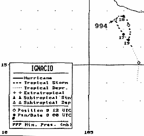
the eleventh of the season. The cyclone moved north-northwest due to steering around the upper cyclone, and became
a tropical storm by noon on the 16th. Once the upper cyclone moved away from Ignacio, its motion towards the
Mexican coast stopped on the 17th, and it executed a slow anticyclonic loop that would be completed late on the 18th.
Proximity to land and west to southwesterly vertical wind shear weakened the cyclone, and Ignacio regained tropical
depression status late on the 18th. The system dissipated as a tropical cyclone that night, and its remnants moved west-
southwest into the tropical Pacific, occasionally flaring up new convection over the succeeding couple days.
Below is the track of this storm, provided by the National Hurricane Center.
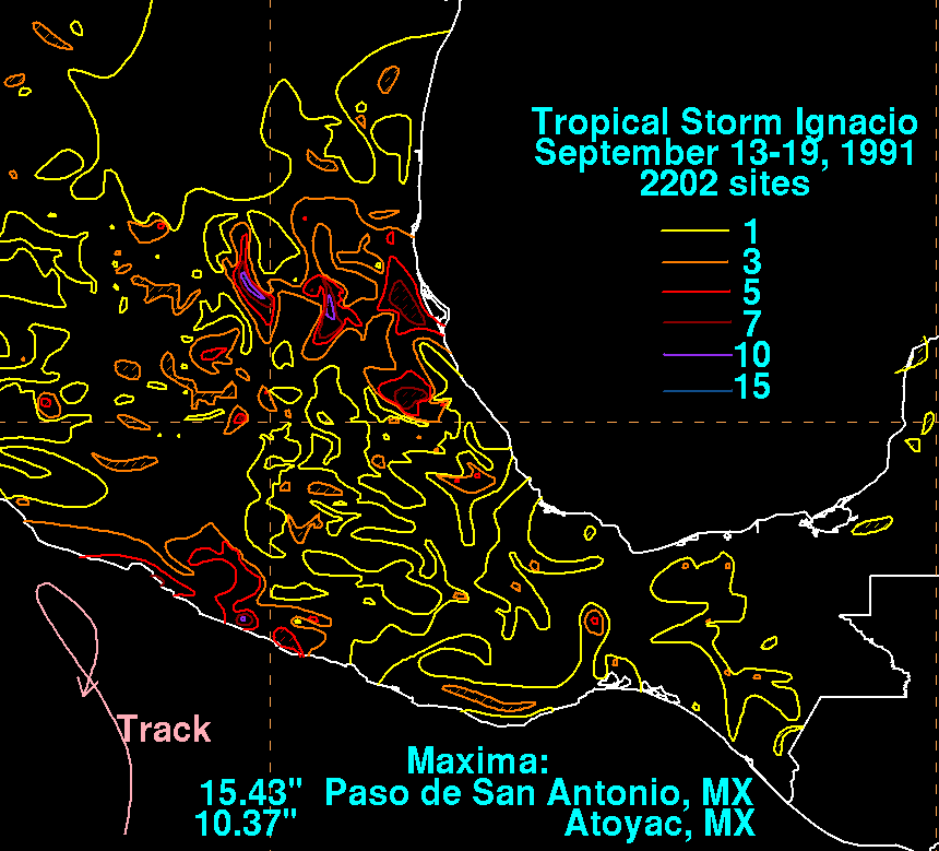
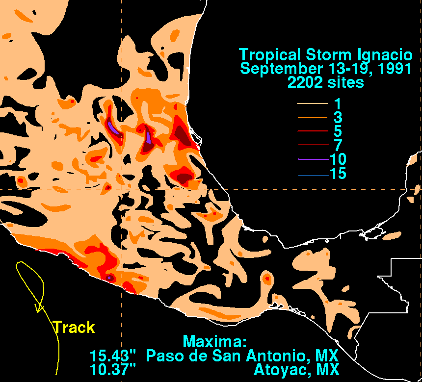
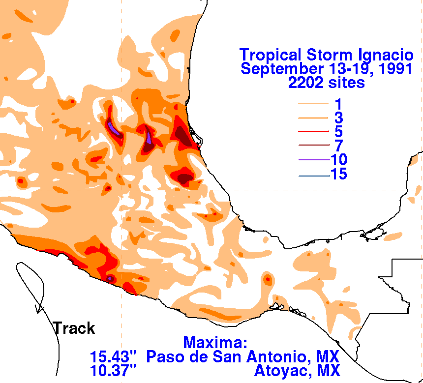
The storm total rainfall map below was constructed using data from
the Comision Nacional del Agua,
the parent agency of Mexico's
national weather service. Much of the precipitation over
east-central Mexico,
the location of the absolute maximum, was due to the interaction
between an upper cyclone to its northeast
with the cyclone's outermost band moving in from the Gulf of Mexico.
 |
 |
 |