On September 14th, an upper level low existed offshore western Florida. A small cluster of thunderstorms formed within its northern
periphery, which moved westward offshore the northern Gulf coast. As it approached the northwest Gulf of Mexico, convective
organization increased and it turned northward. A tropical depression formed on the morning of the 17th which strengthened
into a tropical storm that afternoon while approaching the Upper Texas coast. Imelda made landfall near Freeport, Texas by
mid afternoon and regained tropical depression status that evening. Expected to move northward around a ridge to its
northeast, a small deep layered high developed across central Texas which imparted north to northeast vertical wind shear and
slowed forward motion, ultimately leading to a center reformation farther south. The combination of the vertical wind shear
vector pointing into the instability pool along with sufficient effective bulk shear led to cell training and backbuilding,
which magnified rain totals to the south of the essentially stalled cyclone. Imelda's surface circulation dissipated late on
the 19th. Its circulation aloft continued northeast and contributed to heavy rainfall along a segment of the Red River
of the South near the Texas/Oklahoma border on the 20th.
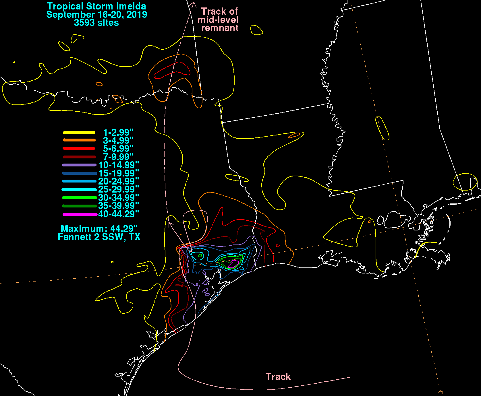
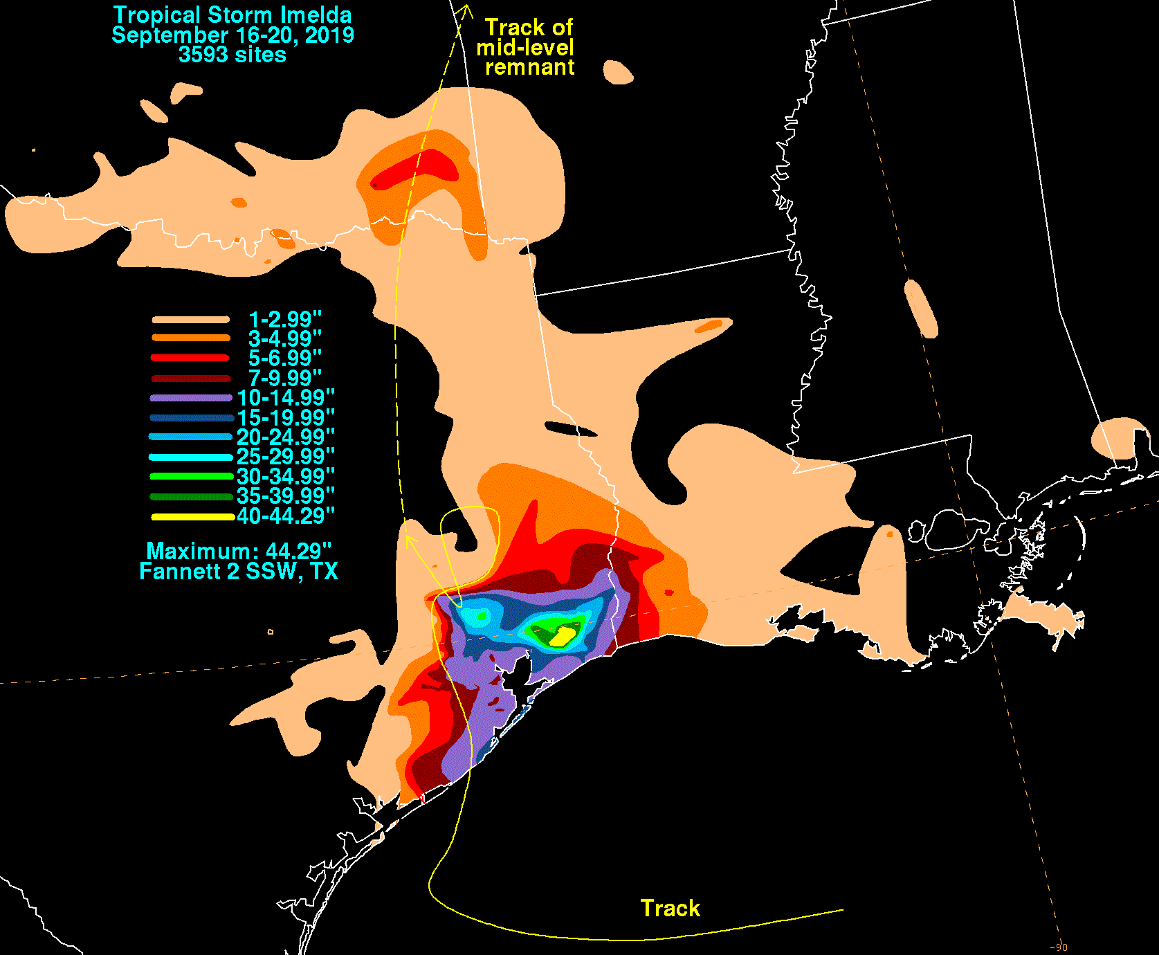
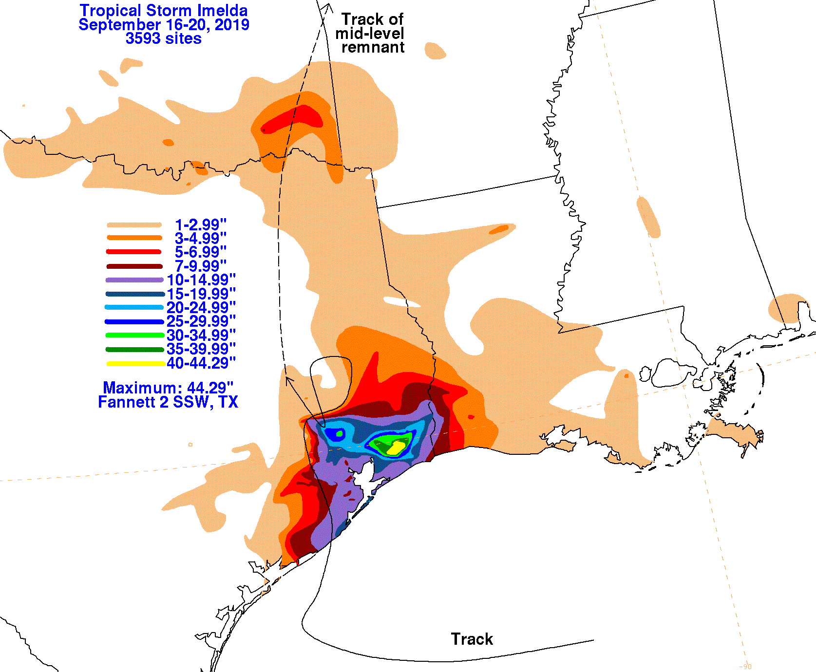
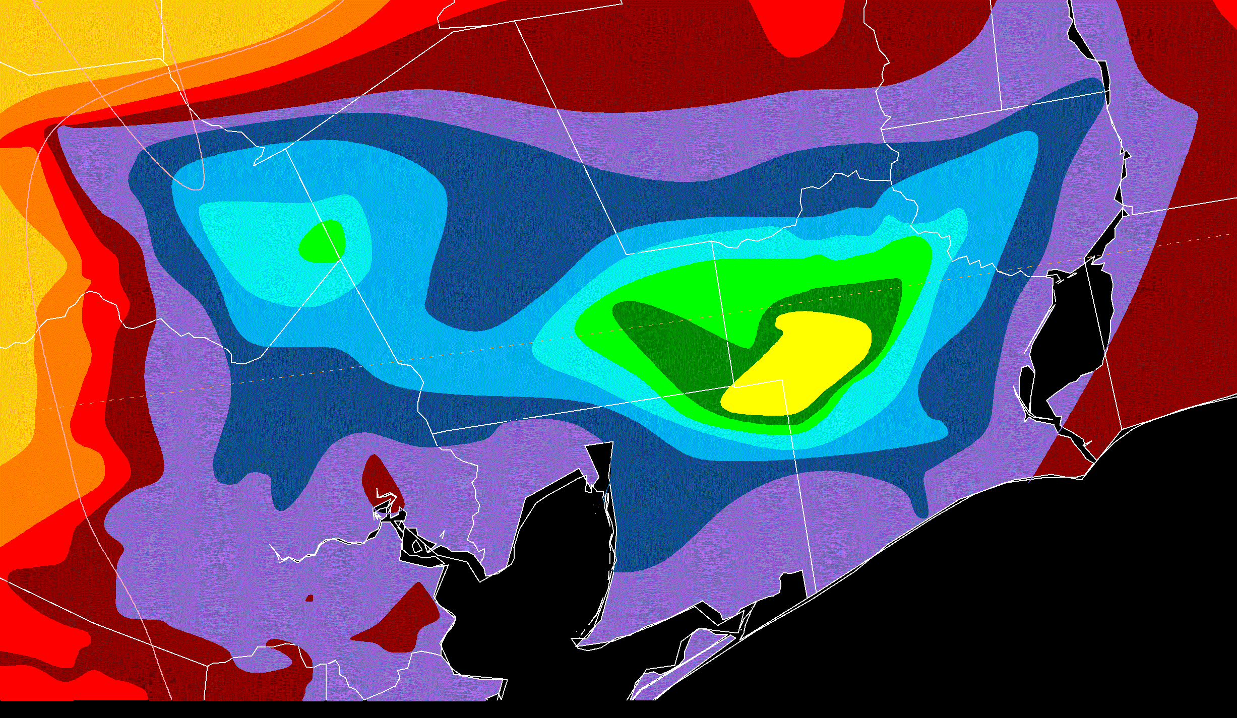
The graphics below show the storm total rainfall for Imelda, which used rain gage information from the National Weather
Service River Forecast Centers, Forecast Offices, and CoCoRAHS.
 |
 |
 |
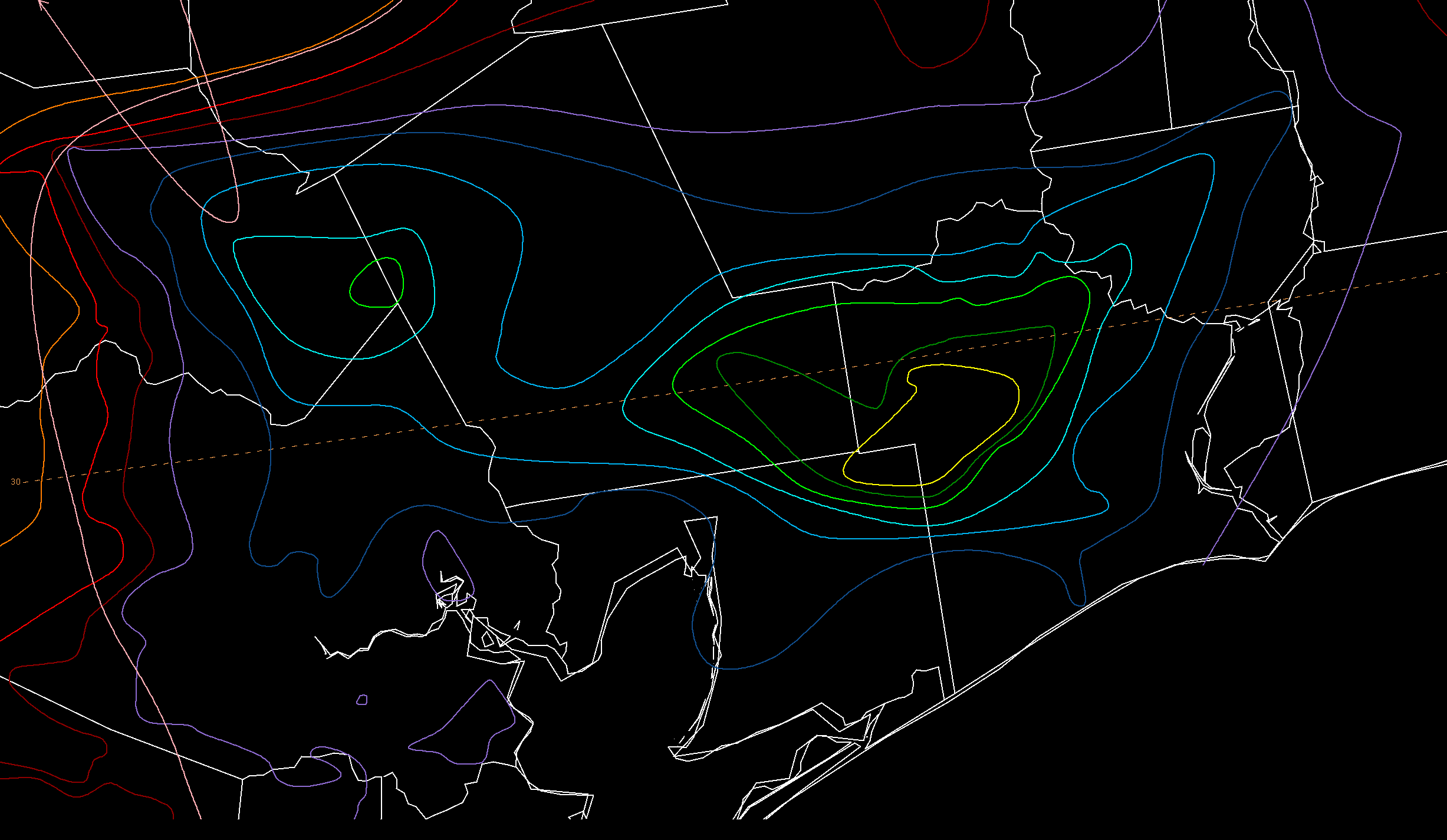
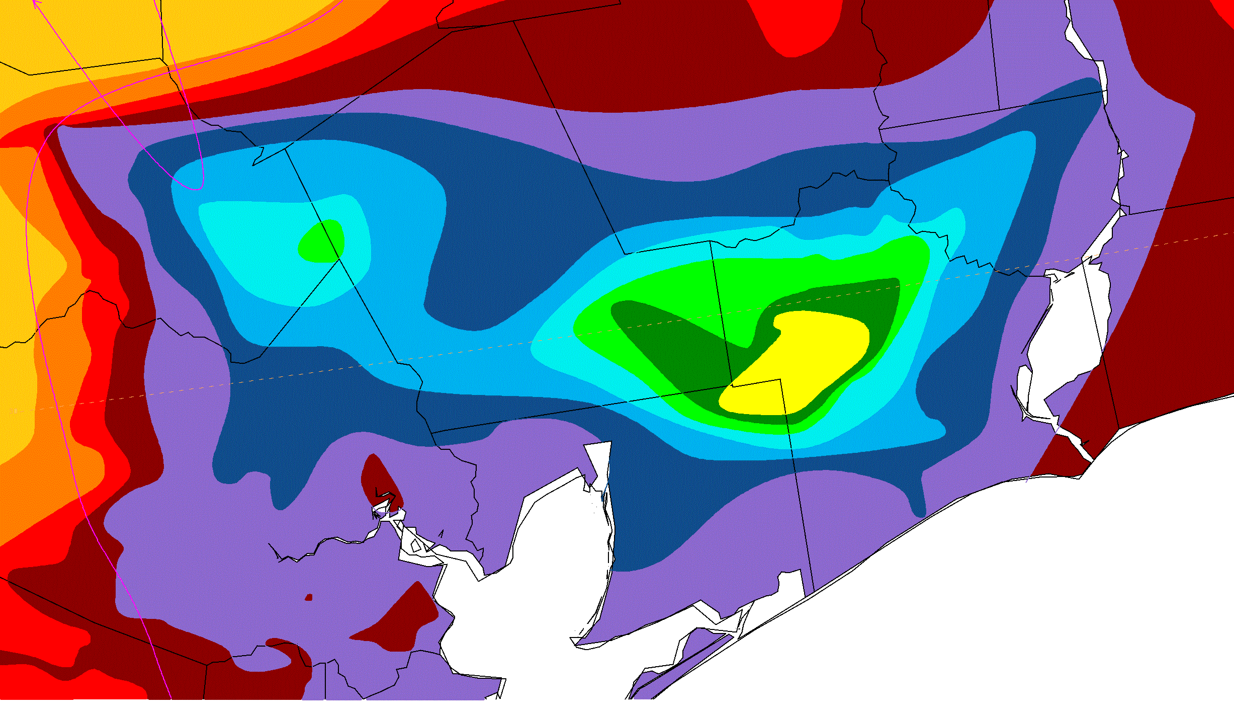
Below is a zoom-in of southeast Texas, using the same color scheme as the other rainfall graphics.
 |
 |
 |