Born in the western Caribbean just after Columbus Day, Irene
was
initially well behaved, moving
on a north-northwest track into the Gulf of Mexico, intensifying into
a hurricane near the Isle of
Pines. As shear increased out of the southwest, convection
deepened
to the point that an MCS-
type thunderstorm complex formed northeast of the center. Like
many MCSs, Irene moved to the
right of the mean flow, splitting the 500 hPa ridge to its north into
two pieces; one over the Gulf,
the other remaining over the southwest Atlantic. After crossing
the Florida peninsula, the storm
moved parallel to the Gulf Stream for the remainder of its life,
rounding
the subtropical ridge to its
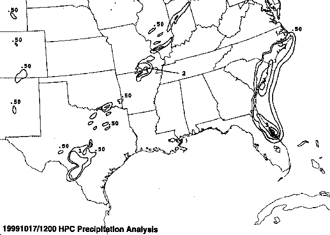
east and southeast. As it began acquiring nontropical
characteristics
off the Carolinas, a comma
head precipitation pattern developed, similar to that of a subtropical
cyclone. This lead to vast
amounts of rain in the Norfolk/Suffolk/Newport News metropolitan area,
well to the left of its
track. After passing just offshore Cape Hatteras, Irene
accelerated
quickly northeastward,
contributing to the development of an intense extratropical low over
the maritime provinces of
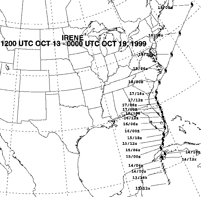
southeast Canada. The track of the storm is located below,
denoted
every six hours, using
Universal Coorinated Time. The time 1200 GMT is the same as 8:00
a.m. EDT.
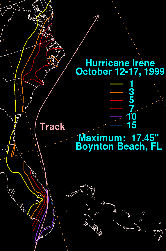
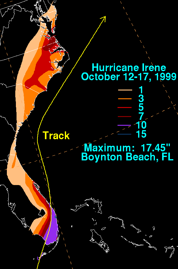
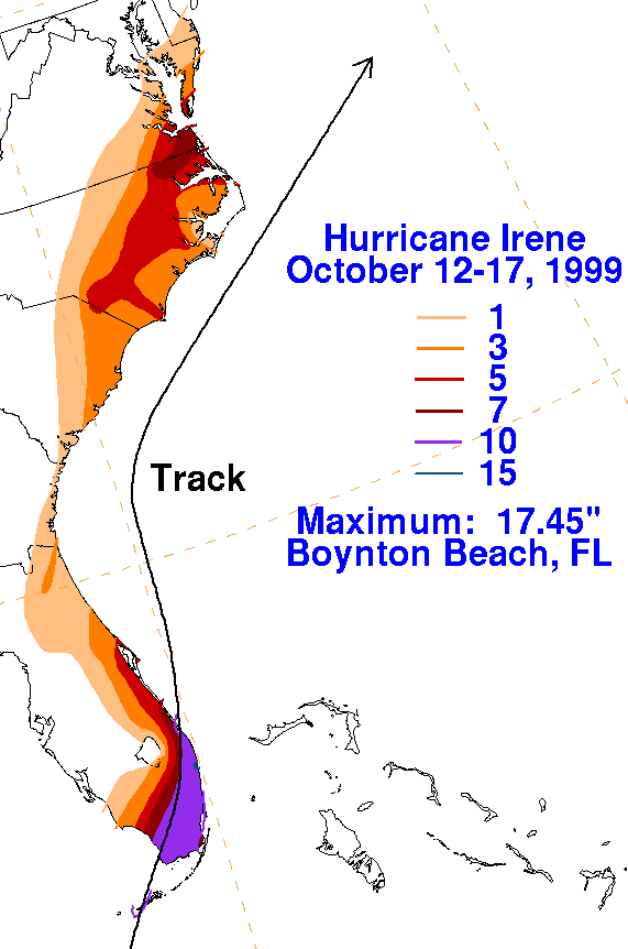
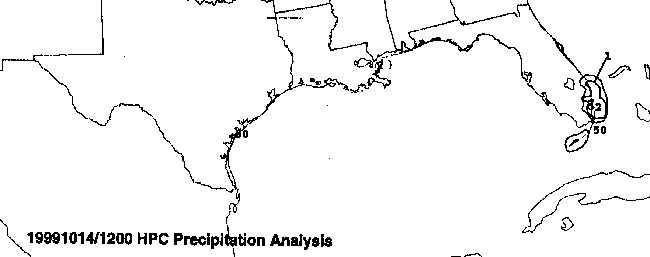
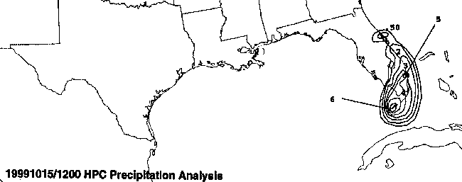
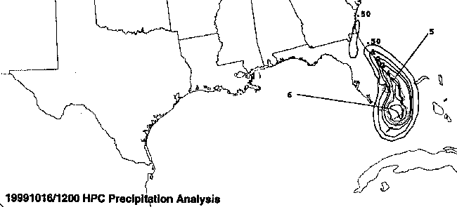
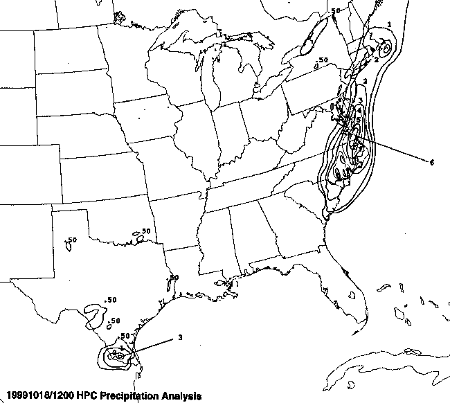
The graphics below show the storm total rainfall for Irene.
Note
the maxima along
the southeast Florida coast, and across northeast North Carolina and
southeast
Virginia. Data for this map was compiled from the Hourly
Precipitation
Data
publication from NCDC, and from the post storm report on the system
from the
National Hurricane Center.
|
|
|
|
Below is the calendar for Daily Precipitation Maps. Note that
the 24-hour periods end
at 12z that morning.