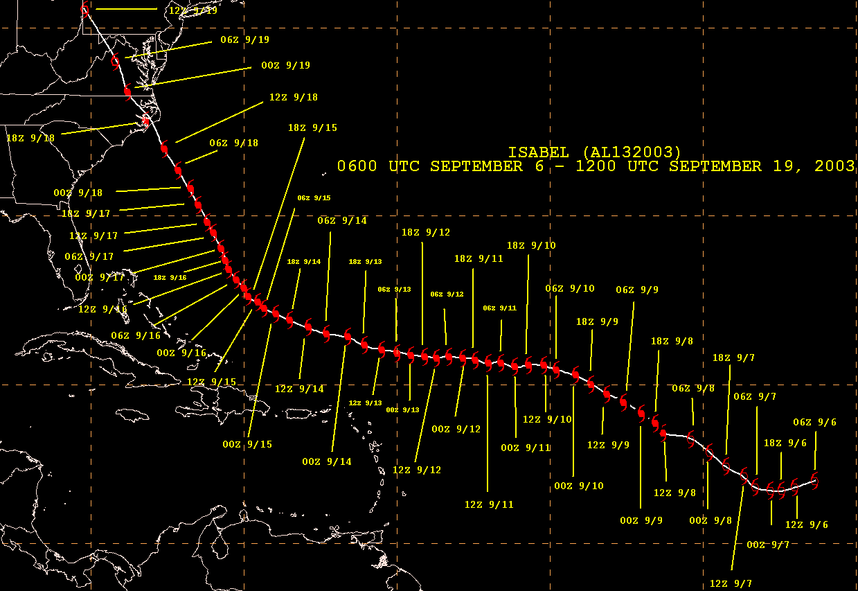
Isabel becgan as a westward-moving tropical depression over the
eastern tropical Atlantic on September 6th.
It became a tropical storm later that day and a hurricane on the 7th as
it veered west-northwest. Isabel turned
more to the northwest on the 8th and 9th while becoming a major
hurricane. The cyclone turned westward
on the 10th and became a category 5 hurricane from the 11th through the
15th. Weakening began on the
16th as the storm turned to the north-northwest towards the East
coast. The cyclone struck Drum Point,
North Carolina on the 18th at category 2 strength. Continuing
northwest, Isabel became an extratropical
low over western Pennsylvania on the 19th.
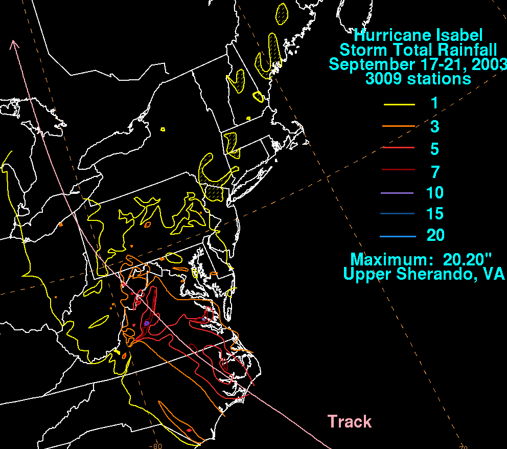
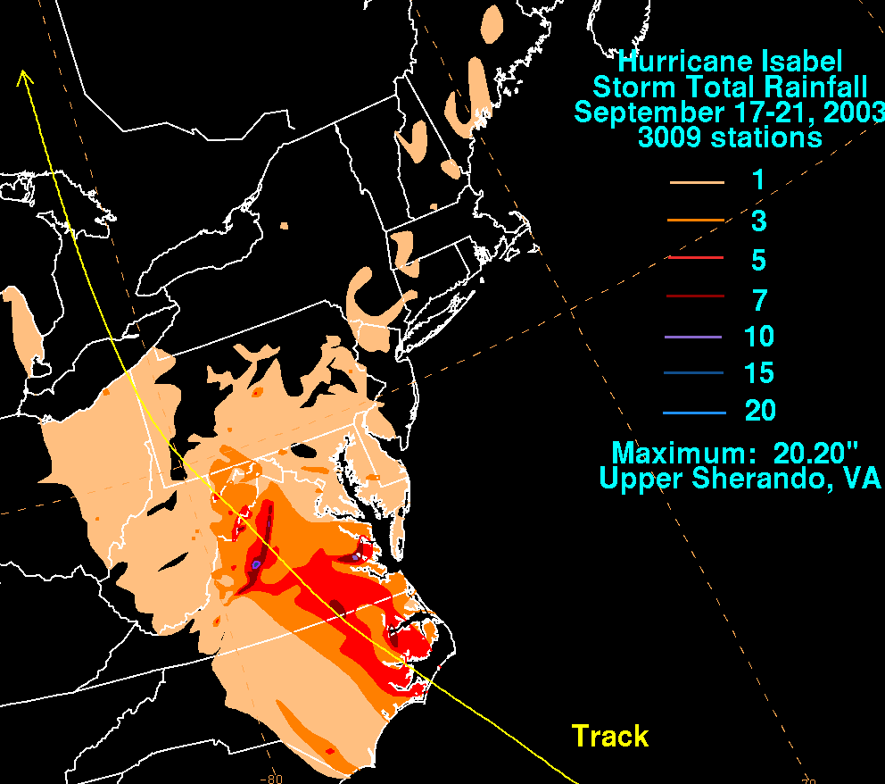
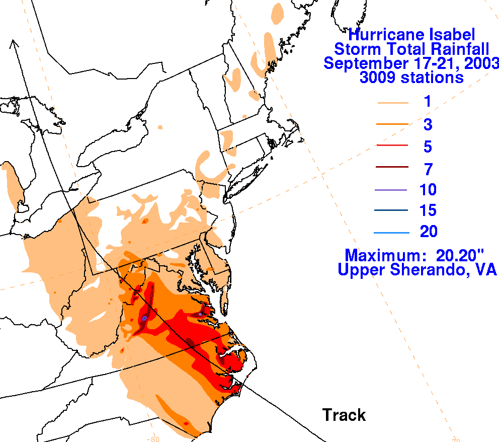
Isabel brought hurricane conditions to eastern North Carolina and
southeast Virginia, with tropical storm
conditions spreading from North Carolina northward to New York.
Extensive storm surge flooding was
seen along the Atlantic coasts of North Carolina and Virginia,
including Chesapeake Bay, the Potomac River,
and the James River. It was comparable to the Chespeake-Potomac
Hurricane of August 1933 for Virginia
and Maryland. Higher than normal tides were seen as far north as
Long Island. Heavy rains fell along the
track of Isabel. The storm was directly responsible for 13
deaths, and indirectly responsible for an additional
17. Extensive wind and water damage was seen from eastern North
Carolina northward through eastern
Maryland. Damage exceeded $1 billion. Below is the track of
the hurricane.
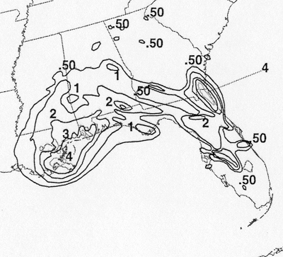
The storm total rainfall map below was constructed using data from
data
provided from NCDC, NWS River
Forecast Centers, the IFLOWS network, and the Washington/Baltimore
Climate Review.
 |
 |
 |
Below are the calendar for Daily Precipitation Maps. Note that the 24-hour periods end at 12z that morning.