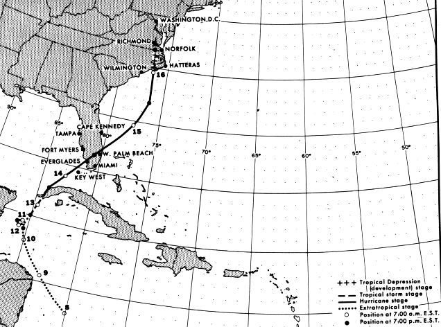
Evidence of a new tropical disturbance appeared over the western Caribbean during October 7th and
8th at the tail end of a frontal trough. The system remained poorly organized and weak for about 48
hours. Late on the 10th winds had increased sufficiently to designate the system Tropical Storm Isbell.
While moving slowly north towards western Cuba on the 13th, Isbell strengthened into a hurricane. After
passing through extreme western Cuba, Isbell turned northeast and crossed southern Florida, before
hooking north around the east side of a closed cyclone moving through the South. Isbell rapidly
became a nontropical low across coastal sections of North Carolina. It then moved out to sea offshore
the Mid-Atlantic on the morning of the18th, and into the Canadian Maritimes by the morning of the
19th. Below is the track of this cyclone provided by the National Hurricane Center.
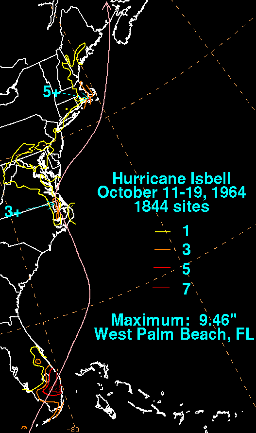
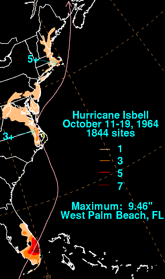
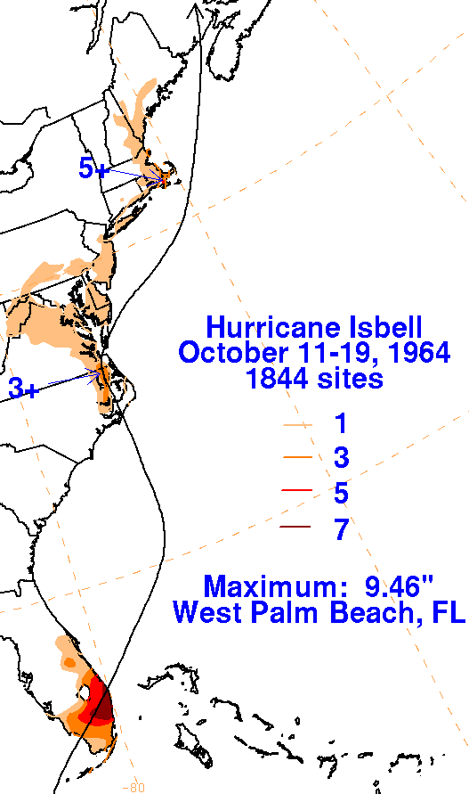
The graphics below show the storm total rainfall for Isbell.
Note the maximum is east of the track
across South Florida, and near the track in eastern North
Carolina. It is worth noting that a good
percentage of the rain (30% for the Miami area and about 80% for West
Palm Beach) fell a couple
days in advance of the center's arrival, along a frontal zone northeast
of the cyclone.
 |
 |
 |