Beginning on July 24, the region southwest of Mexico was being monitored for tropical cyclogenesis due to output from numerical
weather guidance. Thunderstorms developed in this region on July 28 as a tropical wave moved by. The system slowly organized
while moving north of due west, becoming a tropical storm on July 31 well to the southwest of Baja California. Rapid strengthening
ensued due to favorable conditions aloft, with Iselle becoming a hurricane on August 1. Category two status was achieved on August
2, and major hurricane status was reached on August 3. The eye of the cyclone continued tracking towards Hawai'i. Unfavorable
conditions aloft caused weakening beginning on August 5, with Iselle weakening to category one status on August 6. Weakening
thereafter was quite slow, with the cyclone regaining tropical storm status on August 7. Iselle's center crosssed the coast
of the Big Island on August 8, with its circulation strongly disrupted by its high terrain. By August 9, the system had devolved
into a remnant low west-southwest of Honolulu.
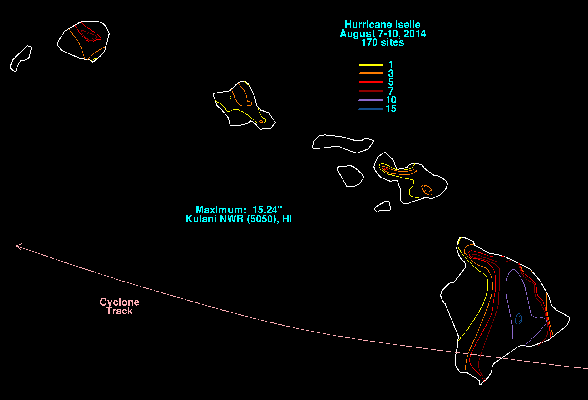
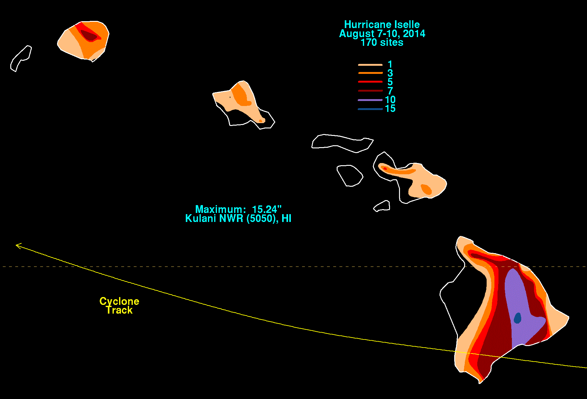
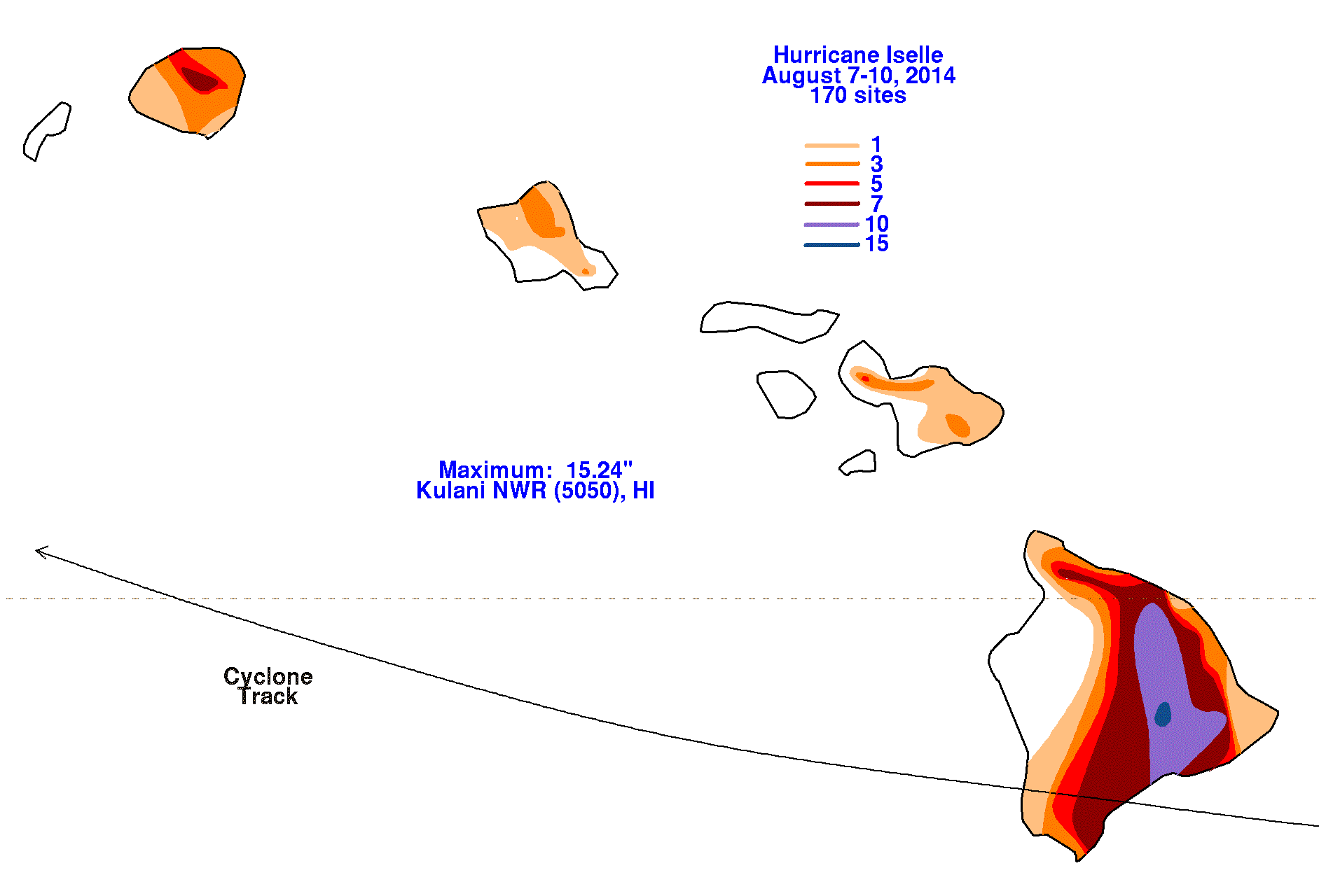
The graphics below show the storm total rainfall for Iselle, which used information from the National Weather
Service River Forecast Centers, Forecast Offices, and CoCoRAHS.
 |
 |
 |