A tropical wave moved across Central America on August 15. Thunderstorms began to organize around the wave on August 17
and 18 as it moved south of Mexico. A broad low-level circulation formed south-southwest of Manzanillo. The system became
better defined as it moved south of Baja California on August 20, though vertical wind shear limited further convective
organization. Once the vertical wind shear decreased, a tropical depression was born west-southwest of Manzanillo on August
22. The cyclone moved north-northwest, briefly composed of two competing centers which then merged which caused a center
jump. Ivo strengthened into a tropical storm as it moved west of Baja California, weakening to tropical depression
strength late on August 24 while moving over cooler waters. It became a remmant low on August 25, and drifted southwest
before ultimately dissipating on August 27.
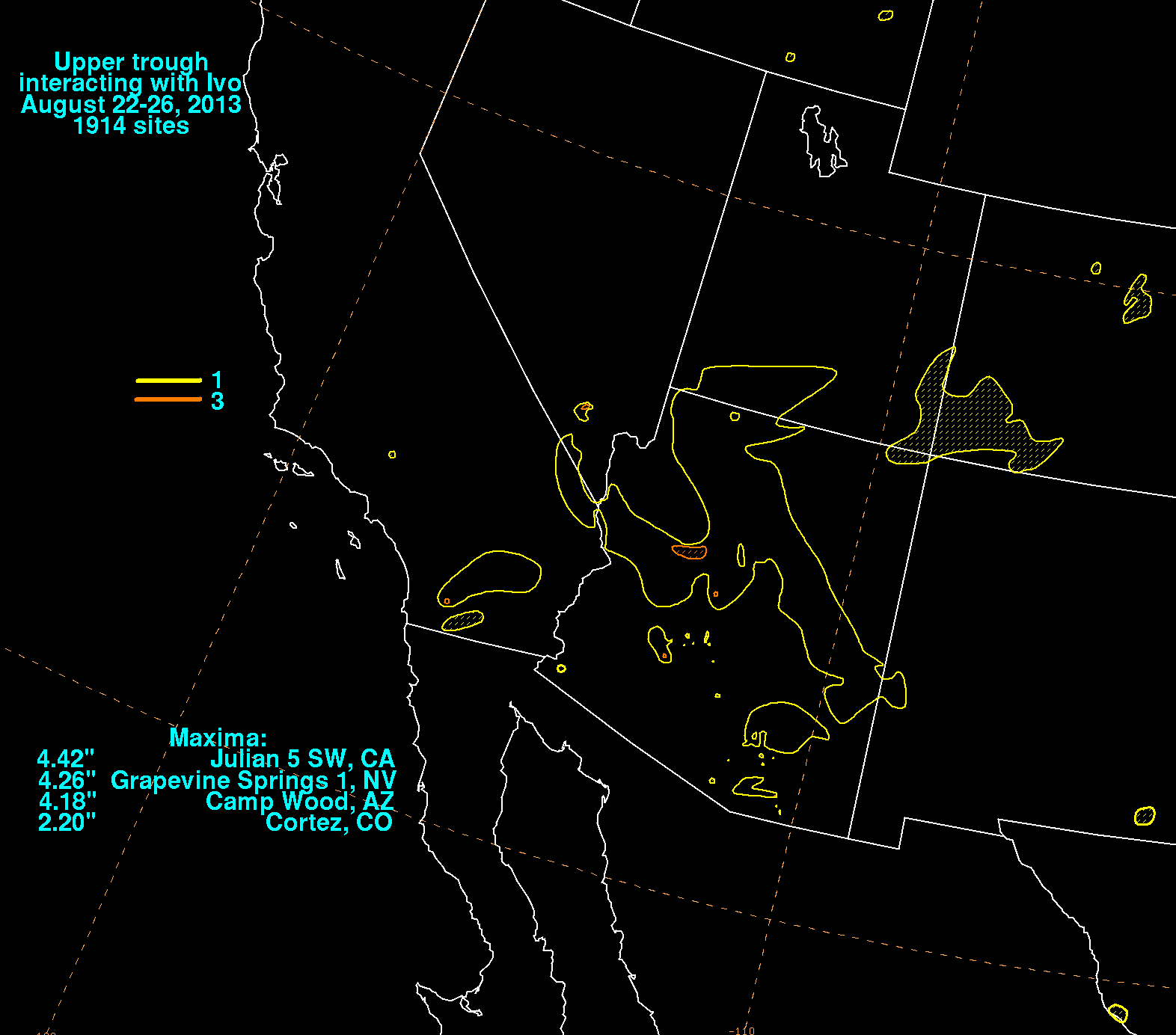
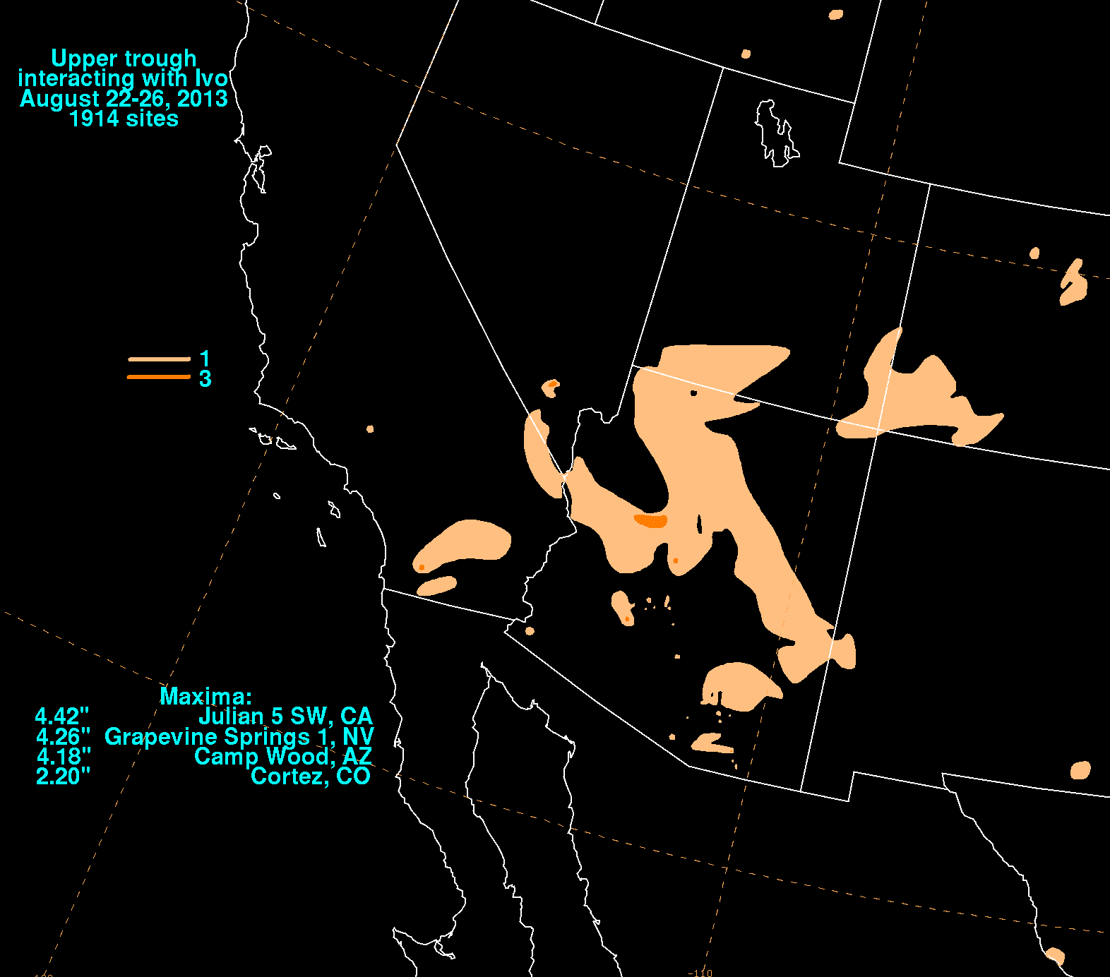
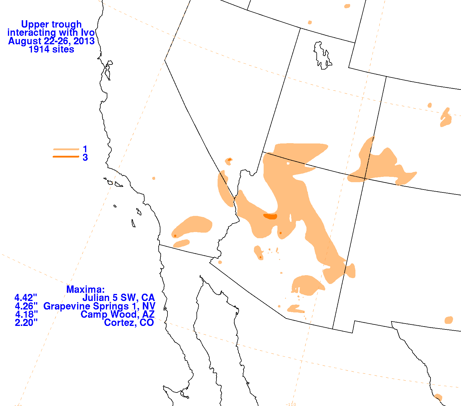
The first three graphics below show the storm total rainfall for Ivo, which used rain guage information from the National Weather
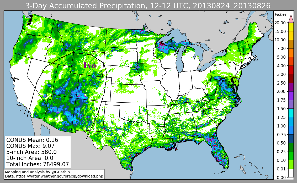
Service River Forecast Centers, Forecast Offices, and CoCoRAHS. The fourth graphic included radar-derived information.
 |
 |
 |
 |