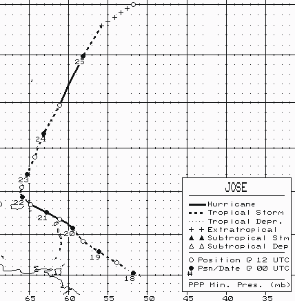
A tropical wave moved off the coast of Africa on October 8th,
drifting slowly across the Atlantic for
the next several days. By the 15th, when located midway between
Africa and the Lesser Antilles, shower
activity became better organized. By the afternoon of the 17th, a
tropical depression had formed about 700
miles east of the southern Windward Islands. With upper level
outflow over the system, development
continued, and the system became a tropical storm on the 18th about 400
miles east of the Windward Islands.
A mid-oceanic trough developed a weakness in the subtropical ridge
near Puerto Rico, which caused Jose to
gain increasing latitude. The cyclone strengthened into a
hurricane 150 miles east of the Leeward Islands.
Its eye moved over Antigua, St. Barthelemy, and St. Martin on the night
of the 20th. Increasing southwest
winds aloft began to weaken Jose, which dropped back to tropical storm
intensity near Tortola in the British
Virgin Islands early on the morning of the 21st. The system
recurved northward just north of Puerto Rico
on the 22nd and increased in forward speed. The
southwesterly flow it was embedded within became
more uniform with height, and Jose briefly regained hurricane strength
on the 24th. After dropping back to
tropical storm strength that evening, the cyclone became a nontropical
low on the morning on the 25th
before merging with a larger mid-latitude low. Below
is a track of the storm, created by the National
Hurricane Center.
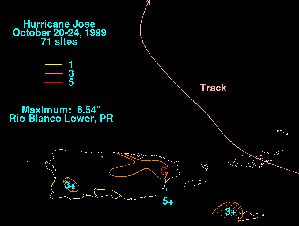
The rainfall graphic below uses data supplied by the National Climatic Data Center in Asheville, NC. Since the
cyclone tracked northeast of Puerto Rico and the U.S. Virgin Islands, amounts were light to moderate.