A tropical wave emerged from the west coast of Africa on September 1st. The system lost its thunderstorm activity soon
thereafter, and the wave moved through a subsident environment during the next several days. While approaching the
Leeward Islands on the 6th, thunderstorm activity increased with the wave and a low pressure area formed which moved
west-northwest through the 8th before degenerating back into an open trough. It remained disirganized as it moved northwest
through the Bahamas. While moving south of the northwestern Bahamas, thunderstorm activity increased again, spawning
a surface low over the Gulf Stream on the 12th. By early on the 13th, the low was deemed well enough organized, after
reanalysis, to be considered a tropical depression as it was making landfall at Jensen Beach, Florida. The system moved
roughly parallel to, but inland, of the east coast of Florida, strengthening into a tropical storm after sunrise on the
13th. The center of Julia propagated towards small batches of convection which formed along the Florida coast, and
moved into southeast Georgia while a tropical storm. Julia eventually moved eastward, offshore the Southeast coast,
before moving into a col in the steering flow and beginning to meander. Northwest flow aloft caused vertical wind
shear over Julia which led to it weakening into a tropical depression on the 16th southeast of Charleston, South Carolina.
After periods where thunderstorms would quickly develop, then dissipate, near its center, Julia became a convectionless low
late on the 18th and extratropical on the 19th. As it moved north to northeast towards North Carolina, thunderstorms
redeveloped in its vicinity and heavy rains fell across eastern North Carolina and southeast Virginia as the low pivoted back
to the west. Its center re-entered the Atlantic on the night of the 21st and slowly drifted just offshore the Carolinas before
the low dissipated late on the 23rd.
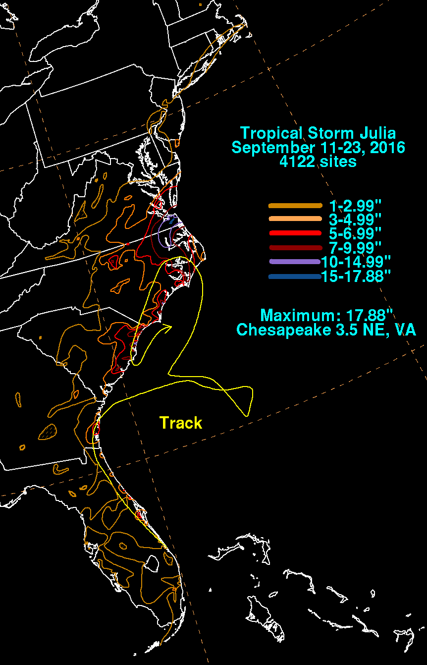
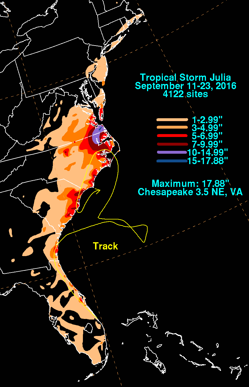
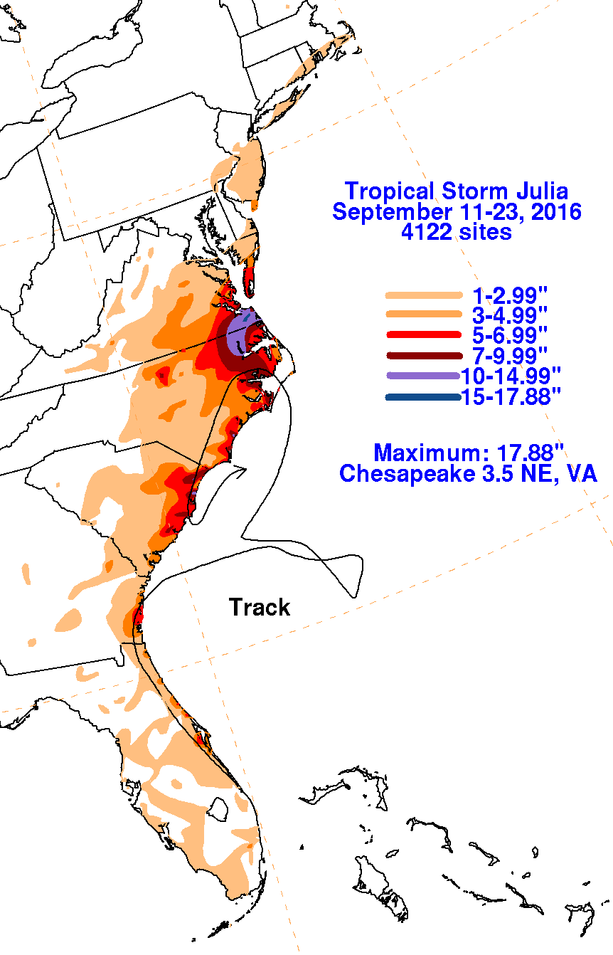
The first three graphics below show the storm total rainfall for Julia, which used rain guage information from National
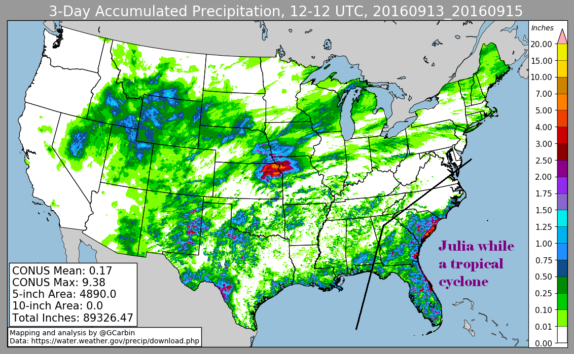
Weather Service River Forecast Centers, Forecast Offices, and CoCoRAHS. The fourth graphic shows its rainfall distribution
using a multi-sensor rainfall estimate, which includes radar-derived information.
 |
 |
 |
 |