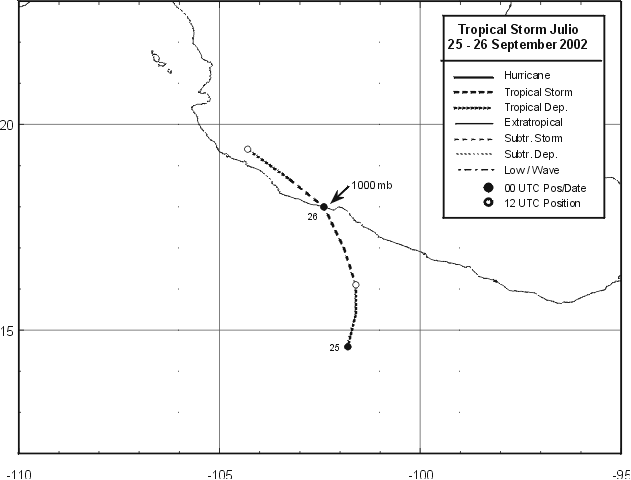
Julio formed from a disturbed area of weather near the southwest
Mexican coast. The area first developed
on the 21st, possibly in response to Hurricane Isidore's approach to
the Yucatan peninsula. A poorly-defined
low level center formed on the afternoon of the 23rd. The system
became better organized into a tropical
depression late on the 24th about 175 miles southwest of
Acapulco. The depression strengthened as it moved
northward, becoming a tropical storm on the morning of the 25th.
Maximum sustained winds increased to
45 mph just prior to its landfall west-northwest of Lazaro
Cardenas. The system moved along the coastal
mountains, dissipating by the morning of the 26th. Below
is a track of the storm, created by the National
Hurricane Center.
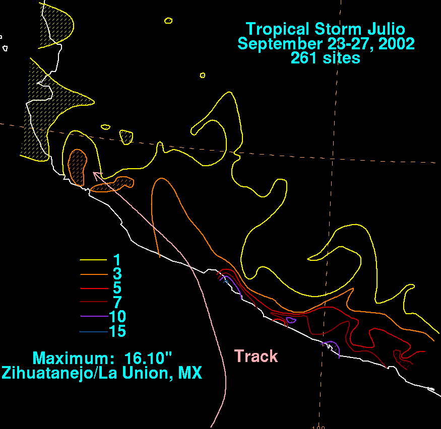
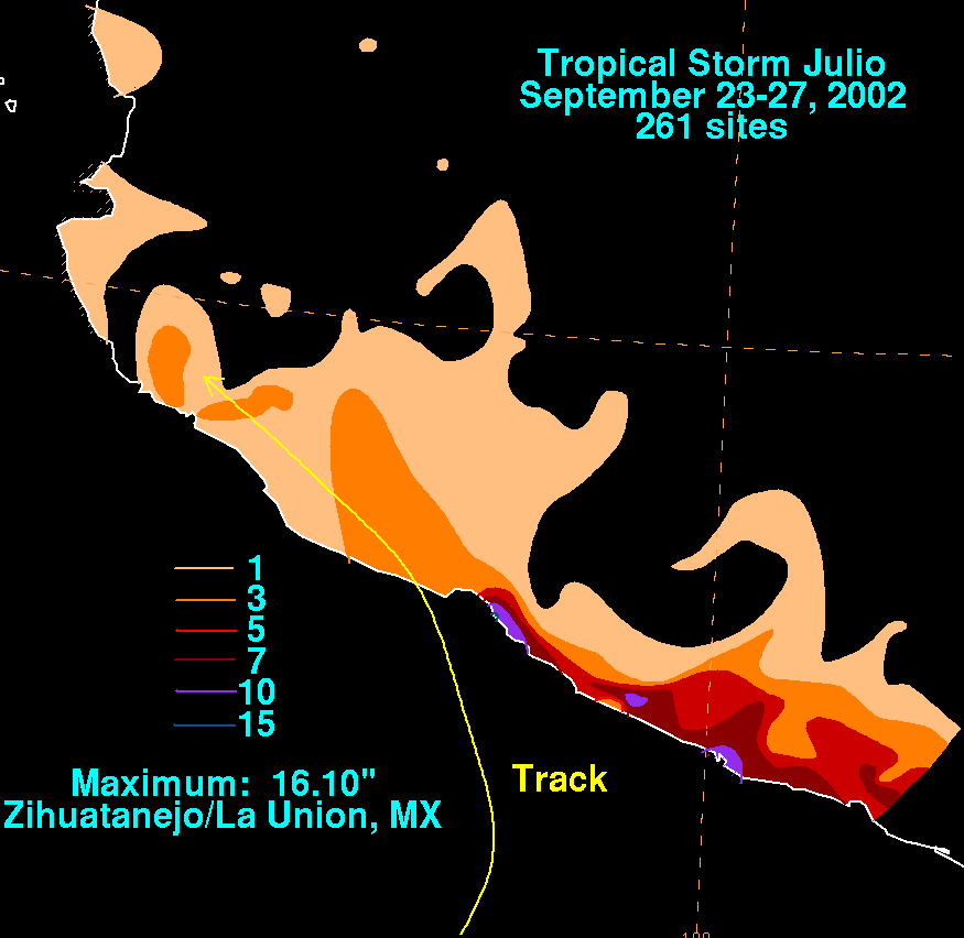
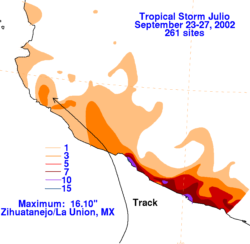
The rainfall graphics below use data supplied by the Comision
Nacional del
Agua, parent agency of the Mexican
National Weather Service. The heavier amounts fell to the right
of Julio's
track. According to press reports, 100
homes in Acapulco and Zihuatanejo were damaged by flash flooding.
 |
 |
 |