A tropical wave moved offshore the western African coast on September 14th. After producing organized showers and thunderstorms
over Cabo Verde on the 16th, the wave continued westward with lesser organization. On the 21st, a broad surface low formed
about 500 miles east-southeast of the southern Windward Islands. Convection gradually increased and became well organized
around a well defined low center gaining tropical depression status late on the 21st about 100 miles east of Tobago. Moving
west-northwest, it moved through the southern Windwards as a tropical storm on the 22nd. Strong northeast vertical wind shear
weakened Karen on the 23rd as it turned northwest. Turning more to the north, wind shear relaxed allowing thunderstorms to
relocate near Karen's center early on the 24th allowing the system to regain tropical storm status as it neared Vieques.
Turning north-northeast, Karen tracked across Vieques and Culebra before emerging into the western subtropical Atlantic
on the 25th. Remaining near the lower fringe of tropical storm intensity, Karen turned northeast while moving about
400 miles south of Bermuda on the 26th. Its circulated elongated thereafter, and Karen weakened back into a tropical
depression on the 27th before dissipating 300 miles southeast of Bermuda later that day.
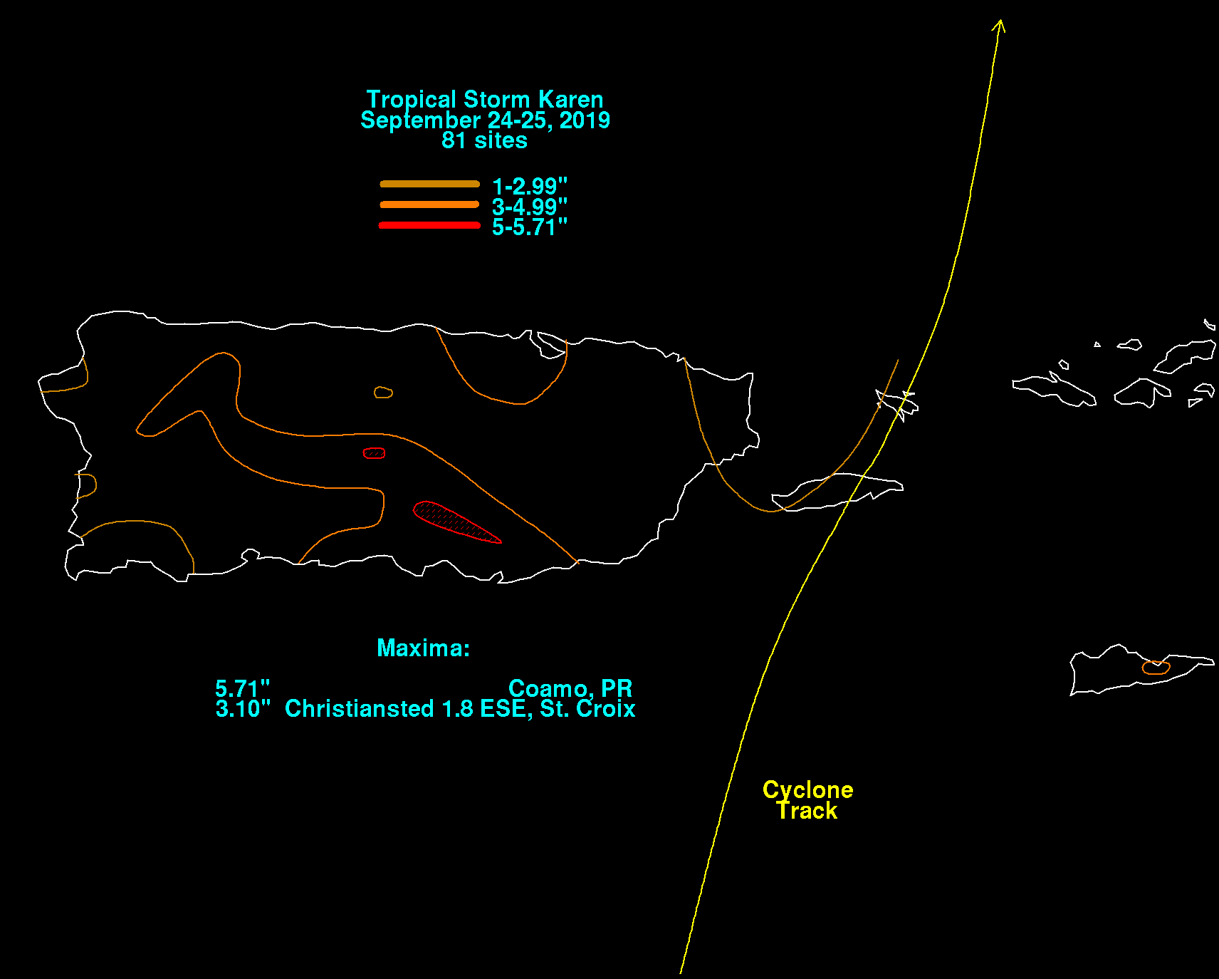
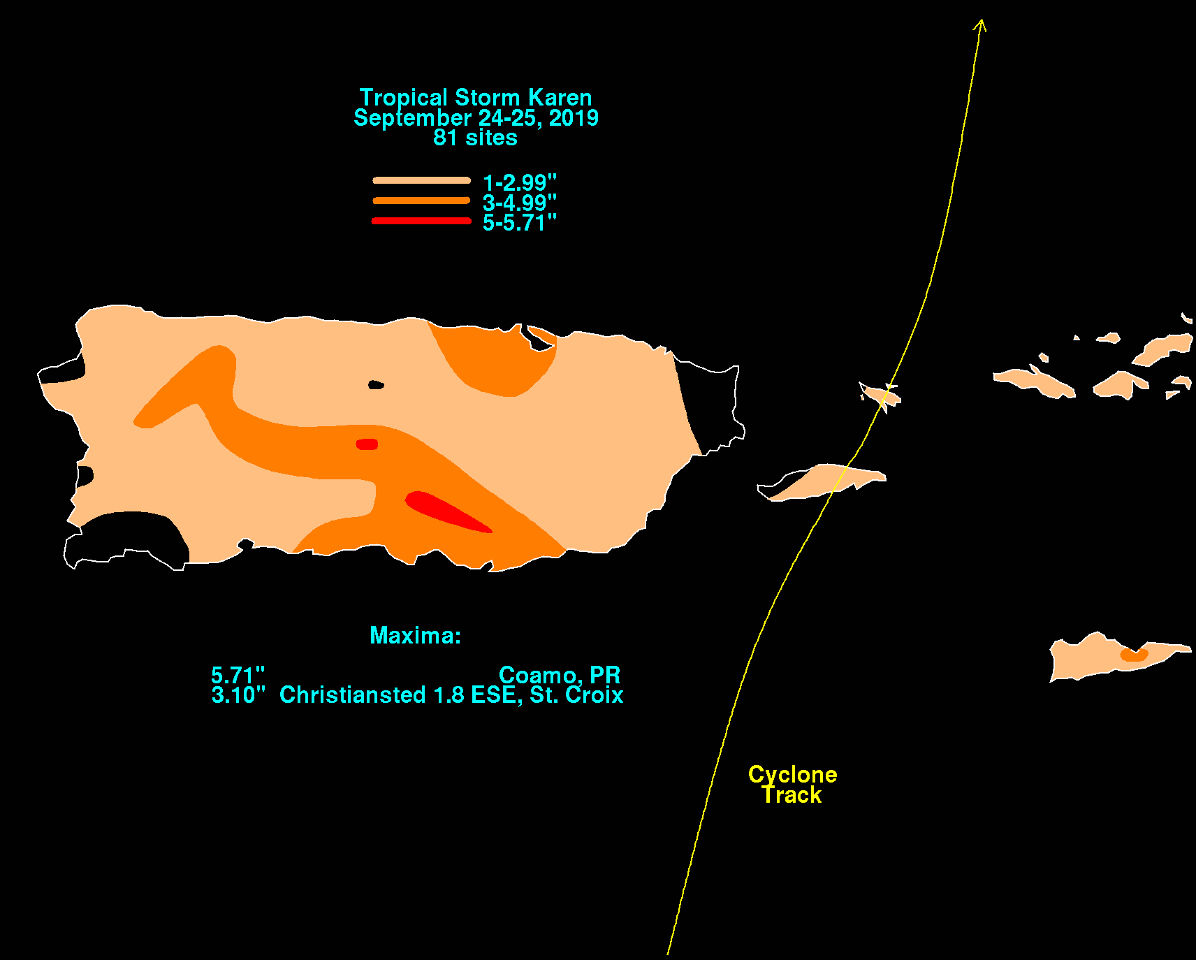
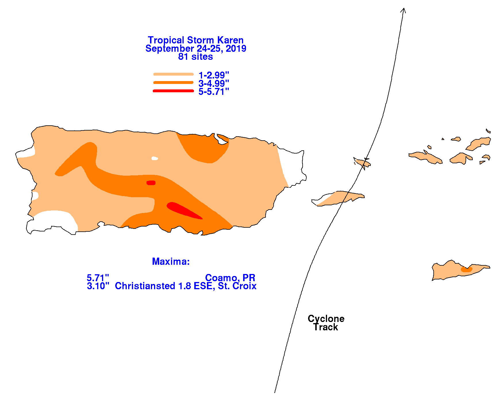
Karen's rainfall graphics for Puerto Rico and the U.S. Virgin Islands lie below.
 |
 |
 |