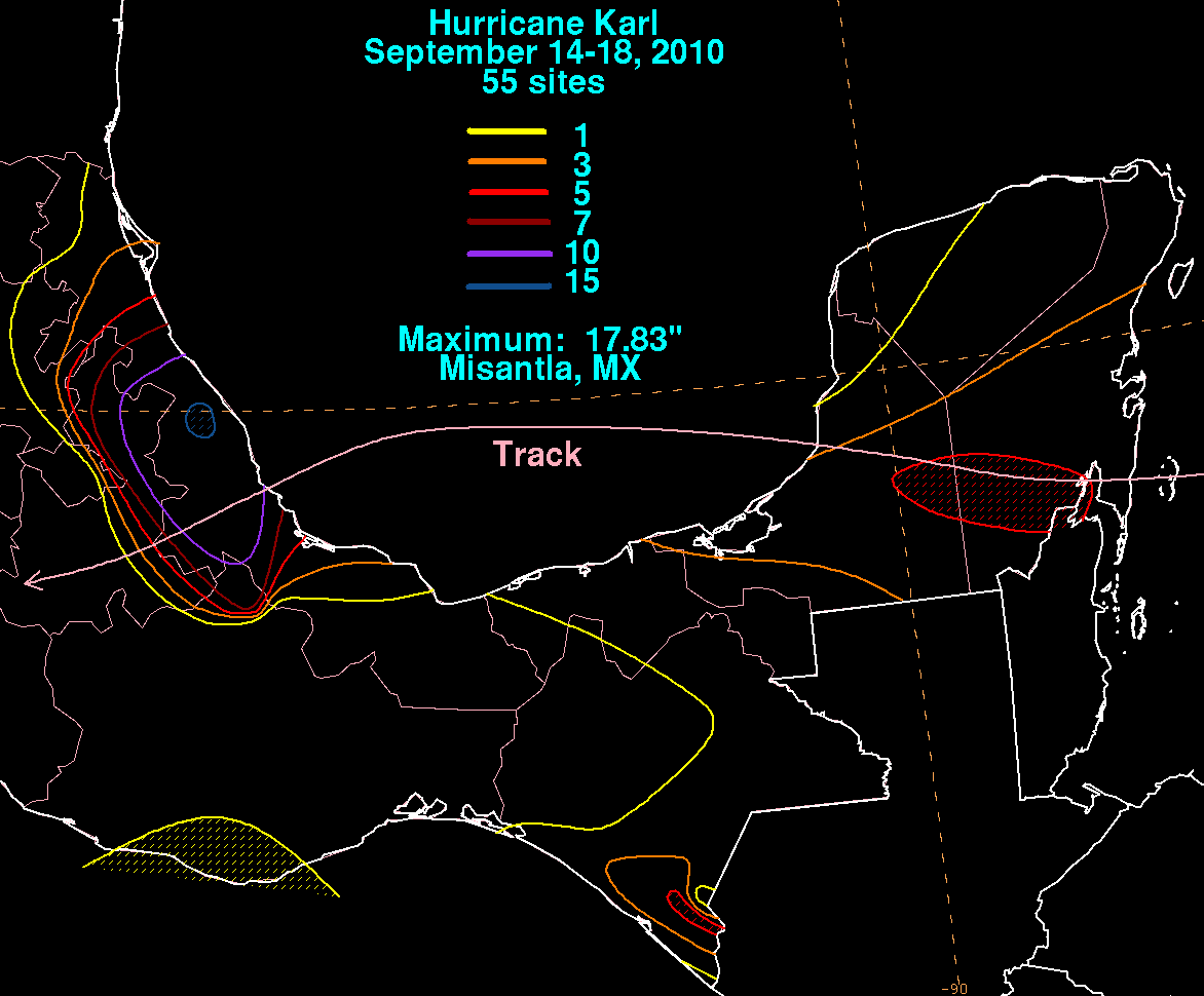
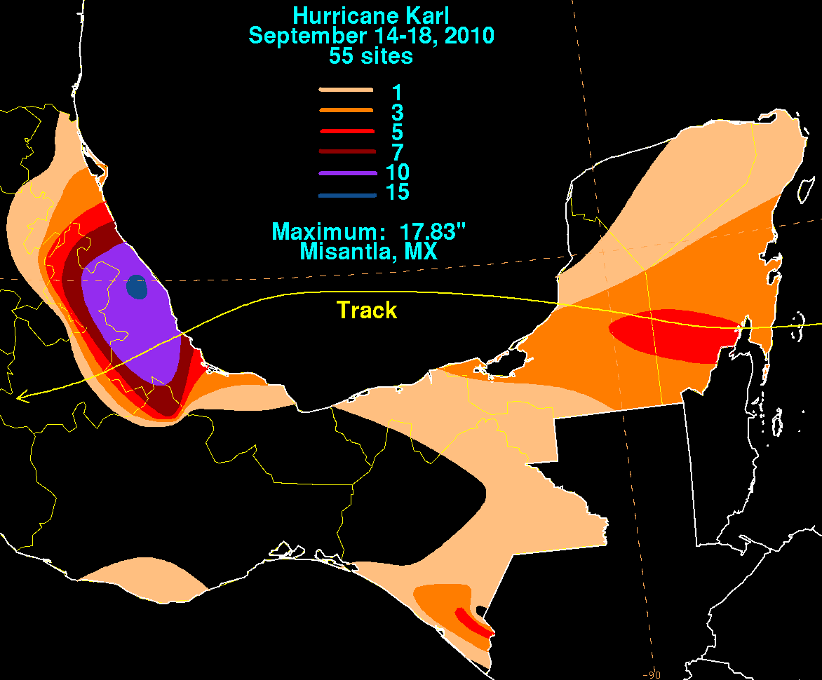
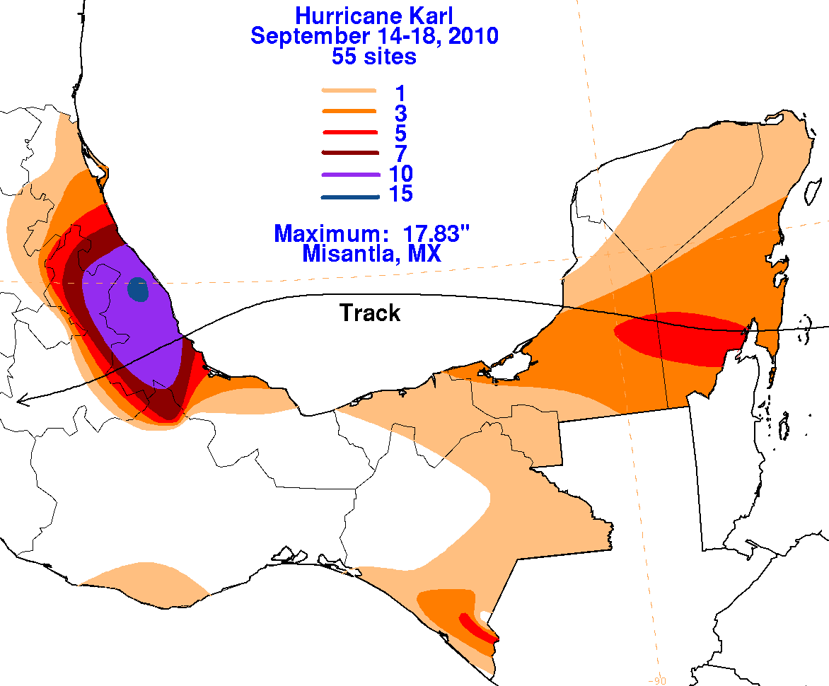
Hurricane Karl - September
14-18, 2010
A tropical disturbance formed just east of the Lesser Antilles on the September 9th along a tropical wave which moved off the
African coast on the 1st.  A low pressure area formed with the disturbed weather area, which moved west-northwest through the
northern Caribbean sea.  The system became gradually better organized, becoming a tropical storm on the 14th east of the
Yucatan peninsula.  Karl struck land as a strong tropical storm on the morning of the 15th, and developed an eye feature after
moving inland.  Karl weakened to a tropical storm as it crossed the Yucatan peninsula, and redeveloped an eye after emerging
into the Bay of Campeche, becoming a hurricane on the morning of the 16th.  Karl became the strongest known hurricane to
traverse the Bay of Campeche as it became a category 3 hurricane.  Slightly weakening as it approached the state of Vera Cruz,
Karl became the first major hurricane to make landfall in the Atlantic basin in two years (since Ike) and the first major hurricane
to strike the Gulf coast since Wilma in October 2005.  Once inland, the small storm quickly weakened, and Karl dissipated as a
tropical cyclone late on the 18th with its low pressure area dissipating soon afterwards.  Below are its associated rainfall graphics,
using data and graphics provided by the Comision Nacional del Agua, the parent agency of Mexico's national weather service.