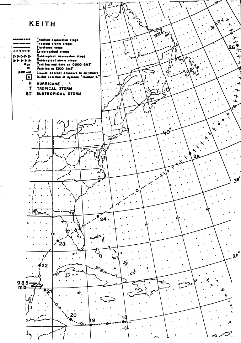
On the 5th of November, a tropical wave emerged off the coast of
Africa.
After moving through the Lesser Antilles on the 12th, its westward
motion
slowed. By the 17th, under the influence of an upper high,
thunderstorms
developed into a cluster and ship reports indicated the formation of a
tropical
depression. Shear occasionally impacted the system, thus
development was
slow. Keith became a named tropical storm by the morning of the
20th
as it was tracking northwest into the Gulf of Mexico.
The system slowly recurved through the eastern Gulf of Mexico and
struck central Florida as a strong tropical storm on the 22nd as it
approached
a frontal zone. It accelerated northeastward, losing tropical
characteristics
north of Bermuda on the 24th, ultimately becoming an intense baroclinic
cyclone with hurricane-force winds well east of the Canadian Maritimes.
Below is the track of this cyclone,
provided by the National Hurricane
Center.
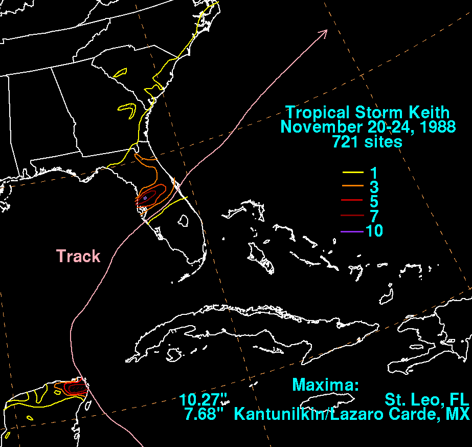
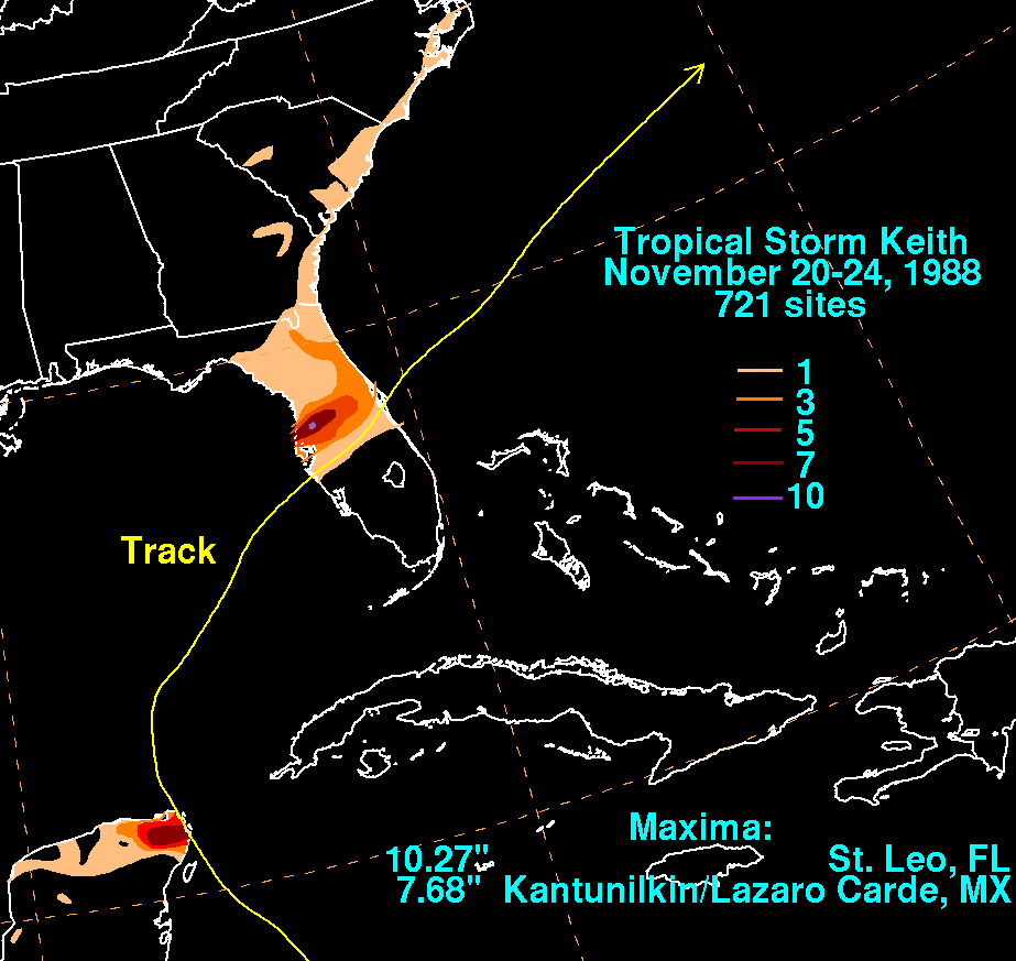
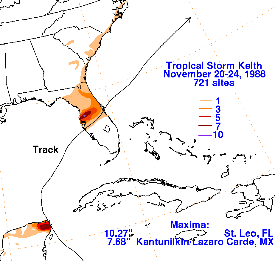
The graphics below show the storm total rainfall for Keith.
Note
the maximum across
central Florida, near the track of the cyclone. Rainfall data was
obtained from both the
National Climatic Data Center in Asheville, North Carolina and the
Comision Nacional del
Agua, the parent agency of Mexico's national weather service.
 |
 |
 |