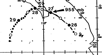
On August 23rd, a large thunderstorm complex formed over west-central Mexico in an area of divergence
southwest of an upper cyclone across northeast Mexico. The system dropped southward offshore the state
of Sinaloa to near the Islas Marias on the 24th. By the 25th, a surface low had formed and the system had
become a small tropical depression. Moving west-northwest, the cyclone became a tropical storm that
afternoon and a hurricane that night. By the afternoon of the 26th, Kiko had become a major hurricane in
the southern Gulf of Califonia as it approached the southern portion of Baja California. That night, the
hurricane made landfall near Punta Arena. The small system weakened rapidly over the terrain of south
Baja Califonia Sur as it moved more to the west. By the afternoon of the 27th, Kiko regained tropical storm
status southwest of La Paz. That night, it became a tropical depression. As it moved into the open Pacific
ocean, it moved southwest around the northwest periphery of Tropical Storm Lorena. By the afternoon of
the 29th, Kiko had dissipated as a tropical cyclone. Its low level swirl continued tracking south and was
ultimately absorbed by Lorean. Below is the track of this storm, provided by the National Hurricane Center.
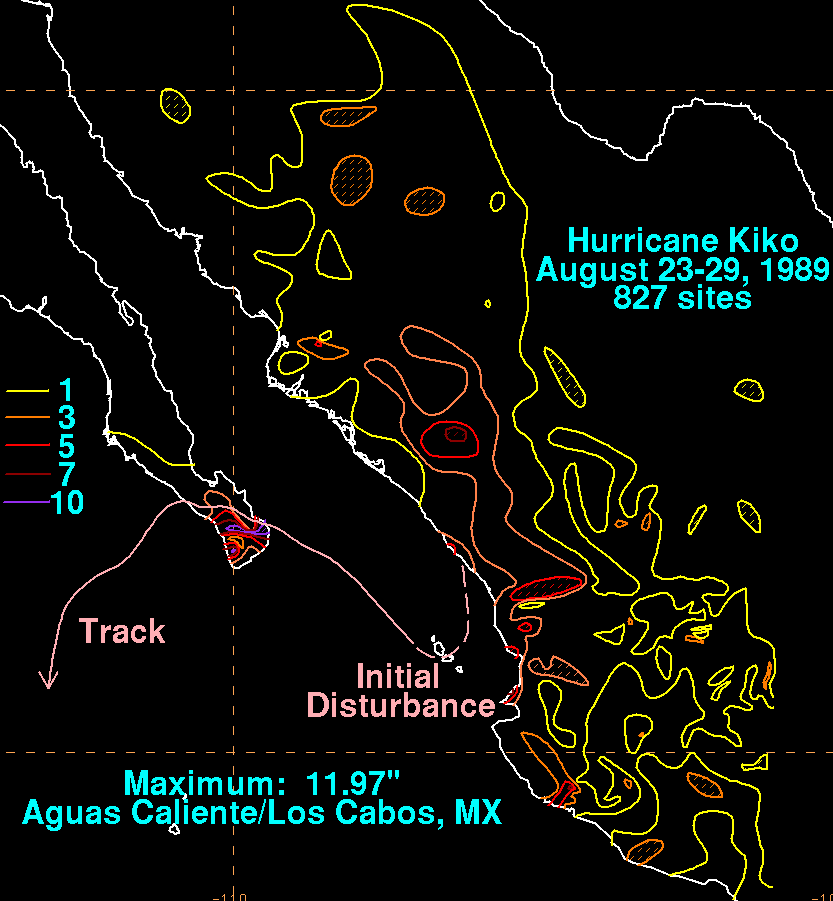
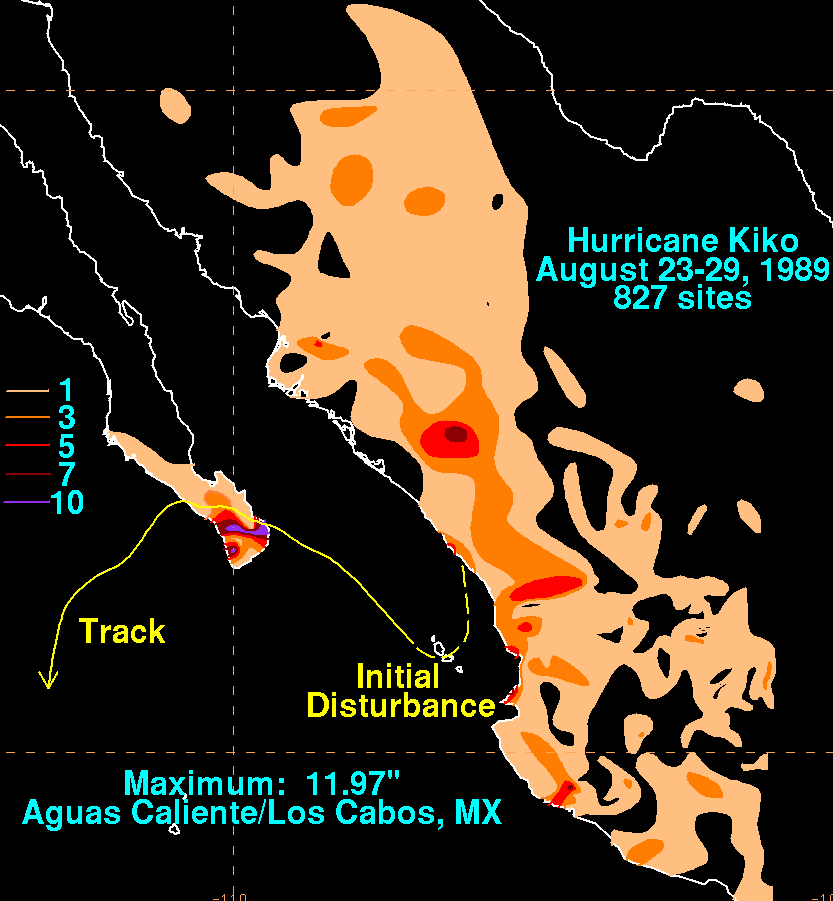
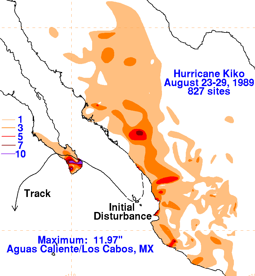
The storm total rainfall map below was constructed using data from
the Comision Nacional del Agua,
the parent agency of Mexico's
national weather service. Much of the precipitation over
northwest Mexico
was due to an enhanced monsoon on the east side of Kiko.
 |
 |
 |