A broad low pressure area developed over the extreme southeast
Caribbean Sea on November 1st. The
system initially drifted westward until the 4th before becoming
quasi-stationary north of Curacao. A better
defined surface low developed on the 5th and 6th, spawning the 15th
tropical depression of the season. Just
south of Puerto Rico, the cyclone strengthened into a tropical
storm. By the evening of the 7th, Klaus had
become a hurricane while moving northeast at increasing forward
speed. Klaus coupled with an upper level
low on the 11th and 12th, while its maximum sustained winds became well
removed from the center, causing
the system to enter the subtropical stage. A major trough
approached from the west, and Klaus accelerated
northeastward once more ultimately becoming an extratropical low.
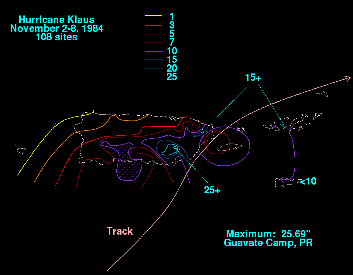
The storm total rainfall map below was constructed using data from
the
National Climatic Data Center. Heavy
rains caused flooding in the mountains across Puerto Rico while Klaus
was evolving from a tropical storm into
a hurricane.
