A tropical wave emerged from western Africa on July 31st. The system moved across the ocean with little activity and entered the
northeast Pacifc on August 8th. Disorganized thunderstorm activity was associated with the wave by the 11th, and the resulting
tropical disturbance gained organization on the 14th, becoming a tropical depression that evening. By the morning of the 15th,
Lane had strengthened into a tropical storm well to the southwest of Baja California. The cyclone moved westward over the next
several days, strengthening into a hurricane on the 17th. Rapid intensification ensued thereafter, with Lane becoming a major hurricane
on the 18th. After crossing the 140th meridian west, Lane slowly weakened as it encountered west-southwesterly vertical wind shear
on the 19th and 20th. Intensification ensued as vertical wind shear abated, and Lane remained a major hurricane until the 24th.
On the 21st, the cyclone began curving to the northwest and north towards Hawai'i and its center eventually became a mere 110
nautical miles from the coast on the 24th. Vertical wind shear had renewed and Lane weakened while approaching Hawai'i. Its
hurricane status ended on the 25th as the system decoupled and traveled within the low-level trade wind flow. On the 26th,
Lane weakened into a tropical depression as it moved south of due west. A brief restrengthening into a tropical storm was
noted on the 27th before Lane weakened again within a hostile environment. It devolved into a remnant low on the 29th and
turned northward, becoming absorbed by what would become a subtropical storm to its north later in the day.
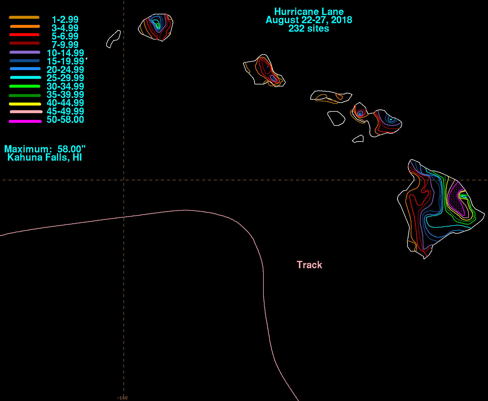
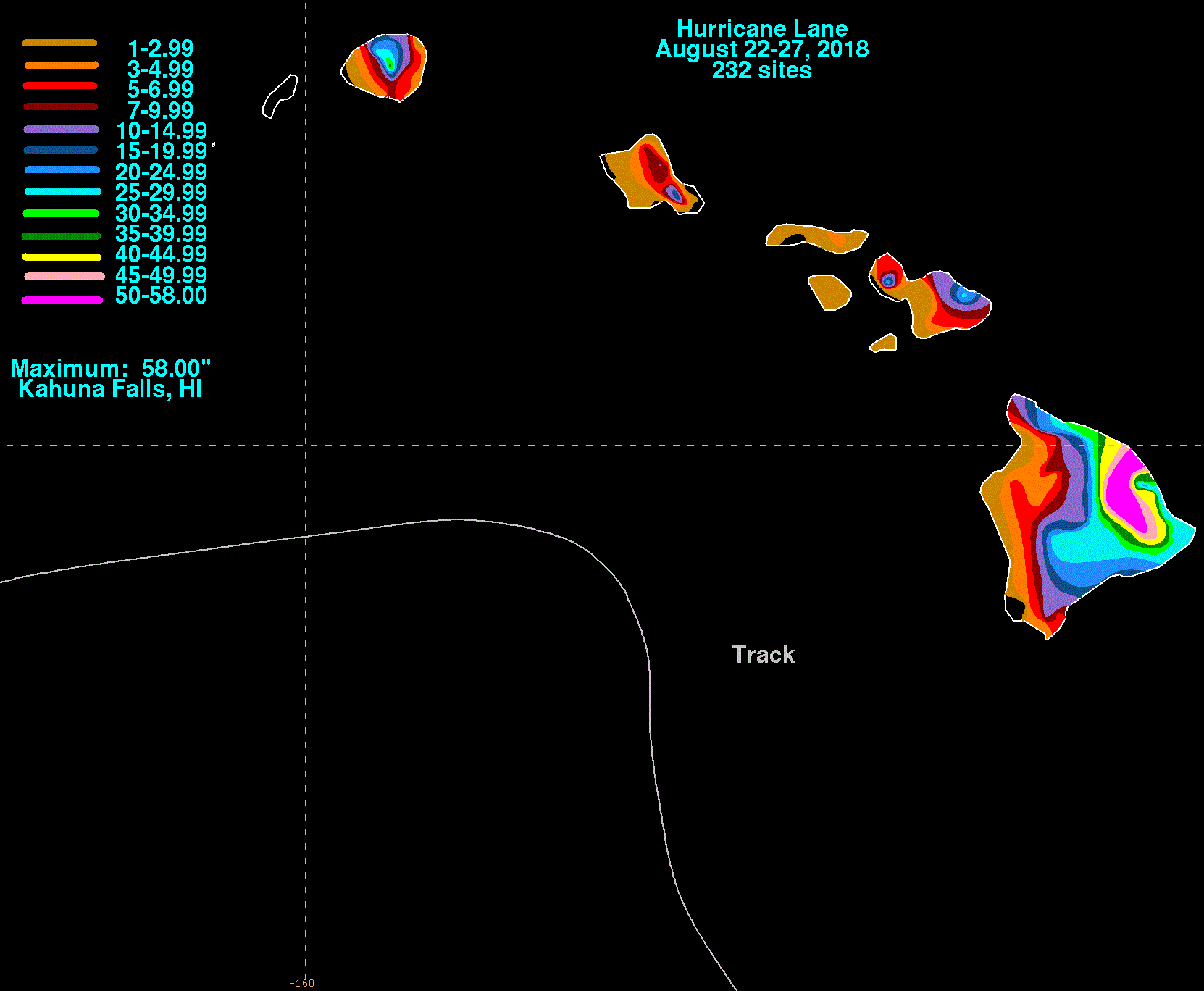
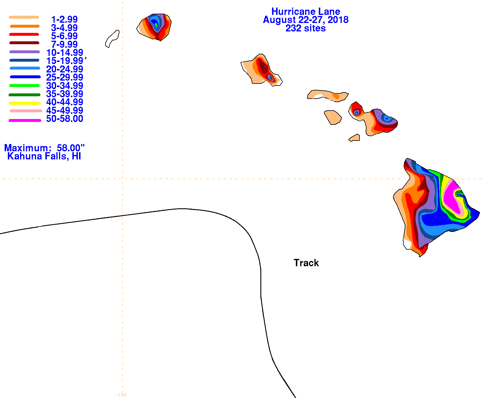
The rainfall graphics below show the storm total rainfall for Lane, which used rain guage information from the National
Weather Service River Forecast Centers, Honolulu Forecast Office, and CoCoRAHS.
 |
 |
 |