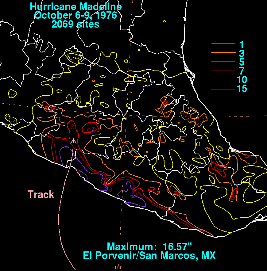
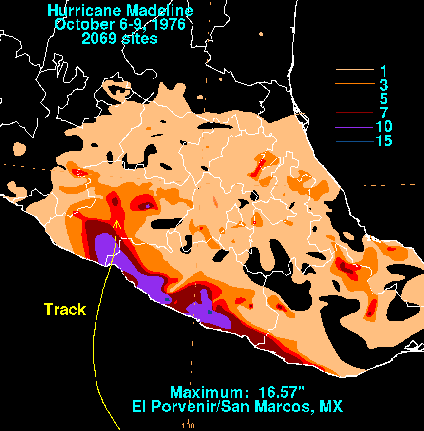
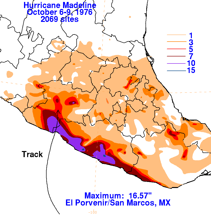
A tropical disturbance formed 300 miles south of the coast of
Guatemala, quickly gaining tropical storm
strength on September 28th. The system weakened thereafter,
becoming ill-defined on the 30th. It remnant
tropical disturbance continued to drift west, and redeveloped into a
tropical depression late on October 2nd
about 400 miles southeast of Acapulco. The cyclone moved slowly,
becoming a tropical storm on the 4th.
Recurving slowly towards the north, Madeline became a hurricane on the
6th while edging towards the
Mexican coast. Its intensity peaked at category 4 strength late
on the 7th before moving inland northwest
of Zihuatanejo on the morning of 8th. The system then rapidly
weakened over the mountainous topography
of southern Mexico. Below are the storm total rainfall maps
related to Madeline. Data for
the maps was
obtained from the Comision Nacional del Agua, the parent
agency of Mexico's National Weather Service.
 |
 |
 |