A tropical wave moved offshore western Africa on August 10-11th. Thunderstorm activity near the wave decreased in
coverage by the 15th while moving over the central tropical Atlantic. Thereafter, convection reignited. The wave
moved through the Lesser Antilles on the 17th while still not having an associated low pressure area. That changed
on the 19th when a low pressure center formed over the central Caribbean Sea. Further develpment ensued on the 20th,
with the system designated a tropical depression just after midnight on the 21st just offshore the Nicargua/Honduras
border. The depression turned northwest due to an upper level trough over the western Gulf of Mexico. After turning
north-northwest, the depression strengthened into Tropical Storm Marco on the evening of the 21st. Marco then moved
throught the Yucatan Channel and briefly became a hurricane on the 23rd in the southeast Gulf of Mexico. Southwest vertical
wind shear led to the beginning of its final weakening trend, with Marco regaining tropical storm status late on the 23rd over
200 miles south-southeast of the Mouth of the Mississippi River. Its center became an exposed swirl on the 24th, which
forced a westward turn due to its new shallow nature. That evening, it passed just south of the Mouth of the Mississippi
River while moving west and became a tropical depression soon afterward. Marco degenerated into a remnant low and surface
trough on the 25th to the south of Louisiana.
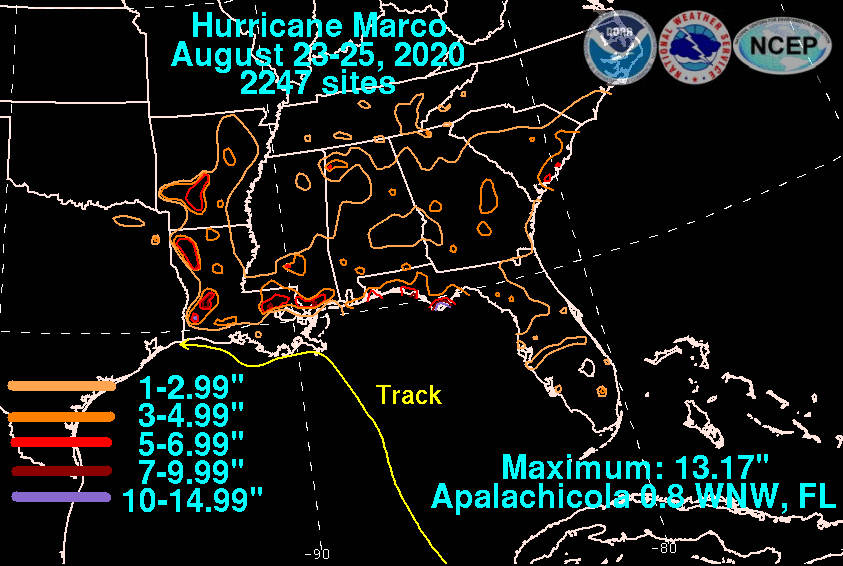
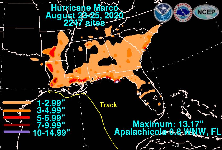
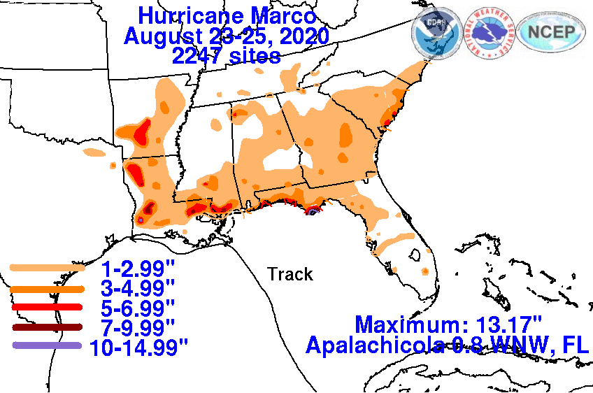
The graphics below show the storm total rainfall for Marco, which used rain gage information from the National Weather
Service River Forecast Centers, Forecast Offices, and CoCoRAHS.
 |
 |
 |