A tropical wave moved off the west coast of Africa on September 7th
and 8th, accompanied with a large low to
mid-level circulation, but little thunderstorm activity. The
system progressed westward through the tropical
Atlantic, and deep convection formed near the circulation on the
12th. Now a tropical depression, the cyclone
moved west-northwest and strengthened quickly, becoming a tropical
storm early on the 13th and a hurricane
that evening. Moving towards a weakness in the west-central
Atlantic, the system moved more northwestward
as it moved through the northeast Caribbean. The center passed
just north of Barbados and Martinique before
moving over Dominica and southwest of Guadeloupe. As a
strengthening category 2 hurricane, Marilyn moved
through the U.S. Virgin Islands late on the 15th. Hail was noted
at this time near its center, which is unusual for
tropical cyclones. Its eyewall passed directly over St. Thomas
and east of Puerto Rico into the southwest Atlantic.
Marilyn ultimately strengthened into a category 3 hurricane as it
turned northward towards Bermuda. A combination
of vertical wind shear and cool waters previously upwelled by Hurricane
Luis caused Marilyn to weaken late on the
17th and early on the 18th. Moving north-northeast, the hurricane
passed about 150 miles west of Bermuda.
Vertical wind shear increased, which partially exposed its low level
center late on the 21st. Considered
extratropical when convection no longer existed near the center on the
22nd, Marilyn meandered for another 10
days before becoming absorbed into an approaching frontal system on
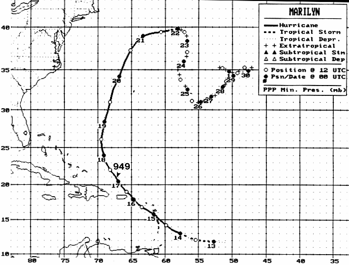
October 1st. Its track lies
below,
provided
by the National Hurricane
Center.
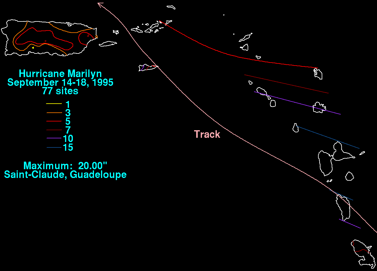
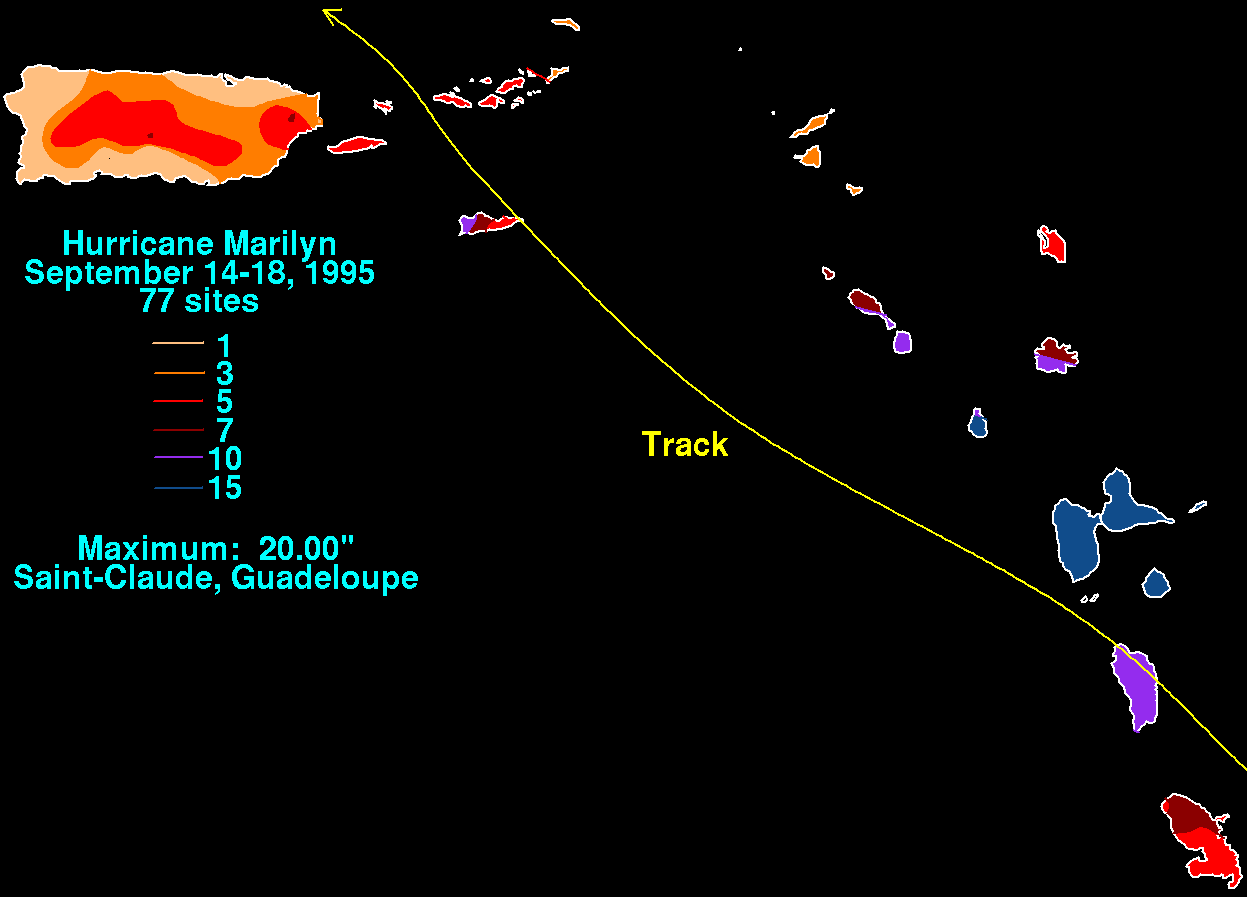
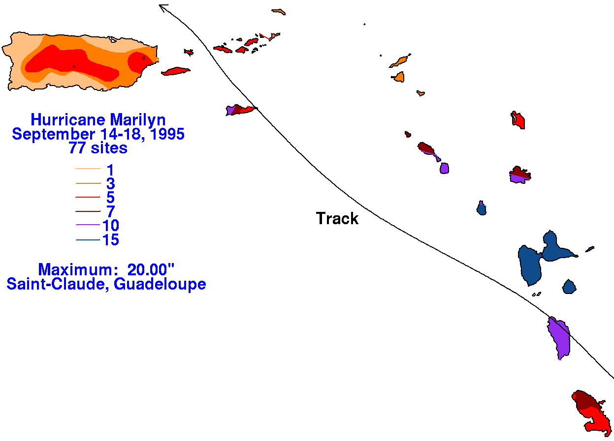
Below are the storm total rainfall maps for Marilyn. Rainfall
information was obtained from the National Climatic
Data Center (for Puerto Rico and the U.S. Virgin Islands) and the
National Hurricane Center Tropical Cyclone
Report on this storm.
 |
 |
 |
