A strong tropical wave emerged from the west coast of Africa September 23rd. The system remained at low latitude, south of
the 10th parallel, until the 26th when the wave's motion slowed and the system turned west-northwest. Over the next
couple of days, the disturbed weather area increasingly looked like a tropical cyclone, yet it did not possess a
closed surface circulation. On the 27th, the open system had tropical storm-force winds. By the 28th, the surface
circulation closed off and Tropical Storm Matthew was named just to the west-northwest of Barbados. The storm
passed midway between St. Lucia and St. Vincent, entering the Caribbean Sea. By the 29th, Matthew had strengthened into
a hurricane while moving through the Caribbean. It turned to the west and west-southwest due to strong ridging to its
north. Intensification became rapid from late on the 29th to late on the 30th, with the system becoming a major hurricane.
Soon afterward, the slow-moving storm upwelled the warm waters beneath it and caused its own weakening trend.
As the ridge to its north weakened on October 2nd, Matthew made a small loop and then drifted northwest. Turning northward,
Matthew restrengthened as it headed towards westernmost Haiti. Clipping western Haiti and eastern Cuba, the hurricane
continued north-northwest just west of Nassau and off the east coast of Florida. By late on the 8th, Matthew had
weakened and was no longer a major hurricane while moving offshore Georgia and interacting with a coastal front.
The hurricane turned northeast nearly paralleling the South Carolina coast before making landfall briefly near McClellanville.
Matthew turned more eastward and gained additional extratropical character. Turning east-northeast, Matthew completed
extratropical transition by the morning of the 9th. The storm then accelerated northeast, brushing the coast
of Nova Scotia late on the 10th and merged with a larger extratropical cyclone across Atlantic Canada on the 11th.
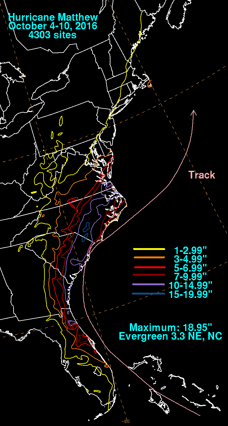
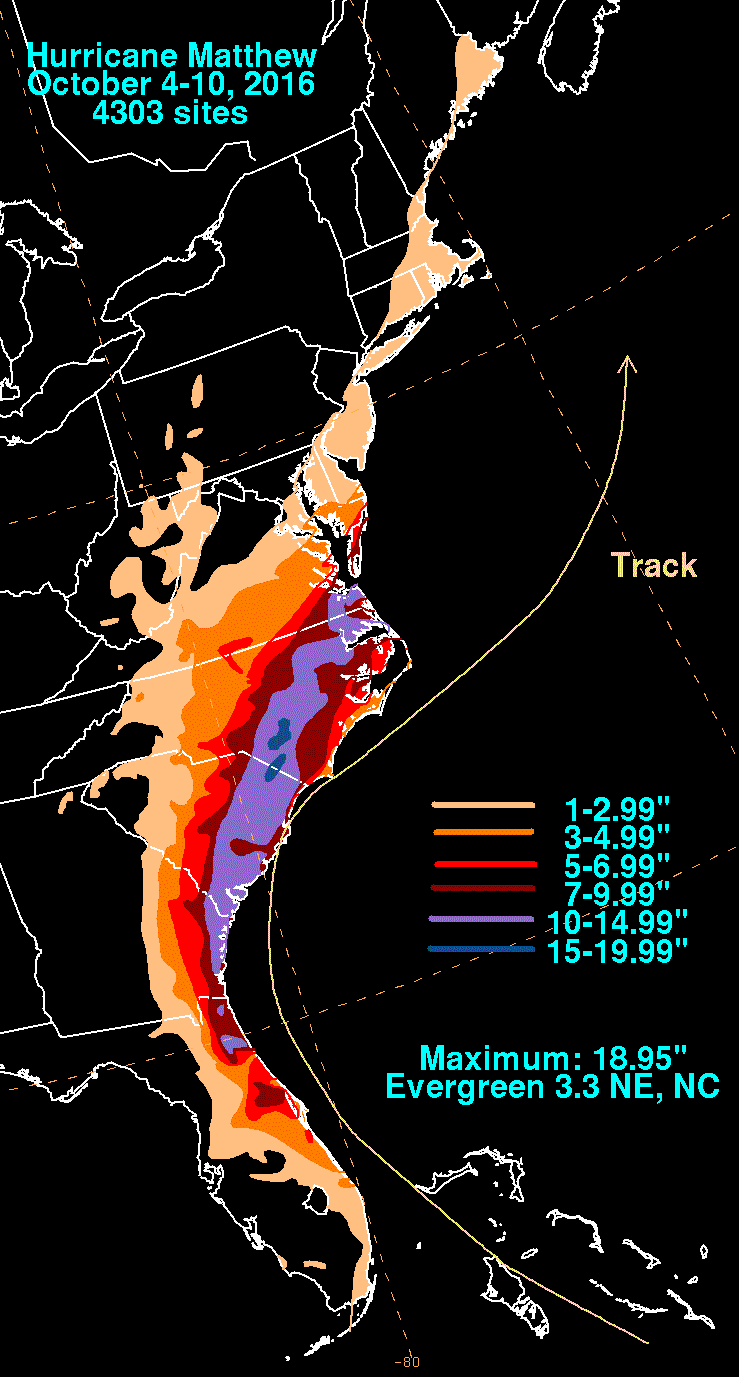
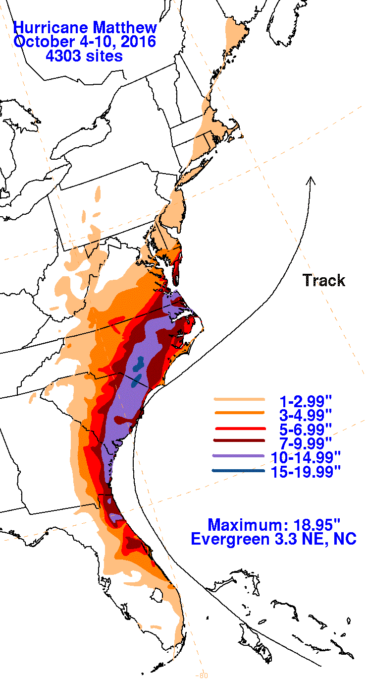
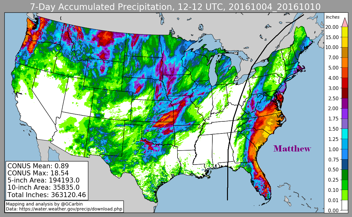
The first three graphics below show the storm total rainfall for Hurricane Matthew, which used rain guage information from
National Weather Service River Forecast Centers, Forecast Offices, and CoCoRAHS. The fourth image uses multi-sensor
precipitation estimates during the lifetime of the storm, which include radar-derived information.
 |
 |
 |
 |