An unnamed tropical storm struck southeast Mexico on the Pacific coast. Its upper level circulation crossed Mexico into the Bay of Campeche, and formed a convective surface low along a frontal zone. On October 4th, it was considered a tropical depression and strengthened into a tropical storm while moving east. An upper level trough across the central United States caused this unusual motion within the broad frontal zone in which it was embedded. By the afternoon of the 6th, Milton had become a hurricane while moving south of due east. Early on the 7th, Milton became a major hurricane on its approach to the northern coast of the Yucatan Peninsula. Milton weakened as it scraped the coast and underwent an eyewall replacement cyclone, then turned northeast toward Florida while restrengthening. An upper level shortwave moved in from the northwest Gulf of Mexico and phased with Milton, radically increasing its size on 9th. Milton made landfall near Siesta Key as a major hurricane late on the 9th, then paralleled Interstate 4 across the peninsula while undergoing extratropical transition. Milton emerged as a hurricane-force low which subsequently weakened while moving south of Bermuda on the 11th. On the 11th and 12th, Milton helped aid Leslie's recurvature into its frontal system. From the 12th into early 15th in the wake of the stronger cyclone that Leslie became, and Milton's surface low dampened out across the eastern subtropical Atlantic.
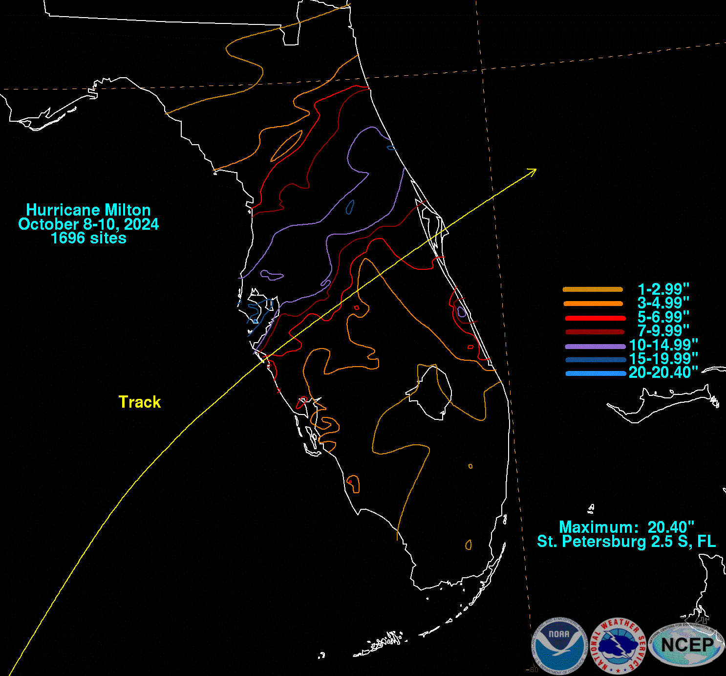
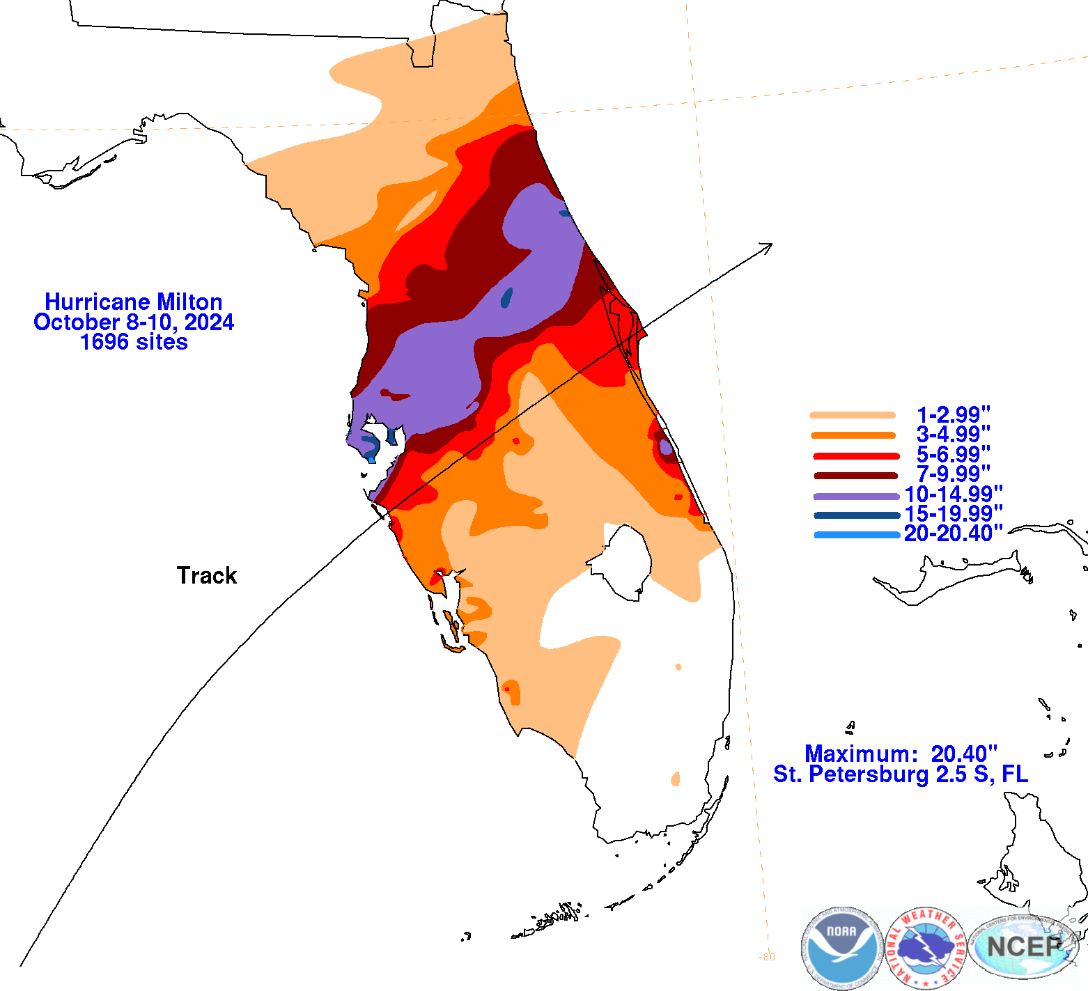
The graphics below show the storm total rainfall for Milton, which used rain gage information from National Weather Service River Forecast Centers, xMACIS2, National Weather Service Forecast Offices, and CoCoRAHS.
 |
 |
 |