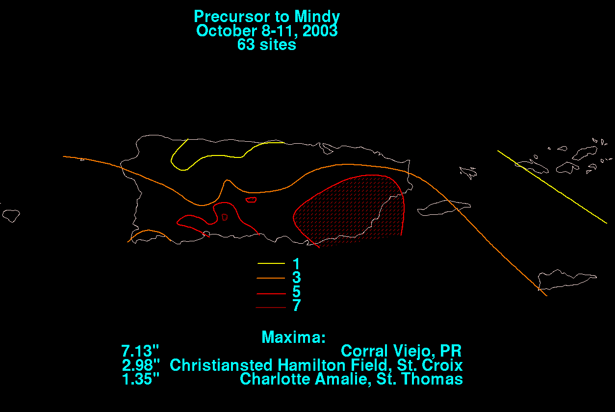
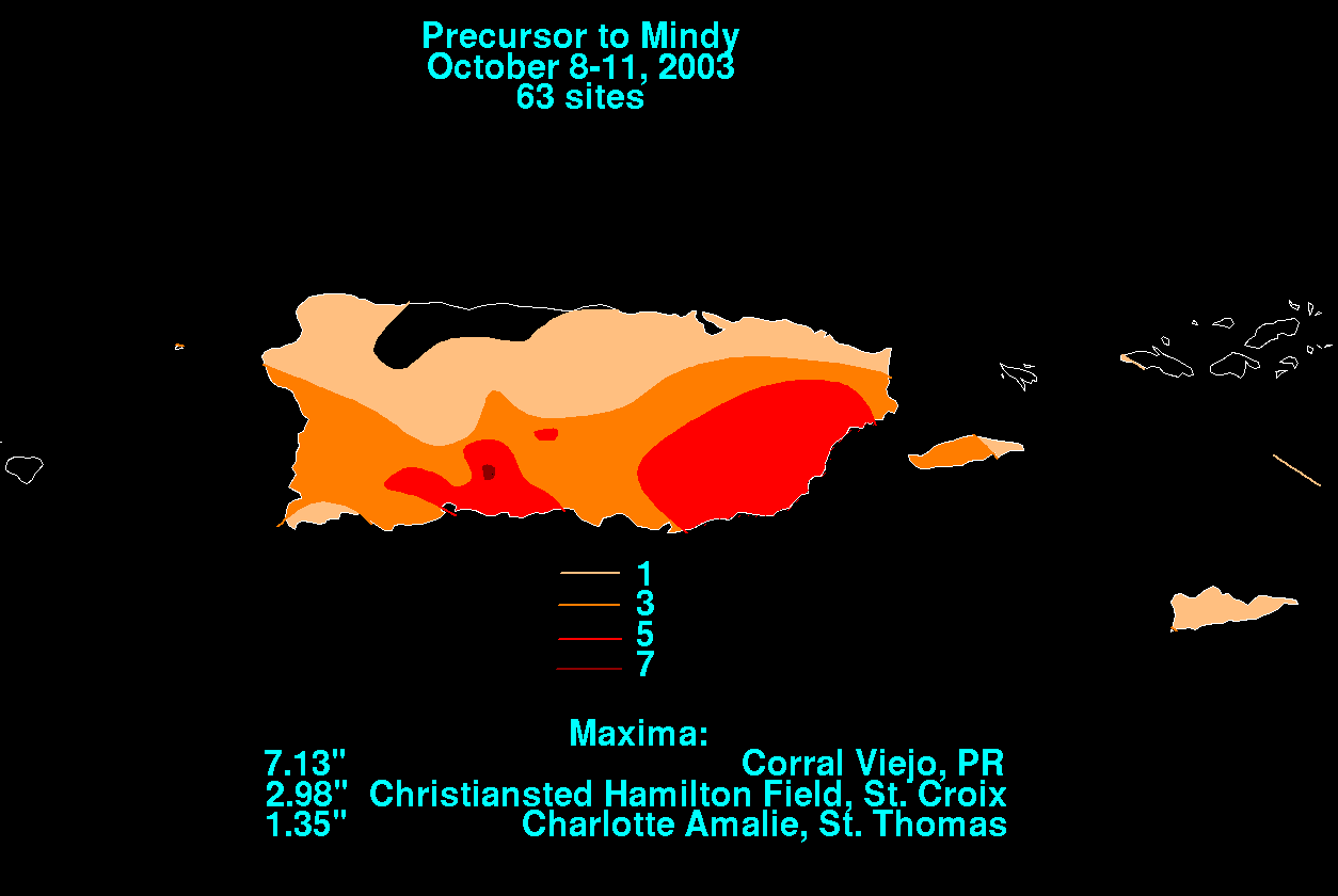
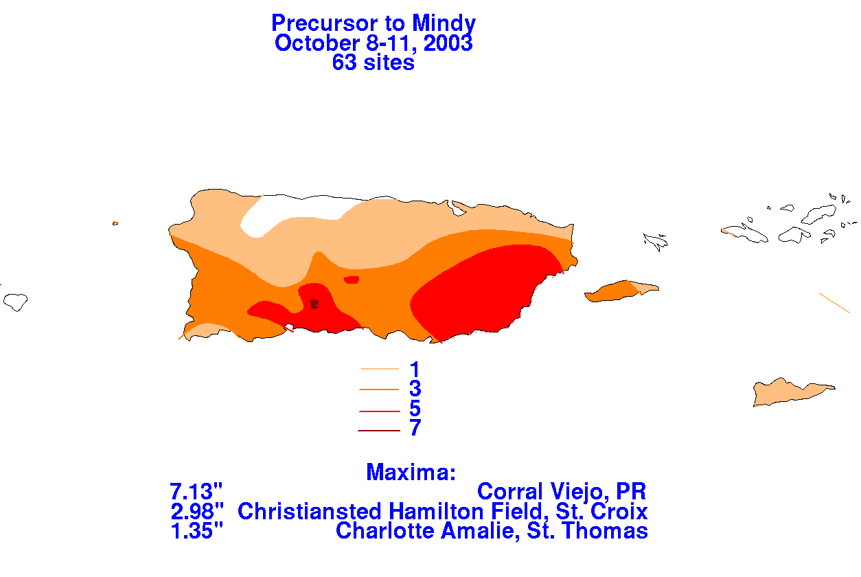
Mindy originated from a tropical wave that moved from Africa to the
Atlantic Ocean on 1st of October.
The wave axis neared the vicinity of the Mona Passage on the 9th when
it encountered a weakness in
the subtropical ridge. On the 10th, strongly diffluent southwest
winds aloft initiated a low level circulation
that moved northwest across eastern portions of the Dominican
Republic. Later that day when the center
moved out into the Atlantic, the disorganized system strengthened into
a tropical storm, and was named
Mindy before drifting northward and dissipating 400 miles
south-southwest of Bermuda. Below is a
storm total rainfall map for Mindy. Rainfall
information was obtained from the National Climatic Data
Center.
 |
 |
 |